
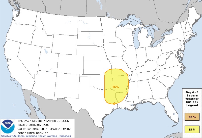
At this point in time we have some new information regarding storm risks this weekend (Saturday and Sunday). Now that we’re closer to the weekend we now have a better outlook for storm chases Saturday with a day 3 outlook, and a remaining day 4 outlook for Sunday. At this time we are currently at a slight (2/5) and marginal (1/5) for parts of the region we cover.
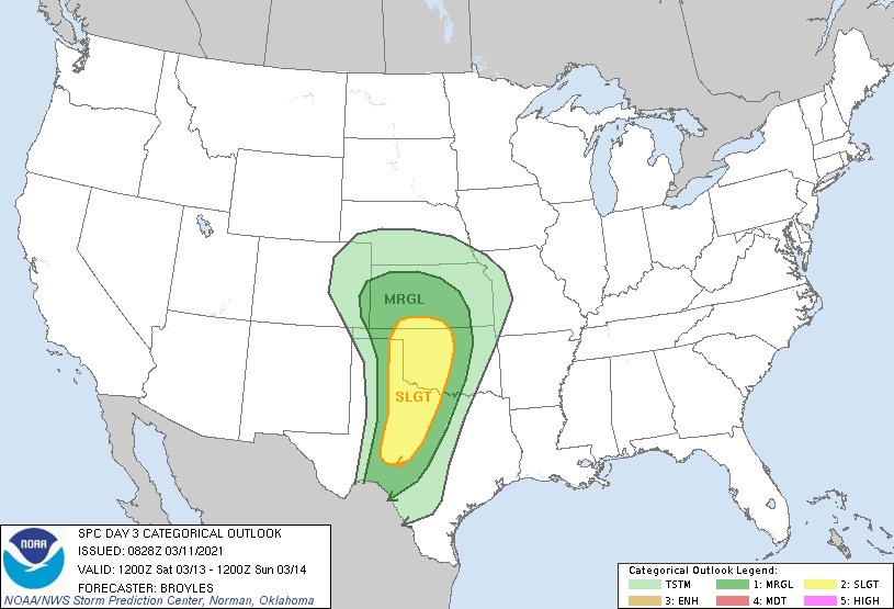
As of now the set up looks like we would see scattered storm activity develop in western/north western Texas on Saturday during the afternoon hours. This would bring a severe weather threat to parts of our far western and north western counties in the late afternoon into the evening. As we head later into the overnight hours, along a front we could see a squall line develop and pose a damaging wind threat, marginally severe hail threat, and a low but not zero threat for a spin up tornado across the North Texas region we cover, and DFW area overnight into early Sunday.
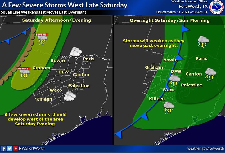
Overall threats at this point are low, with hail and damaging winds being the primary concern. However we cannot rule out a spin up tornado as well with the squall line. If any of these risks change we will let you know. To ease any fears this at this time looks to be a typical North Texas severe weather set up, one we’ve seen many times so nothing historic. With that being said, you should still plan to be weather alert this weekend because there is still a threat for severe weather of some kind. We want to give you the best information so you can prepare for storms and not be caught off guard. If you are weather alert, and have a plan you will be fine during any severe weather risk.
Stay tuned for more updates once they become available. Until then, it wouldn’t be a bad idea to go ahead and review your severe weather safety plan just to be safe.
Leave a Reply