
We have an updated look for storm activity later tonight into early Monday. Before we begin with the forecast, let’s be clear, NOT everyone will see storm/severe storm activity. However, that does NOT mean you should let your guard down with these storms. Stay weather alert, and make sure you have a way to receive alerts, especially since we have a chance for storms overnight.
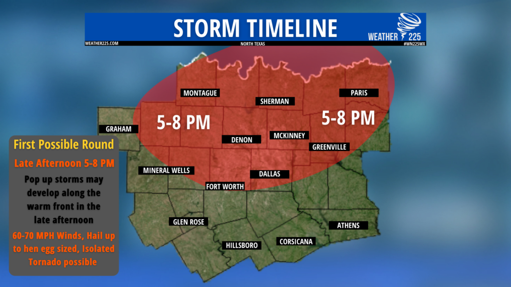
As of now, it appears we could see 2 rounds of activity. The first round would be in the mid/late afternoon into the evening, as some isolated storm development may occur along the warm front. If we see development during the afternoon along the warm front, these storms would be capable of damaging winds of 60-70 MPH, Large Hail near hen egg sized, and an isolated tornado cannot be ruled out as well.
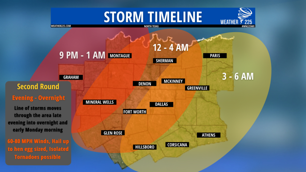
Round 2 will likely occur later tonight into early Monday across the region, as a Pacific cold front pushes through the region. Above is our forecasted timeline for storms. All types of severe weather would be possible with this round overnight. Including damaging winds near 60-80mph and a few isolated spin up tornadoes could be possible as well. So make sure you have a way to receive alerts overnight if they’re issued.
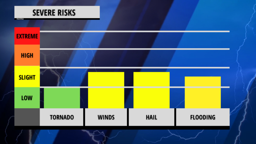
Above is our overall risk level for storms today across the region. Once again make sure you’re weather alert with the potential for storms across the region. You can visit severe weather safety tips here on our website, on our “weather safety” page.
Stay tuned for more updates.
Looking for a new roofer? Make sure you visit MyPro Construction and Roofing! Click the link bellow

Leave a Reply