
UNDERSTANDING RAIN % FORECASTS by Joshua
CAPPING INVERSION “THE CAP”
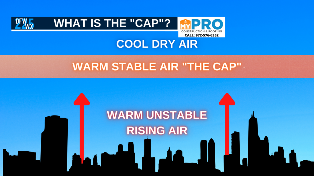
The “CAP” or Capping inversion we speak of during storm season, is a layer of warm stable air roughly between 2000-5000 feet above the surface that acts as a lid over the atmosphere. This lid separates warm moist unstable air from the surface, from cold dry air aloft. When warm moist unstable air mixes with cold dry air aloft, you get explosive storm development. However, with a cap separating these conditions, you may have conditions in place, but the separation of these conditions means storm development is hindered or halted all together.
When a CAP is weak it means the air aloft is just a few degrees shy of the surface air temperatures, or it is equal to them.
When a CAP is strong it means temperatures are well in excess of the temperatures of the surface rising air.
In some cases when a cap is weak storms can break through weak spots in the cap, allowing storm development. In other cases, with extreme instability you can get building up pressure under the cap, which could violently break through the cap, causing explosive storm development once the energy breaks through.
WHAT CRITERIA IS NEEDED FOR A STORM TO BE “SEVERE”?
In other cases, when a storm is not reaching severe limits, the National Weather Service will issue alerts called “Special Weather Statements” for storms that are strong, and capable of producing winds under 58 mph, and small hail.