
This morning (Tuesday 10/4/2022) the National Hurricane Center issued a Special Tropical Weather Outlook, regarding an area of circulation forming with a tropical wave trying to develop east of the Windward Islands.
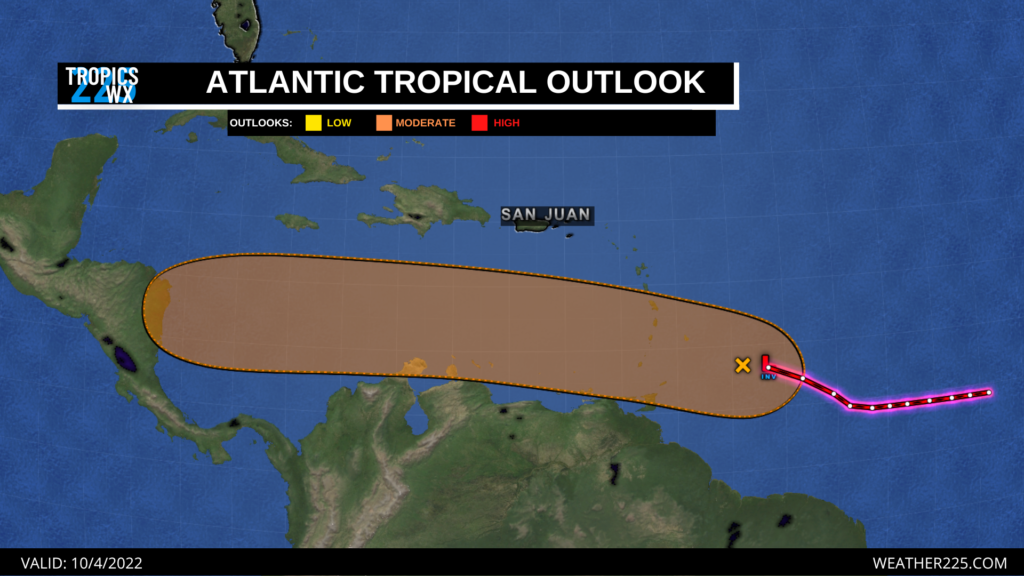
At the time of this post, this system is being monitored as it could strengthen in the coming days as it moves further into the Caribbean sea, where conditions appear to be more favorable for the development of a tropical depression. However, at this time this system is currently having trouble strengthening as it is conflicting with strong upper level winds. This system is moving westward around 15 mph. Regardless if this system strengthens into a tropical system or not, heavy rainfall and thunderstorms are possible over parts of the Windward Islands over the next 24-48 hours. As of 11:00 a.m. central time (10/4/2022), the National Hurricane Center says their Hurricane Hunter aircraft is currently enroute to investigate this system. Areas potentially in the path of this system such as Venezuela, the ABC Islands, and Windward Islands, should monitor this system in the coming days as updates become available. Chance for development over the next 2-5 day period 60%.
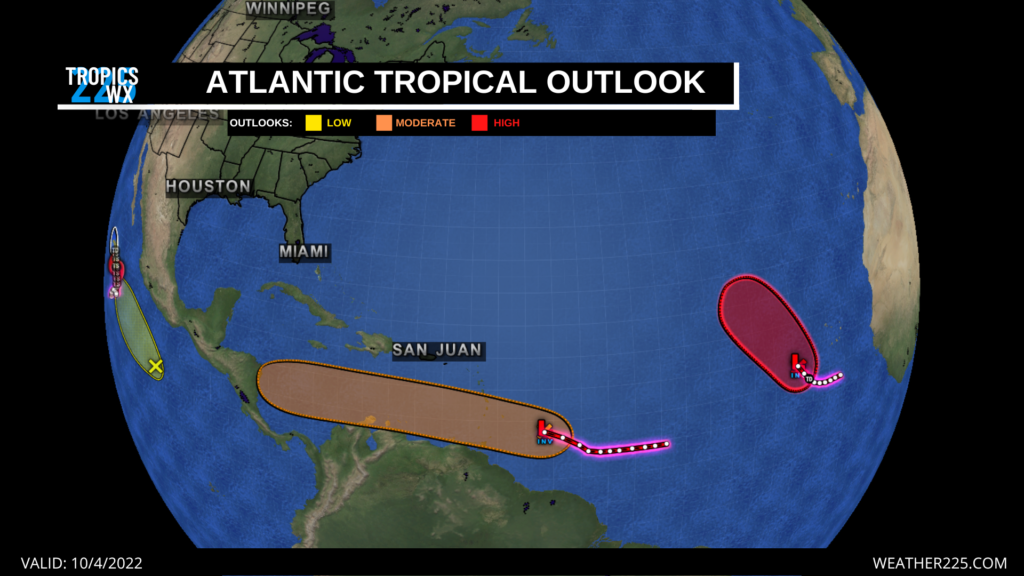
Elsewhere in the Atlantic, we have a high 80% risk for tropical development in the middle of the eastern Atlantic. This system is currently a few hundred miles west of the Cabo Verde Islands, and is likely to reach tropical depression strength over the next 24 hours. This system is currently moving northwestward around 10 mph. This system based on the models at this time, looks like it should stay mainly over open waters in the central Atlantic.
Stay tuned for more tropical updates with Weather 225!
Leave a Reply