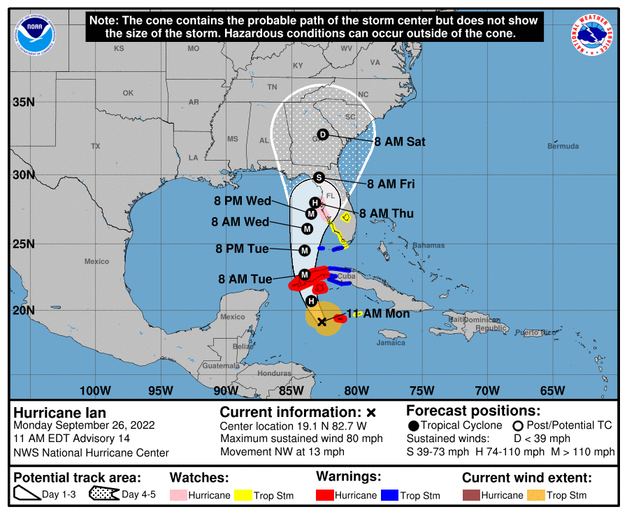
Hurricane Ian continues to rapidly strengthen as it makes its way further north through Cuba into the Gulf Of Mexico. Ian continues show signs of strengthening into a major hurricane by early Tuesday, and could impact portions of western/southwestern Florida as a major hurricane, bringing dangerous weather conditions to coastal areas, potentially around the Tampa region by late Wednesday.
As of 10:00 a.m. Central Time this morning, the City of Tampa announced mandatory evacuation orders for Zone A areas in Hillsborough County Florida. A voluntary evacuation order has been issued for Zone B.
The evacuation order take effect at 2PM. Please visit the website to type in your address and find your zone:https://t.co/DahPv3sdox
— City of Tampa (@CityofTampa) September 26, 2022
Map legend:
RED: Zone A
ORANGE: Zone B
YELLOW: Zone C
GREEN: Zone D
BLUE: Zone E
The red circles w/C’s are @HillsboroughFL shelters opening at 2PM
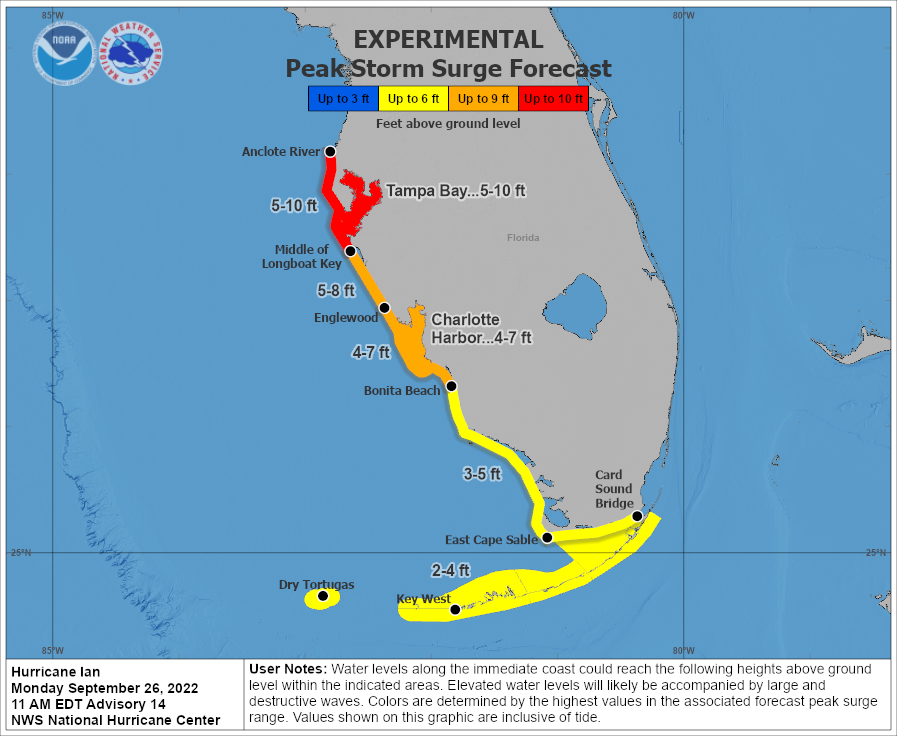
As of this morning (10:00 a.m. 9/26/2022), the latest storm surge forecast for coastal areas in southern/southwestern Florida shows the potential for significant storm surge from the Anclote River, to Tampa Bay, to Middle of Longboat key, where forecasted storm surge could peak around 5-10 feet. Areas from Englewood to Bonita beach could see storm surge around 5-9 feet.
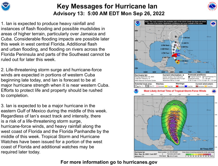
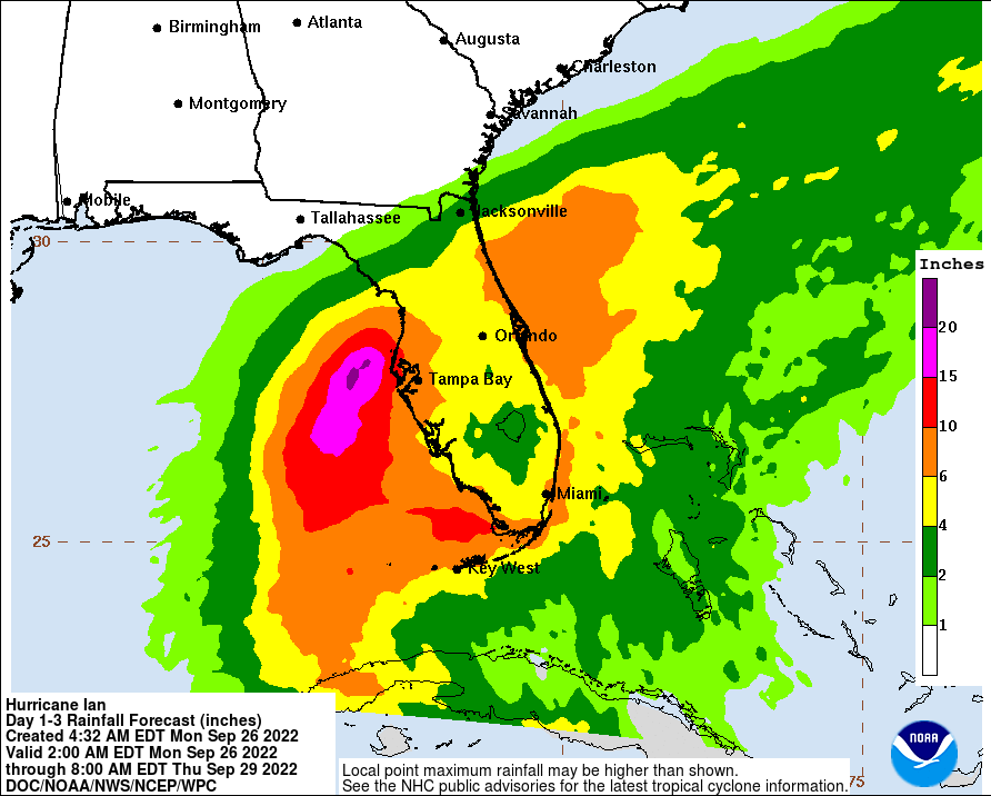
In addition to storm surge concerns, hurricane conditions with significant rainfall, and hurricane force winds are likely over the next few days as Ian makes its way further north, and as it makes landfall along the western/southwestern Florida coast. Below is the latest rainfall projections for the day 1-3 forecasting period, as well as timing for hurricane force winds.
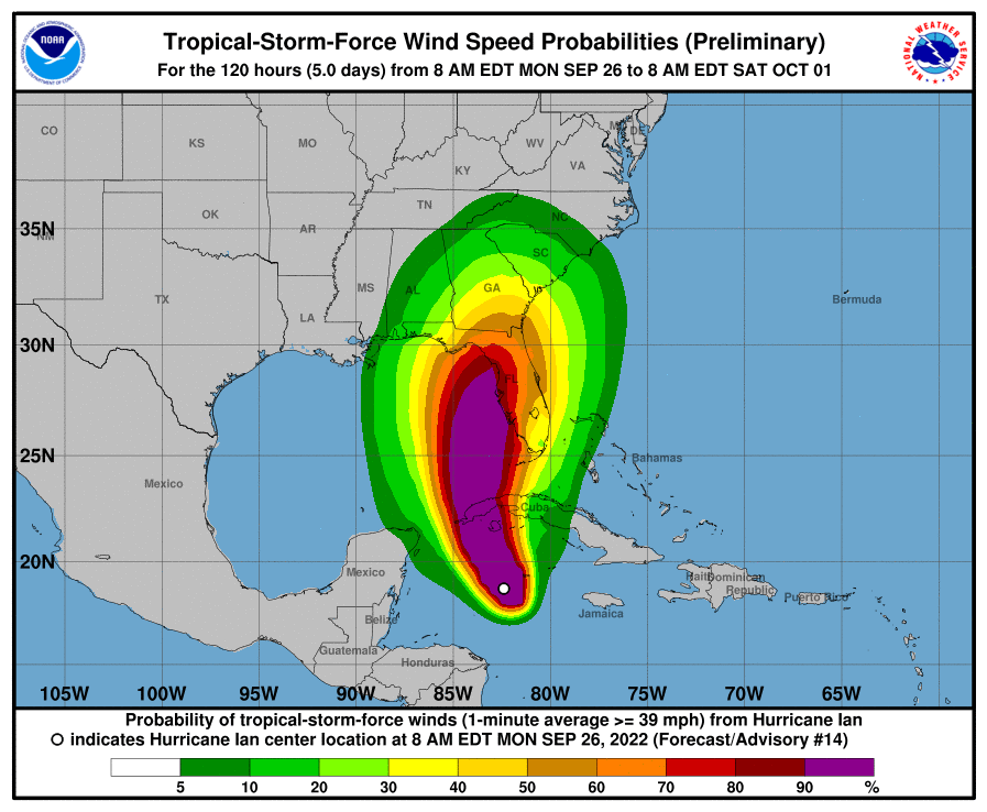
If you live near the Tampa area, or within the forecast cone for Hurricane Ian, please stay tuned to local authorities for any evacuation orders, updates, and forecast details in the coming days as Ian gets closer to landfall. Please develop or review your hurricane safety plan.
⚠️Hurricane Ian continues to intensifying and is forecasts to track into the Eastern Gulf of Mexico tomorrow Tuesday, NOW is the time Evaluate your Checklist to ensure you are ready protect your home and family.
— NWS Jacksonville (@NWSJacksonville) September 26, 2022
Visit https://t.co/iZQz0Nx2E1 for Details#Flawx #Jaxwx #GaWx pic.twitter.com/wx3HdjhXqI
And be sure to tune in to trusted weather sources like the National Hurricane Center, local official and weather media, and your local National Weather Service for the most updated, trustworthy, and reliable information.
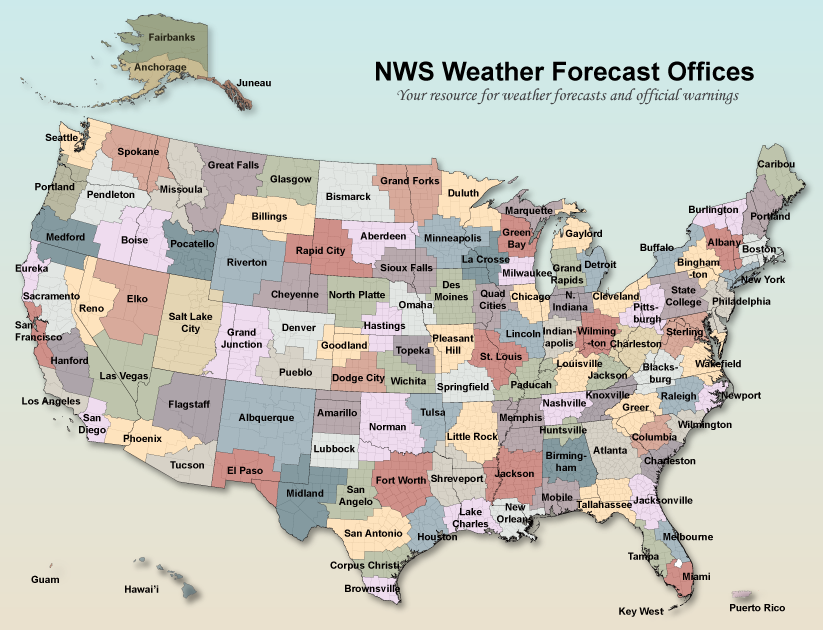
NWS Office Websites in the path of this potential major hurricane are the following:
National Weather Service Tampa Florida
National Weather Service Miami Florida
National Weather Service Melbourne Florida
National Weather Service Tallahassee
National Weather Service Jacksonville Florida
View live tropical outlooks and maps on our website with the links below:
Tropical MapsTropical outlooksStay tuned for the latest.- Joshua Wisel

Leave a Reply