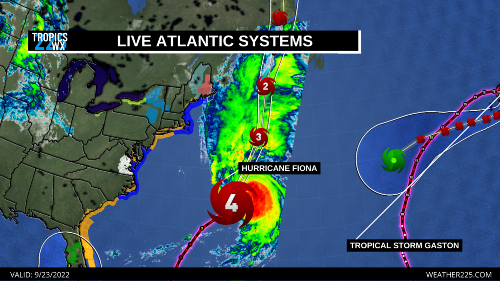
As of this morning (Friday 9/23/2022) the Atlantic has 2 active storms, with the biggest and most concerning storm being Hurricane Fiona. Hurricane Fiona as of 10:00 a.m. central time, had shown signs of strengthening once again, and the National Hurricane Center now has Fiona once again at category 4 strength, upgraded from a previous weaking CAT 3 storm. Fiona now has max winds of 129 mph, and is moving north east around 29 mph. Fiona is forecasted to move towards and potentially impact portions of Atlantic Canada as a Category 3 hurricane. Viewers in that area should stay tuned to local officials, the National Hurricane Center, and Environment Canada for the latest information.
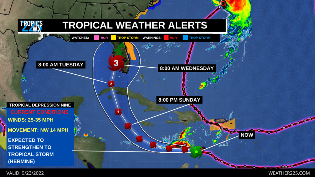
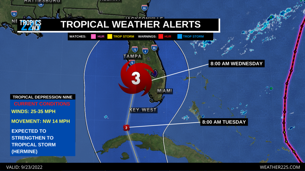
This potential major hurricane is forecasted to reach the Florida coast by Wednesday morning, with current forecasted landfall around the Fort Myers area. During that time, areas along the southern and western Florida coast could expect dangerous hurricane conditions, including flash flooding inland, storm surge flooding concerns along coastal areas, and potential dangerous winds from 115-145 mph.
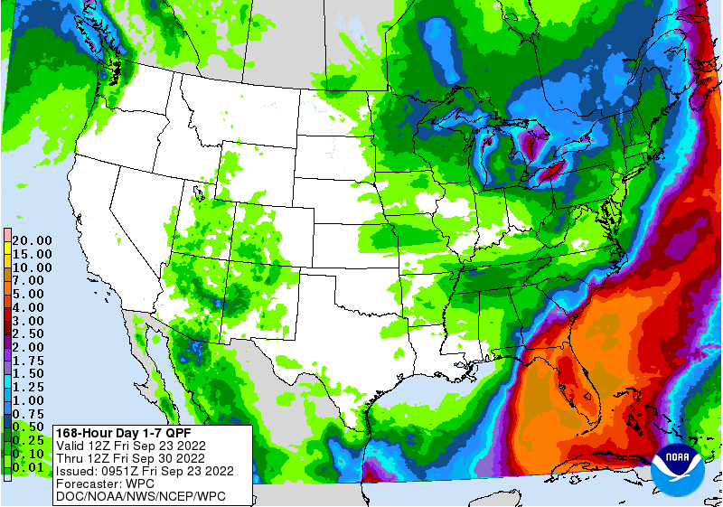
Viewers in these areas should stay tuned to local National Weather Service media, the National Hurricane Center, and local officials for updates in the coming days.
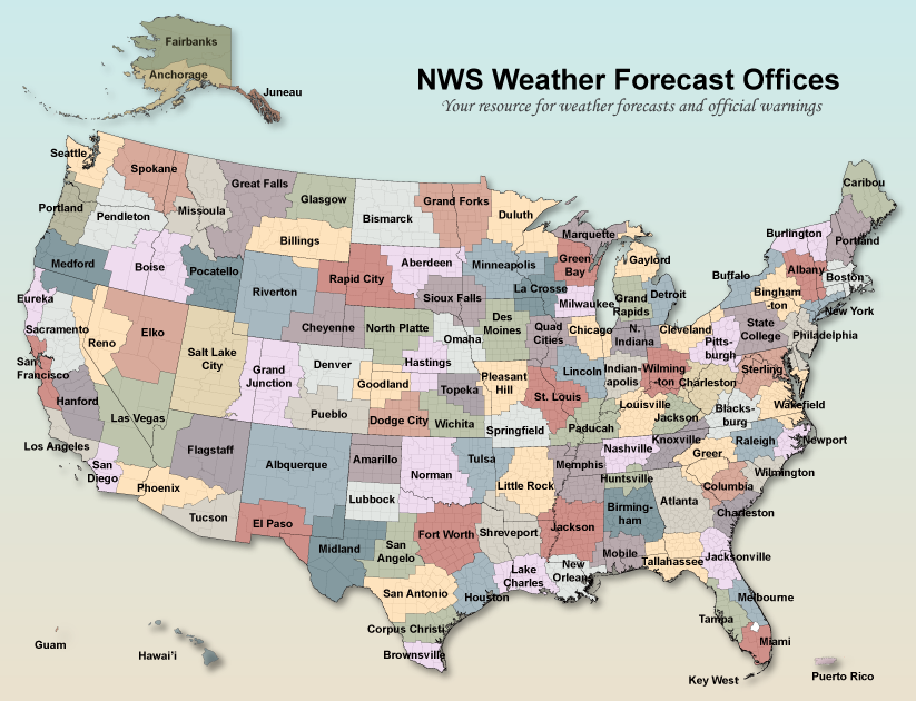
NWS Office Websites in the path of this potential major hurricane are the following:
National Weather Service Tampa Florida
National Weather Service Miami Florida
National Weather Service Melbourne Florida
National Weather Service Tallahassee
National Weather Service Jacksonville Florida
View live tropical outlooks and maps on our website!
Stay tuned for the latest.
– Joshua Wisel

Leave a Reply