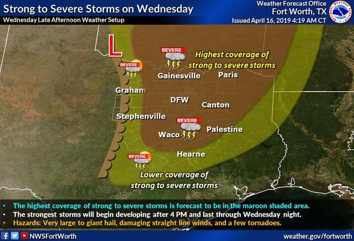
Good morning north Texas and happy Tuesday. Tomorrow a moist air mass will be beneath a well developed EML (Elevated Mixed Layer) in the early half of the day, this should keep activity from developing early in the day/early afternoon, however, this capping is expected to likely deteriorate during the afternoon with peak daytime heating. Once the cap is gone storms will likely develop over the western half of the region and become more mature with strong updrafts as they move East/NE through the region. 
By far the main threat looks to be large to giant hail 2.50″+! So I would plan now for very large hail and clean out the garage to move the car. Not everyone will see giant hail, however coverage will be pretty scattered and there’s a chance for the whole region to see this threat (but once again it’s not a guarantee your area will be the area to see this activity) it’s just a good idea to prepare.
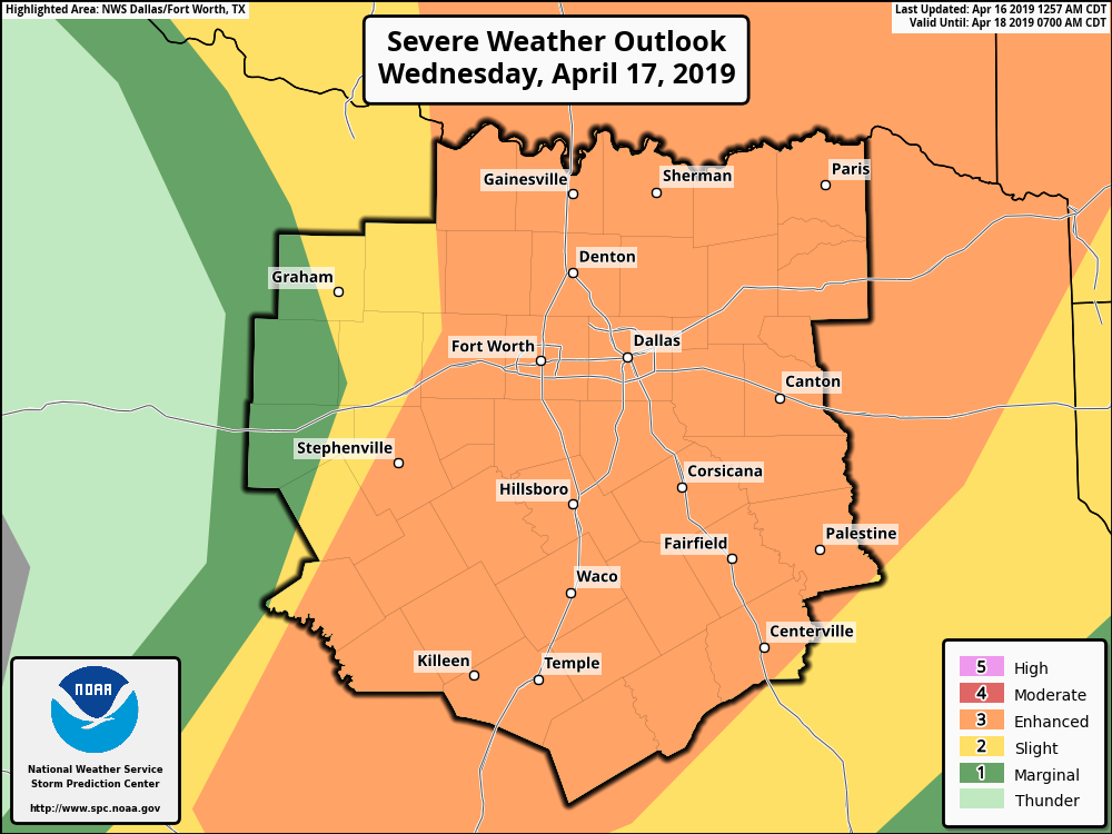
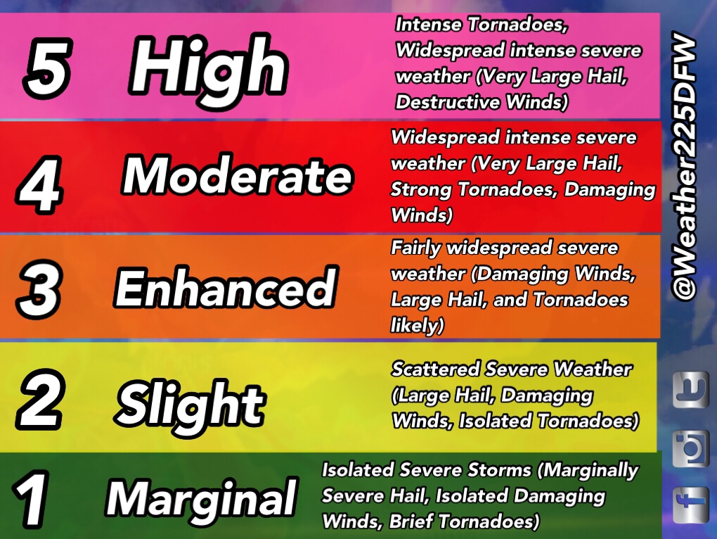
As of this morning the SPC has almost all of the region we cover under a (3/5) enhanced risk for storms tomorrow. If you’re new to the area and unfamiliar with these outlooks and their meanings, we have a graph bellow the outlook with what each color means. Also these outlooks don’t indicate the severity, they indicate where the highest coverage of storms is forecasted to be, as any outlook color can see all types of severe weather, just at a lower coverage than higher risked areas. The main threats with storms tomorrow will be large-giant hail, damaging winds, and a few tornadoes possible

So a quick overview: Storms are likely across the region during tomorrow afternoon into tomorrow night
Threats- Hail anywhere from 1″-2.50+”, damaging 70mph winds, and a few tornadoes possible (THIS IS NOT a recap of what we saw the other day in central TX and LA, MS)
Timing- Tomorrow afternoon into tomorrow night (specific timing will be clear by tomorrow morning so stay tuned)
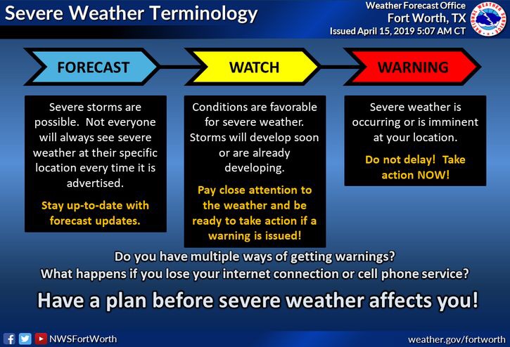
How to prepare- To be clear there is no reason to panic or be anxious, the absolute best thing to do is I would prepare a plan of what to do with your car in the event of a hail storm moving towards your location, and just review your severe weather safety plan just to be safe. Safety plans are plans you should develop for home or work like knowing where to seek shelter in the event of a storm impacting your area, and what you should bring with you. We see set up’s like this dozens of times over the years, after all we do live in the south and it’s storm season. Make sure you also have ways of receiving warnings (NOAA weather radio, text alerts or alerts from an alert app).
We still have some details to refine over the rest of the day, we’ll keep you up to date with the latest, and let you know of any changes 

Leave a Reply