
Good morning NTX, and happy Sunday. To start this blog, today across the region expect a pleasant day with highs in the mid/upper 60’s with mostly clear skies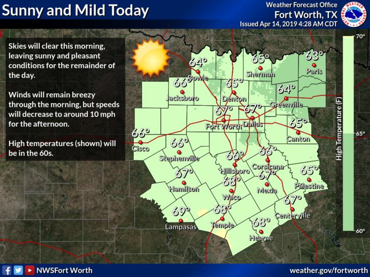
After storms yesterday we’ll remain quiet weather wise across the region until mid week this up coming week. The SPC (Storm Prediction Center) has placed the DFW area under a 15% and 30% risk zone in a day 4 outlook (Wednesday) . The highest likely hood for activity would be for the areas shaded in the orange 30% outlined areas
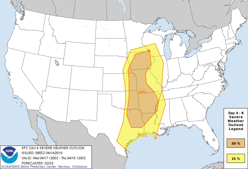
Models are now coming into better agreement in the medium range period as they show a strong upper trough moving from the Rockies into the plains in the day 4 period. Conditions will be favorable for severe weather, however we won’t know the full story until we get closer to mid week.
While these 30% outlined areas aren’t issued all to often with these 4-8 day outlooks, we will caution you with what you read online! Several sources and “weather pages” will see this outlook and skim over the text before going online and posting “run for the hills this is going to be horrible!” When that may not be the case. At this point this is a forecasted area to watch over the next 3-4 days for the POTENTIAL for severe weather, there are still many uncertainties with this, and long range forecasts aren’t entirely accurate days out, they just give us a glimpse of what could be possible. We will continue to monitor the forecast, it wouldn’t be a bad idea to review your severe weather safety plan because it is spring and it’s always a good idea to plan where you would go in the event of storms in your area. I would advise our readers to take any articles you see online mentioning an outbreak across the area with a grain of salt, we truly won’t know the full picture until the day before or day of. So stay tuned!
Leave a Reply