Good morning NTX, we have a threat for strong to severe storms today across the whole region. This is a day to stay weather alert! 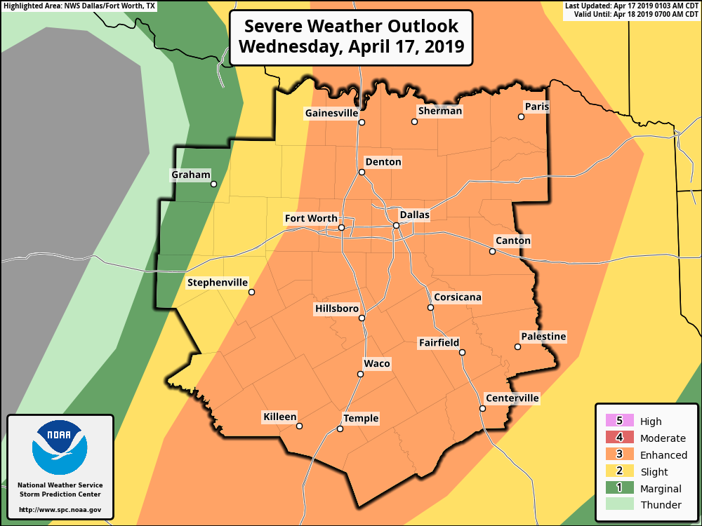
To start this forecast, a large portion of NTX including the DFW metro, is under an enhanced (3/5) risk for storms. However, no matter the risk you’re in, you should stay weather alert today. Threats with storms today will be: Large hail 1″-3″, Damaging straight lined winds of 70mph, and a few tornadoes. To be clear not everyone will see storms. A lot of us may not see anything. But its a good idea to keep an eye on the weather today and tonight
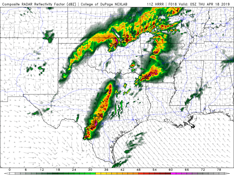
Storm timing will be the greatest from 4pm on into tonight. Latest models this morning are showing isolated cells move across the region with a large hail threat, before a line of storms comes together west and pushes into the region, transitioning the threat from large hail to a damaging wind threat. 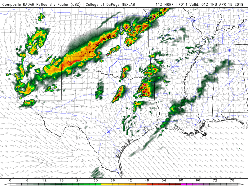
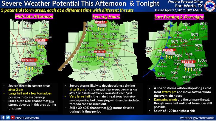
Here’s a graph from the National Weather Service answering some questions about today’s storm risks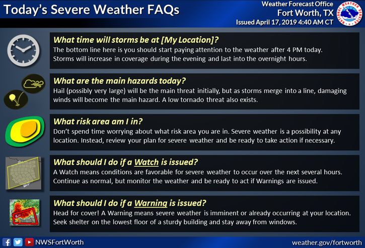
Today you will need to stay weather alert from 4pm on. Make sure you have numerous ways to receive warnings! And stay tuned to Weather225 for the latest.

Leave a Reply