We have an area of concern we’re keeping a close eye on in the central Atlantic, making its way closer towards the Caribbean. This area of board low pressure that’s associated with a tropical wave, continues to develop areas of slowly organizing showers and storms in the central Atlantic. As this system continues to move west/north-westward, it will continue to move through a more favorable environment for development, and we could see a Tropical Depression form within the next 48-72 hours.
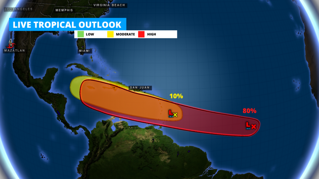
This low pressure area now has an 90% chance for development within the next 72 hours. And a 70% within the next 48 hours. If this system develops, we could see our next named Storm of the season with tropical Depression
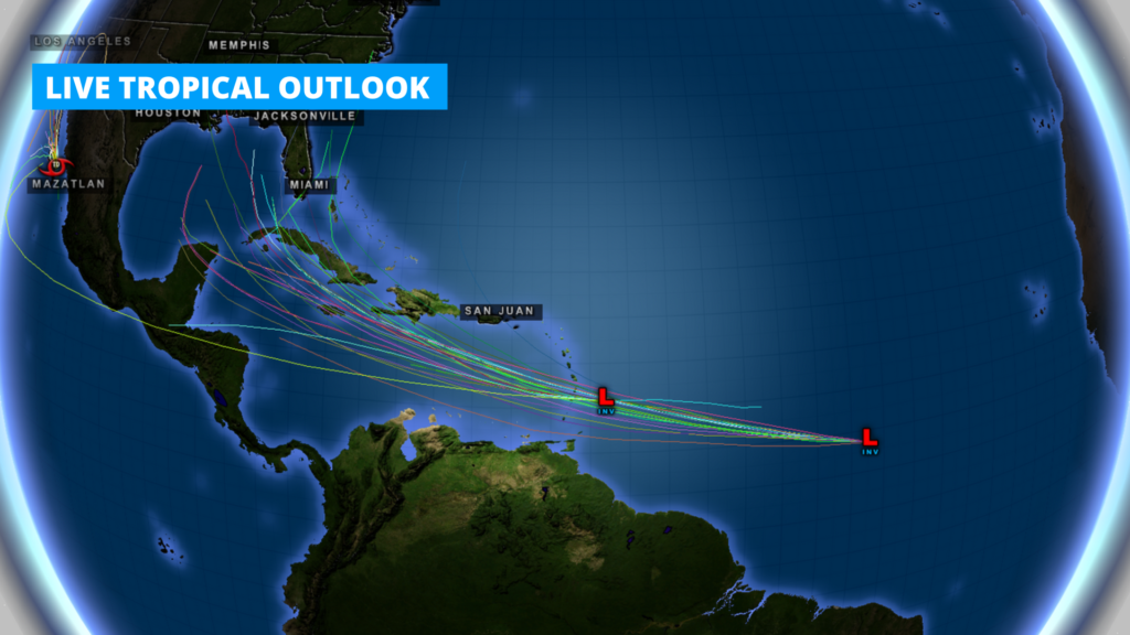
As we get more information, it’s always a good idea to just be aware of this developing system along the Gulf Coast, southern Florida, and the Caribbean just to be safe. It’s just that time of year. Current Spaghetti Plots for potential paths of this system show it could eventually make its way towards Cuba, Southern Florida and possibly into the Gulf of Mexico. However, with that being said, it’s easy to be caught up in the hype of online posts saying it will for sure impact certain locations because of model guidance. For the most reliable information because there is still many uncertainties with this system, stay tuned to local forecasters, National Weather Service, and Weather 225. We’ll keep you ahead of the storm.
Visit our Tropical Outlooks and Map page for the latest tracks and development risks 24/7.