
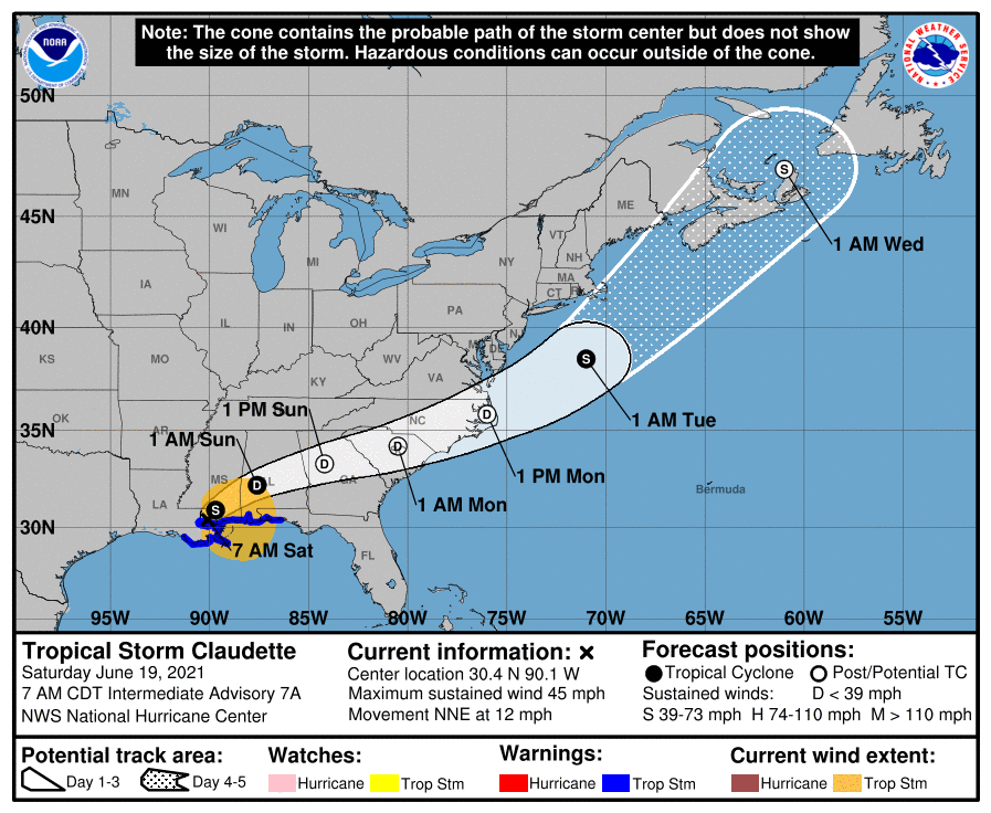
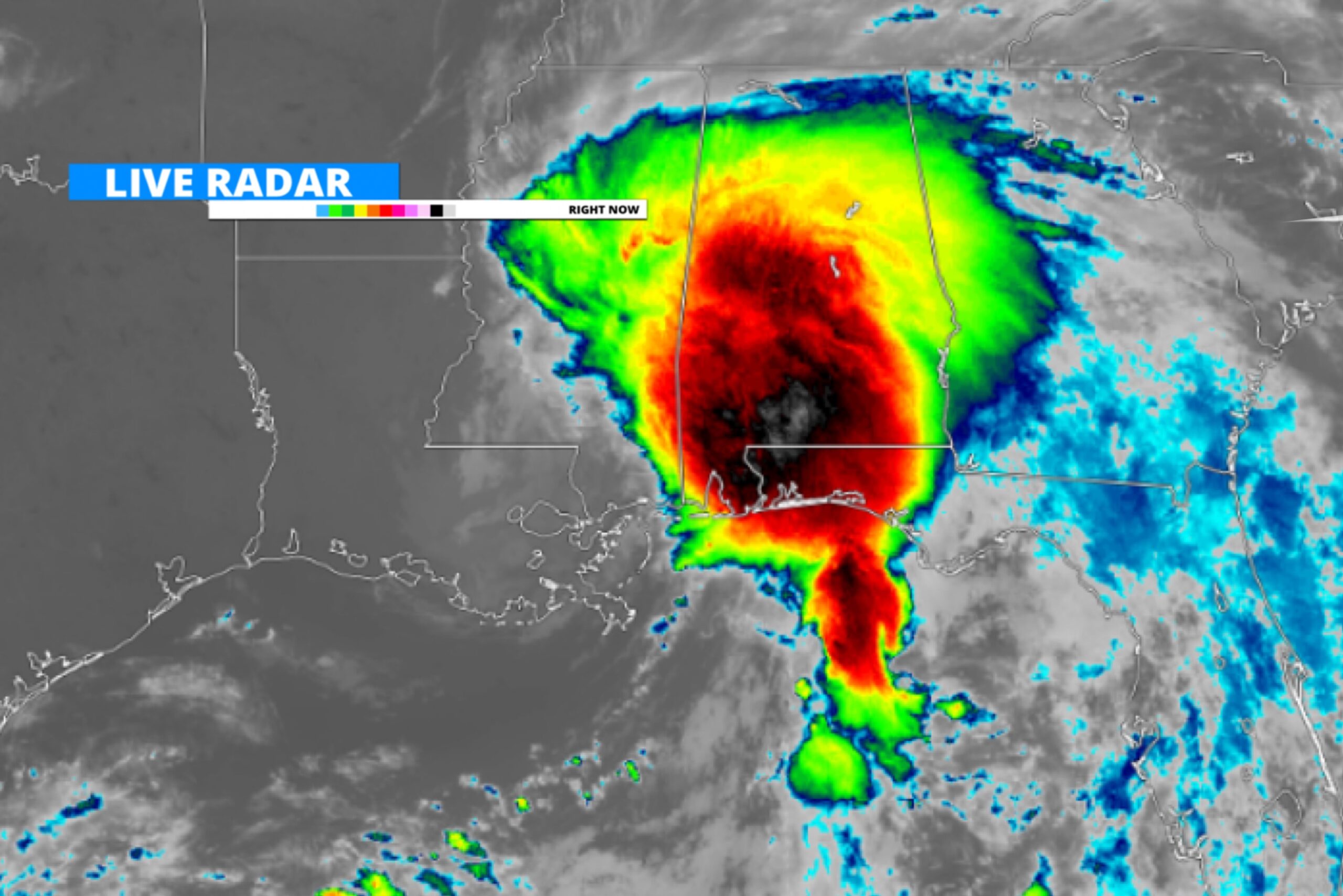
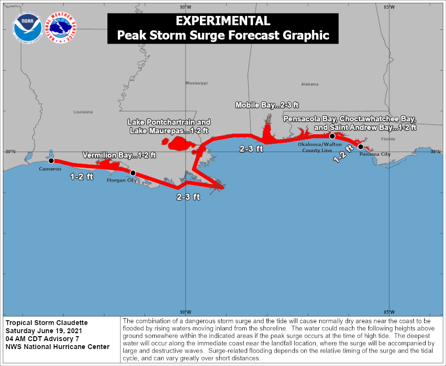
Tropical Cyclone Three now Tropical Storm Claudette, continues to move further north into the costal areas of Mississippi and Alabama, and the far western Florida panhandle. As this storm moves further inland, it’s bringing tropical storm force winds, heavy rain and flooding, and even some tornadoes with it. Bellow is the current track of Tropical Storm Claudette.
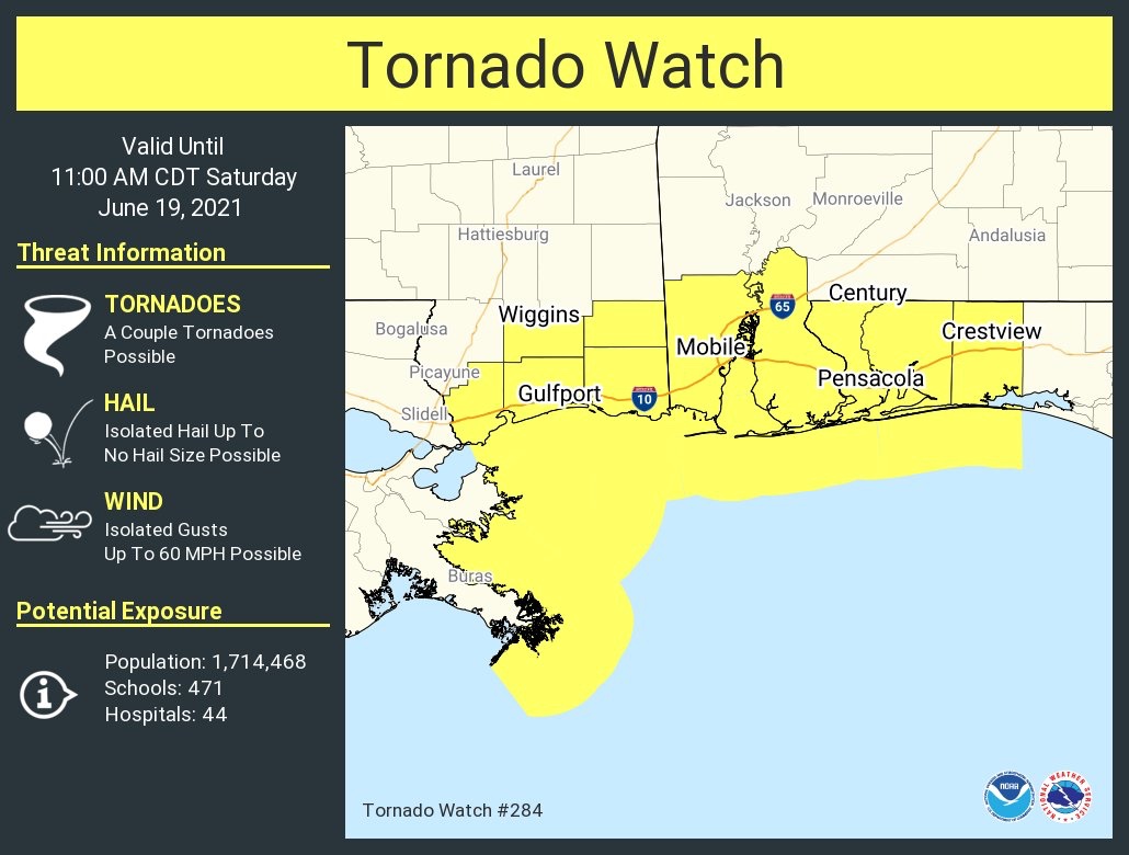
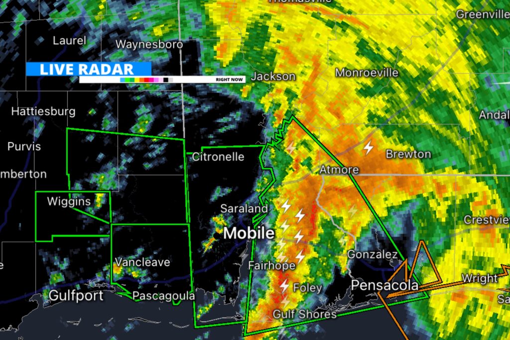
Very early this morning the Storm Prediction Center issued a Tornado Watch until 11am CDT (6/19/21) for parts of southern Mississippi, Alabama, and the far western Florida panhandle. This morning numerous tornado warnings have been issued for parts of these states. Stay tuned to local NWS and news outlets for warnings.
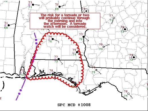
As of 9:30 AM CDT, the Storm Prediction Center issued a mesoscale discussion for parts of southern Alabama, and the western Florida Panhandle, where an additional tornado watch could be considered, as the threat for tornadoes may continue later into the day.
In addition to the threat for damaging winds, and some tornadoes, flash flooding continues to be a primary threat with Claudette as flash flood warnings have been issued for many Mississippi and Alabama coastal areas, as storm surge, and up to 3-5” of rain is causing some flooding issues.
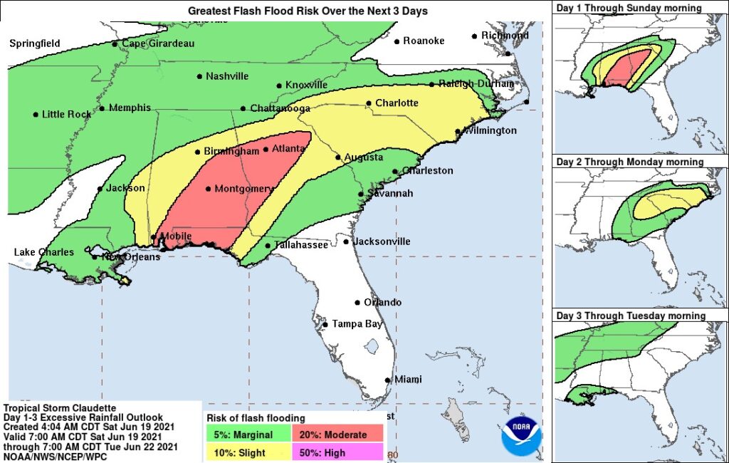
There is a moderate risk for excessive rainfall today for a large portion of the western Florida Panhandle, central and eastern Alabama, and western and northwestern Georgia. This includes major metropolitan areas such as Mobile, Montgomery, and Atlanta. Please stay tuned for updates and alerts from your local NWS.
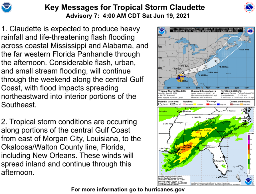
Above is a key statement from the National Hurricane Center on Claudette.
Follow our media for more updates!
Leave a Reply