
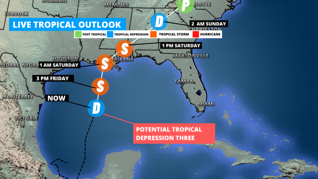
Here’s a look at the current track for Potential Tropical Depression Three in the Gulf of Mexico. This morning the current forecast has this storm strengthening into a Tropical Storm by later today and make landfall as a tropical storm by 12am tonight. Stay tuned for updated tracks on our website and from the National Hurricane Center for track updates throughout the day.
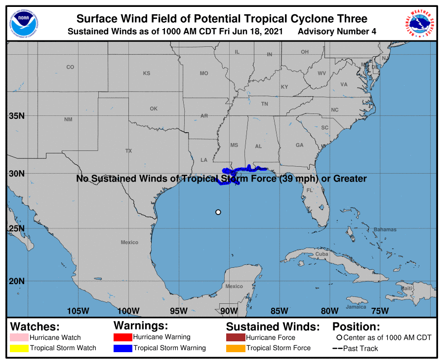
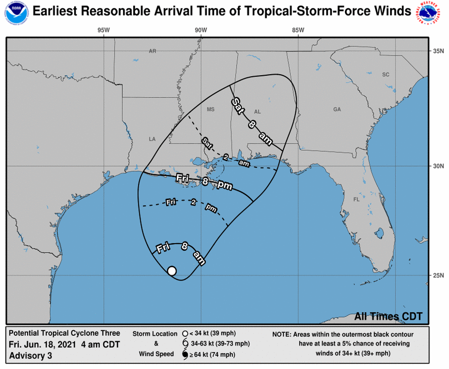
Tropical storm warnings remain in effect for parts of coastal areas in LA, MS, AL, and FL. Earliest times for tropical storm force winds to arrive to coastal areas in LA, MS, AL, and FL look to be around 8pm this evening. The biggest concern will be not only for tropical storm like conditions, but also for heavy rains and flash flooding.
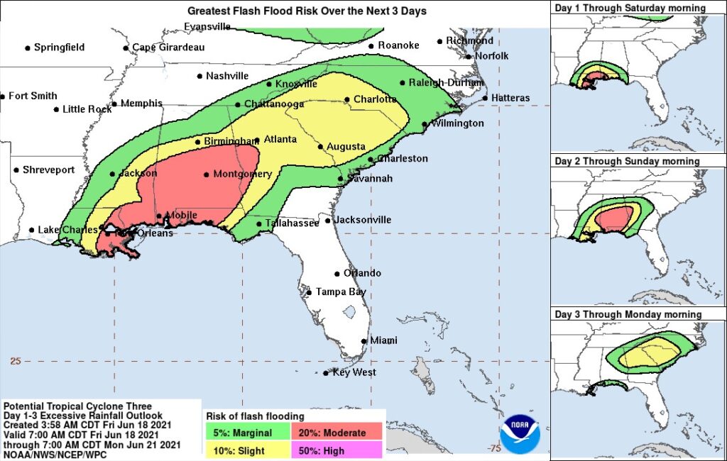
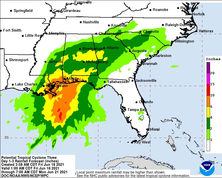
There is a moderate risk for excessive rainfall the next days 1-3 period. Forecasted rainfall amounts for some areas in southern LA, MS, AL, FL could be anywhere between 3-9” with isolated amounts of higher possible. Stay tuned to local NWS and officials for updates and alerts.
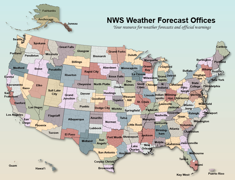
If you’re not sure what National Weather Service office covers your coastal area, please refer to the map bellow, and visit their website for more information.
Stay tuned for updates from us and local officials
Follow our media for more:
Leave a Reply