
We now have a high risk for potential tropical development in the Gulf of Mexico, over the next 48-72 hours. The National Hurricane Center has raised the short term risk for development over the next 48 hours to 70%, and raised the next 72 hour threat up to 90% for potential development. We could likely see a tropical depression form in the western Gulf north of the Bay of Campeche, by later today or Friday.
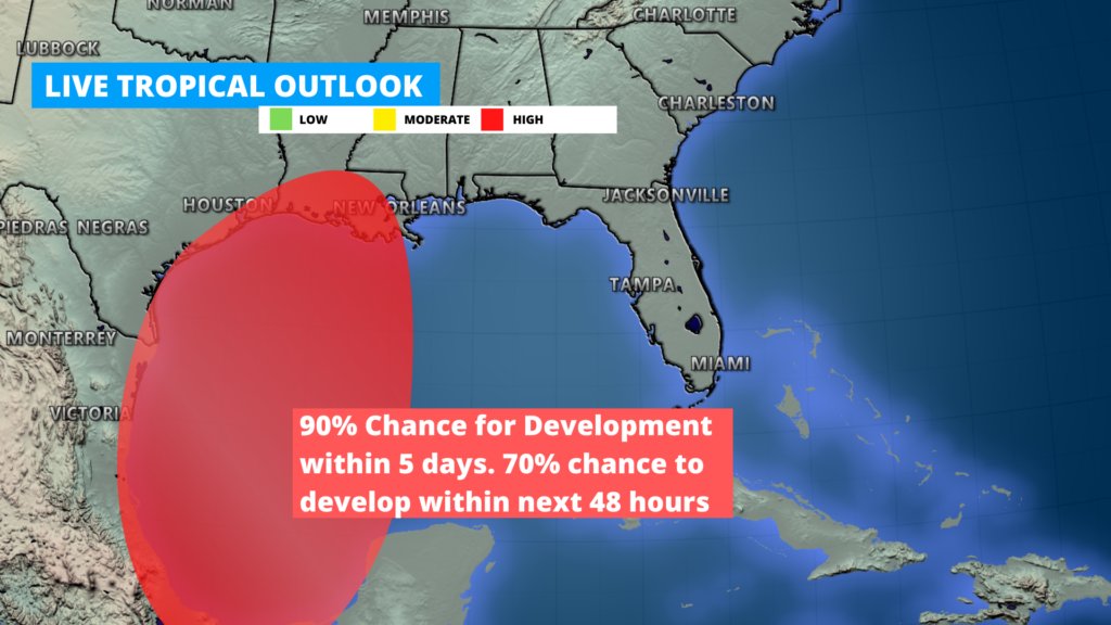
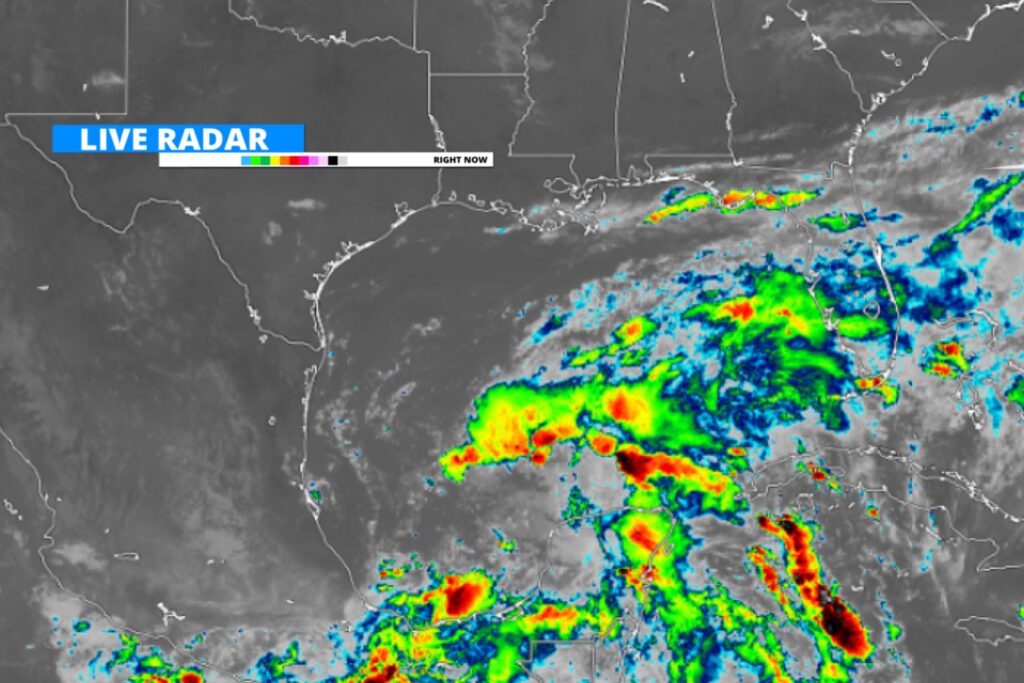
An area of disorganized showers and storms associated with a low pressure system, continues to organize and develop just north of the Bay of Campeche. This system has brought heavy rain to parts of Central America and Mexico as it developed, and could bring heavy rainfall to the northern Gulf by late Friday. Stay tuned for updates as we get more data throughout the day.
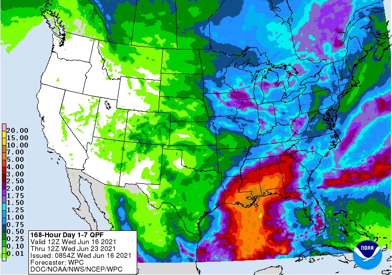
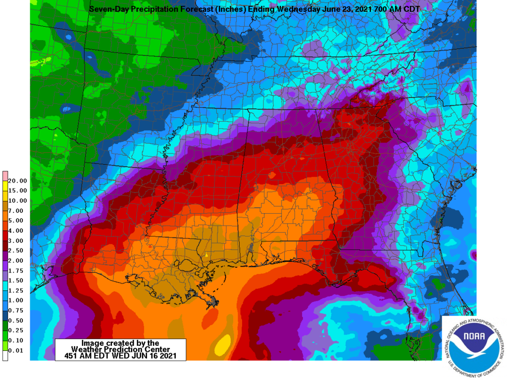
Coastal areas from far southeastern Texas, Louisiana, Alabama, Mississippi, and Florida should brace for a risk of heavy rain and a flooding threat Friday through Sunday. Estimated rain totals from this tropical systems arrival at this time appear to be between 3-8” with localized amounts of more possible. Please stay tuned to local forecasts and officials for updates.
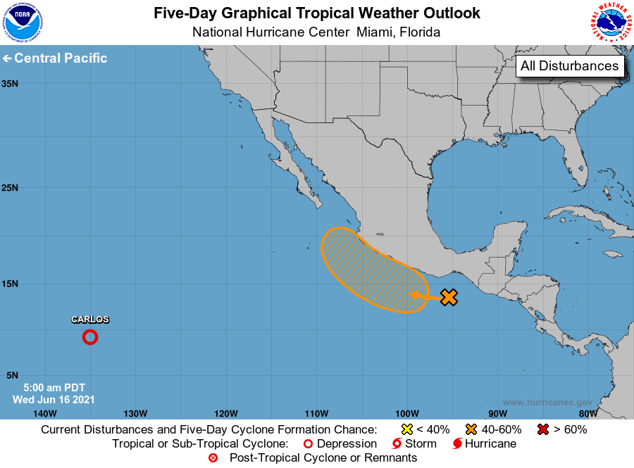
Taking a look now at a broader picture of Tropical activity, we now have a 60% chance for tropical development off the western coast of Mexico as a low pressure system is expected to develop later in the week, combining with disorganized storm activity. This could bring a flash flooding threat to coastal areas in western Mexico if it develops.
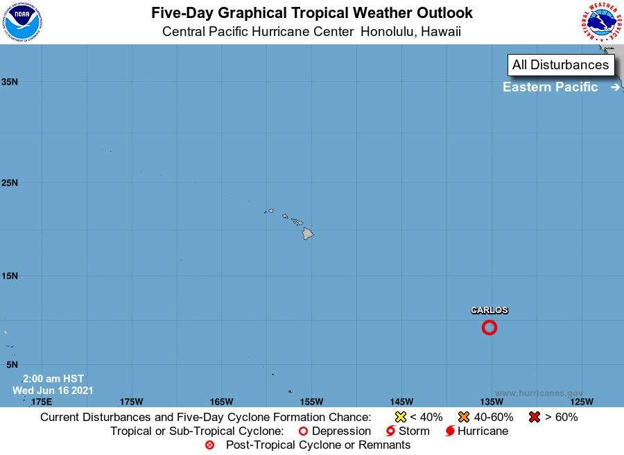
In the Central Pacific, post tropical Carlos continues to slowly move west and weaken, with a chance of Carlos fully dissipating by Friday. Carlos is currently 1,500 miles ESE of Hilo Hawaii.
Follow our Tropical Updates media pages for the latest updates. And follow our Telegram to be notified for further updates and posts.
Leave a Reply