
The National Hurricane Center has stated that they will go ahead and issued advisories at 4pm (CDT) for potential Tropical Cyclone Three, developing in the Gulf of Mexico.
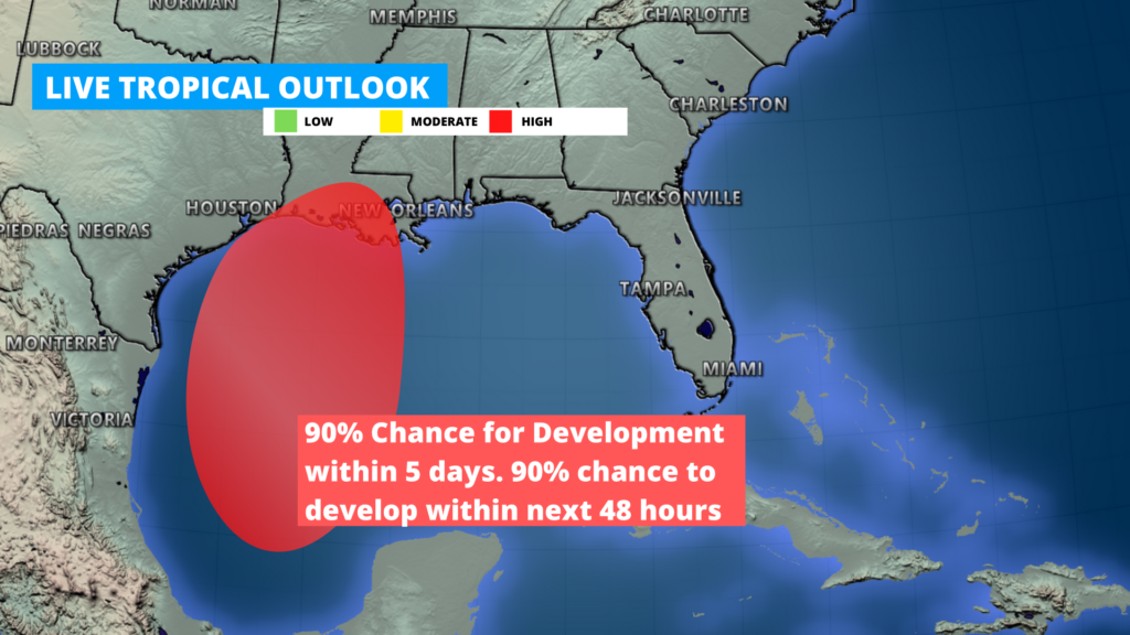
This system will move towards parts of some Gulf Coastal state (LA, MS, AL, FL) by Friday, and bring a chance for heavy rain, and flash flooding along the southern coast Friday through Sunday.
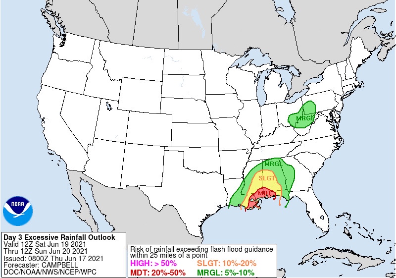
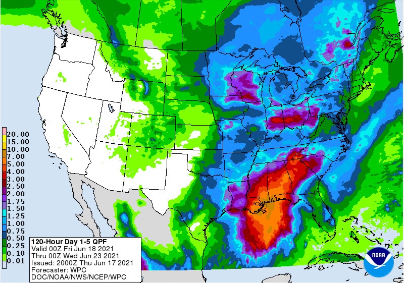
The heaviest rainfall forecasted, looks to be for areas between New Orleans Louisiana, Mobile Alabama, and Tallahassee Florida. There is a day 3 moderate risk for excessive rainfall for late Friday and Saturday, where forecasted rainfall amounts could be anywhere from 3-9” of rain across parts of souther LA, southern MS, southern AL, and western FL
Stay tuned for further updates and tracks and advisories are issued.
Follow our media
Leave a Reply