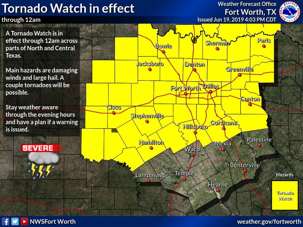
The National Weather Service in Fort Worth, and the Storm Prediction in Norman OK, have issued a Tornado Watch for all of North Texas, and a large portion of Central TX until 12am tonight! 
During this time all types of severe weather will be likely, as the atmosphere above is very to extremely unstable with dew points in the mid to upper 70’s! As well as CAPE levels near 7000. Hail anywhere from Penny to Softball sized, Damaging winds of 60-80mph, and a few tornadoes will all be possible with storm development!
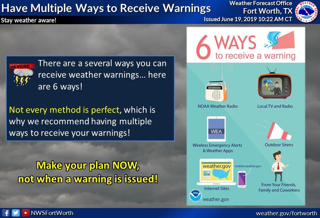
Not everyone will see storms, or these severe weather threats, however, we all have an equal shot at seeing severe activity. So make sure you have numerous ways of receiving warnings.
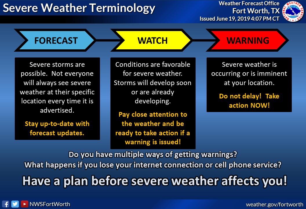
And remember a Watch means that conditions are favorable for the development of severe weather. Do you know the differences between a Watch and a Warning? See the graph bellow for their meanings
And stay tuned to local NWS, News media, and Weather225 for the latest!

Leave a Reply