
Good morning north Texas, we have a few things to mention for today’s forecast. To start, we have a heat advisory in effect for areas we cover to the south 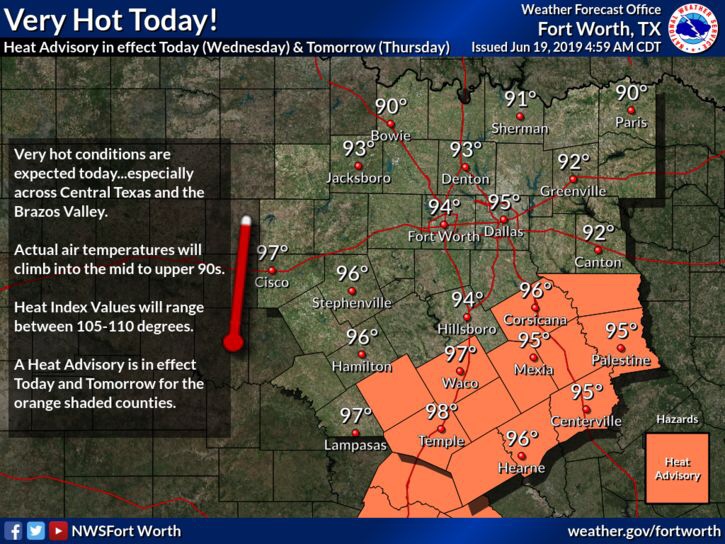
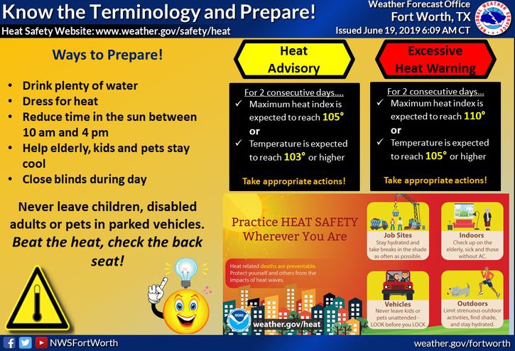
Heat index values in the advisory areas will be around 105-110! However, the actual temperatures will be in the mid to upper 90s. If you have any activities outdoors today in these areas, remember to hydrate, and to take plenty of breaks in the shade!
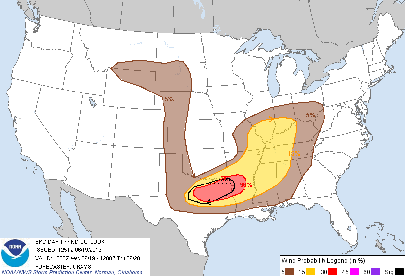
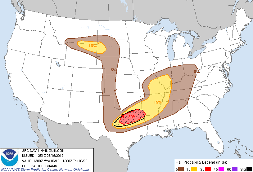
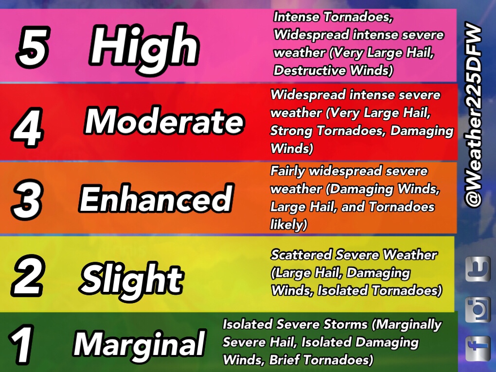
For the metro area, expect hot conditions with highs in the mid 90’s, and humid conditions as well, as dew points will be in the upper 60’s and 70’s today. Later this afternoon, this evening into night, storm chances return to the region. Currently the SPC has most of north, and north east TX under a (3/5) enhanced risk for storms, with a marked “significant” risk area for damaging straight line winds, and the threat for small to very large hail. A tornado risk will exist however, not be as significant as the hail and wind threat. 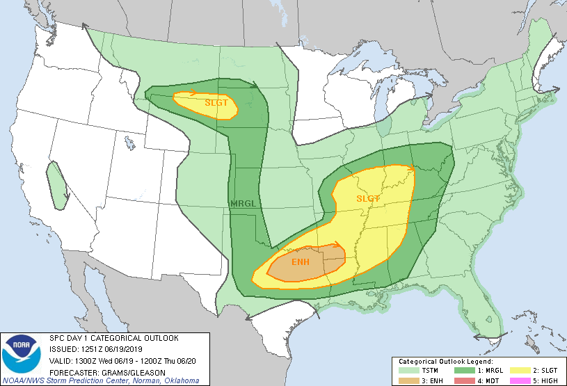

To be clear, not everyone will see storm or severe storm activity, however a large majority of us could see some storm activity later today into tonight. Timing tonight is shown on the graph bellow from the NWS Fort Worth. Best timing for DFW looks to be later this afternoon/ early evening into tonight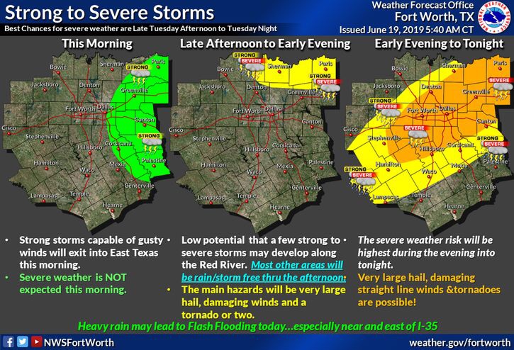
Stay weather alert today and tonight! And make sure you have a way to receive warnings. And stay tuned to DFW Weather 225 for the latest and possible broadcasts on Facebook
-JW
Leave a Reply