
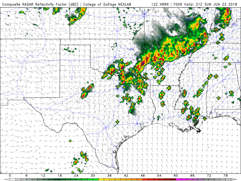
Good morning NTX, today we have a chance for storms this evening into tonight across the area. It looks like most of us are going to see rain/thunderstorm activity today as coverage is looking to be about 90-100% across the area, scattered thunderstorms should develop this afternoon before a complex or line of storms pushes south east across the area. 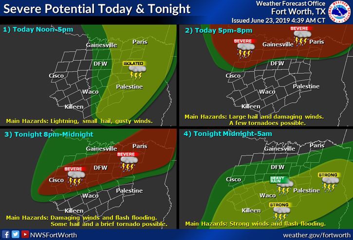
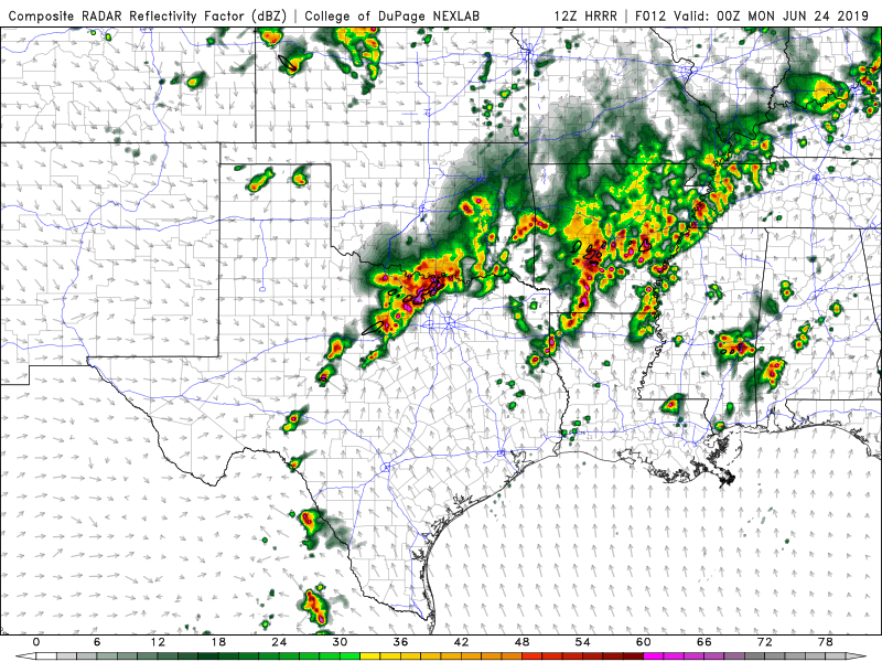
With the storms during the afternoon and early evening, we could see a threat for hail anywhere from pea to tennisball sized (most likely half dollar to goflball but a threat for bigger sized near tennisball), damaging winds, and a few tornadoes, before storms later tonight merge into a line shifting from a hail threat, to a damaging wind (60-70mph), and isolated tornado threat, as well as a flash flooding threat. 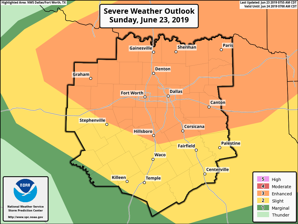
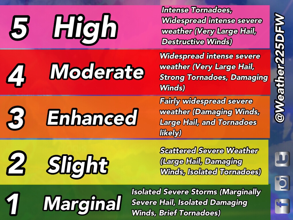
The Storm Prediction Center in Norman has placed much of north Texas under a (3/5) enhanced risk for storms today. These outlooks are not just issued on the anticipated intensity, these are issued on anticipated coverage. Not all of us may see severe weather activity during the afternoon, however, a large majority, if not all of the metro could see a damaging wind threat as a line of storms moves through. The greatest hail threat would exist with isolated storms separate from the line of storms this afternoon and evening, or with any isolated cells ahead of the main line tonight. 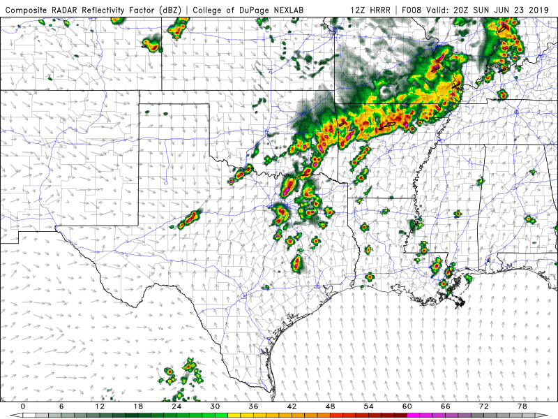
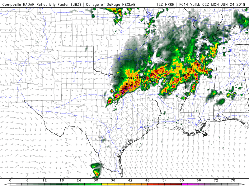
In addition to the severe weather threat, flash flooding may also cause some issues in spots. Be mindful of low lying areas, or areas prone to flooding this evening and tonight, and heavy rain from thunderstorms could cause some issues, and ponding on some roadways. The Weather Prediction Center has placed parts of the metro area under a moderate (3/4) risk for excessive rainfall/flash flooding risk today and tonight. 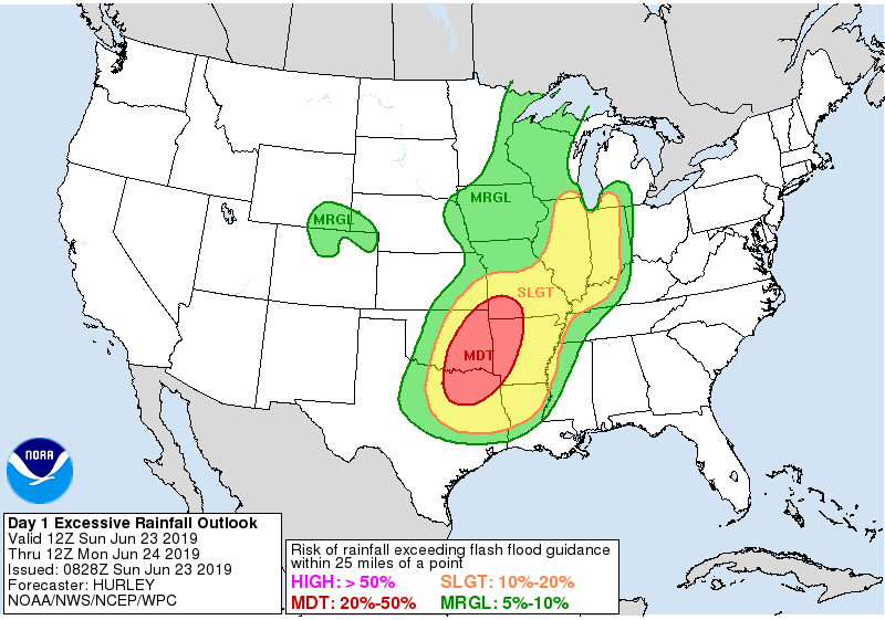
Make sure you have multiple ways of receiving warnings, with these 6 ways of getting warnings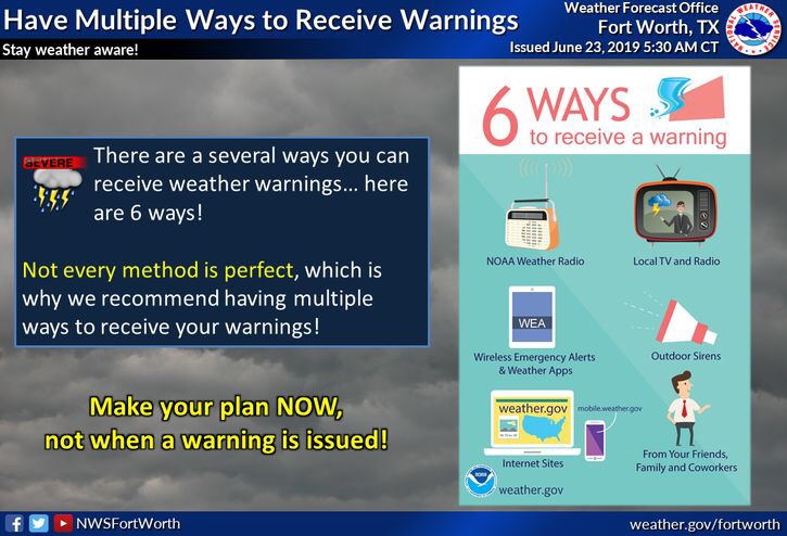
And stay tuned for the very latest.
-JW
Leave a Reply