
Good morning north Texas. To start your weekend expect party cloudy skies and highs in the mid to upper 80s with south winds of 15-20mph. A slow moving cold front will push into the region from the north west today, mid day showers and a few thunderstorms will be possible ahead of the front, mainly for areas north and north west of DFW.
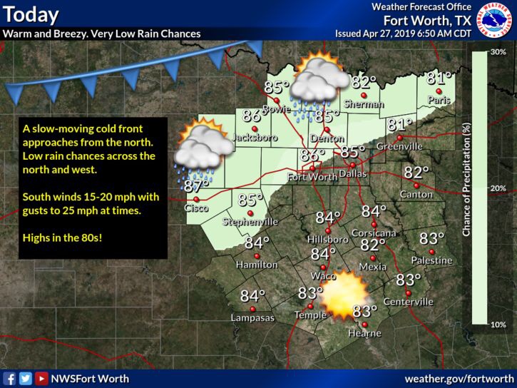
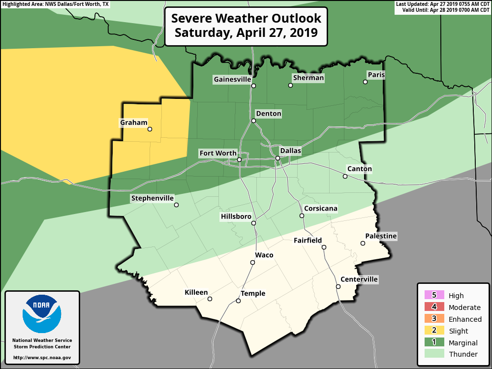
This evening we’re monitoring a chance for some strong to severe storms across areas mainly north of I-20. The chances to see this kind of activity will be determined off of whether or not a cap over the atmosphere will break or stay intact. The main hazards with storms would be large hail, damaging winds, and frequent lightning. Timing looks to be from 7pm-12am. So stay tuned throughout the day for forecast updates.

That’s tonight’s storm chances, the next storm chances for us appear to be around Tuesday as a day 4 outlook has NTX placed under another enhanced risk for severe storms. There’s still many uncertainties with this forecast, however you should stay weather aware as we head into the week, we’ve been watching the forecast for Tuesday for a couple of days at this point, and it appears we have a potentially classic spring NTX set up, with conditions being favorable for all types of severe weather, including Large Hail, Damaging Winds, and even a Tornado threat, however to what extent we don’t know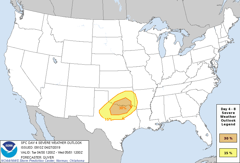
Stay tuned for the latest
Leave a Reply