
Good morning north Texas. Before we begin to make this clear NOT everyone will see all types of severe weather over the next two days. This is a forecast notifying you that the atmosphere will be supportive for all types of severe weather, so with that we have to tell you there is a risk. There is no way to forecast pinpoint exact locations/towns and neighborhoods and if you will be hit or not, we can forecast that the region has an equal opportunity to see some sort of activity. If a forecast is issued our goal is to never overhype of forecast if it doesn’t need it, so if any forecast is issued and your area doesn’t receive damage, not is not means to be harsh online towards meteorologists and sites who work hard to keep people notified and safe during storm season, it should be a good thing that your area didn’t see anything! We know with the last forecast there was a lot of confusion and negativity online about no storms. With that being said let’s get into the forecast
Today there is a threat for all types of severe weather between 1pm-10pm (timing is for all the region not just DFW)
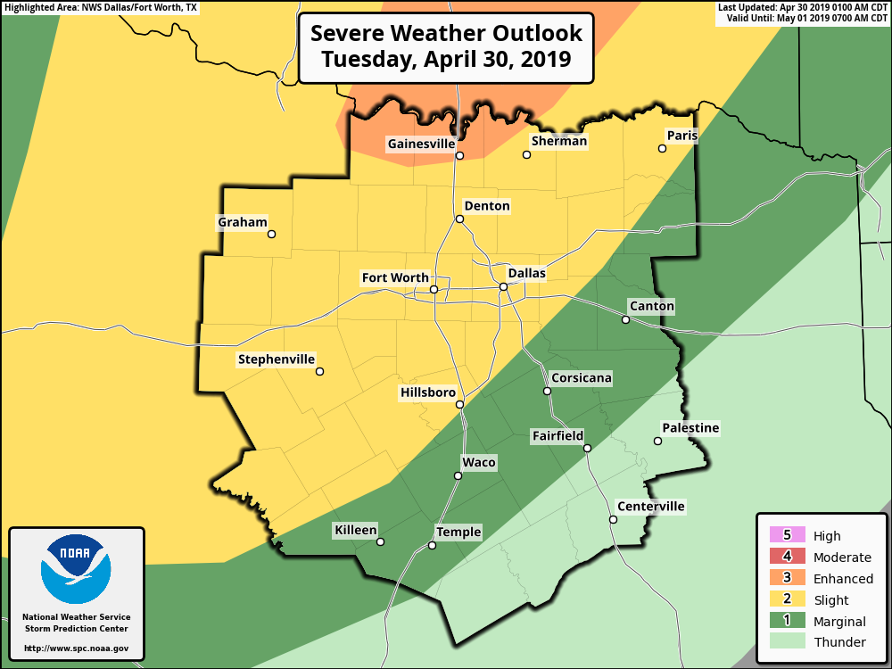
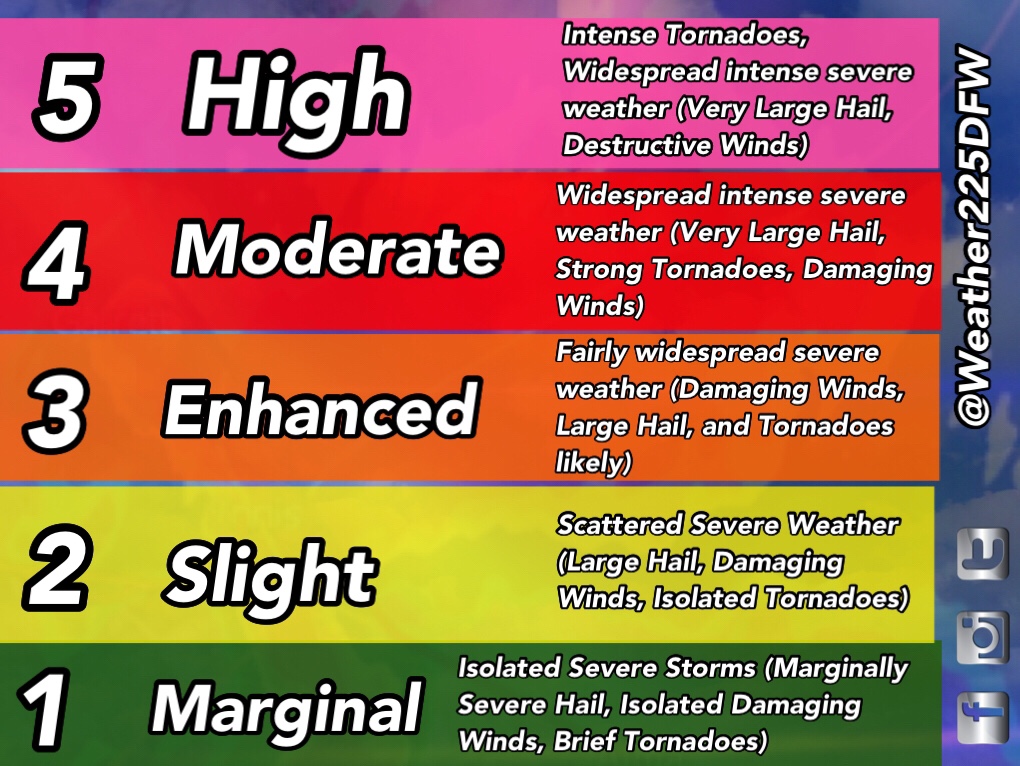
Today’s threat is currently at a (2/5) slight risk for almost all of NTX, with a small area of a (3/5) enhanced risk for storms covering Gainesville and areas north into Oklahoma. Storms will have the potential to produce 70mph winds, Large hail anywhere from quarter sized to tennis ball sized or even in isolated spots up to baseball sized, and even a tornado threat, especially for areas slightly NW of the DFW area. However, everyone in the risk zones should stay alert today for the possibility of strong storms. The main activity should start early-mid afternoon today, and continue into the evening. Warm temperatures and rising humidity this morning as well as patchy drizzle will linger this morning. So we may get a few spots of pop up showers this morning, not everyone would see this however. 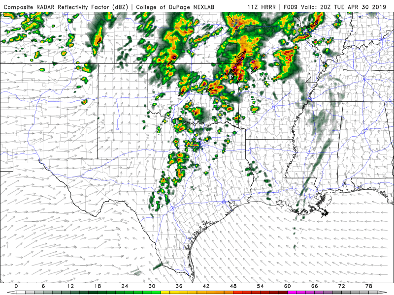
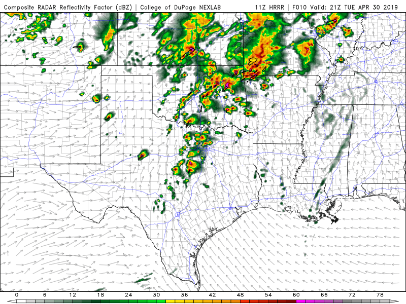
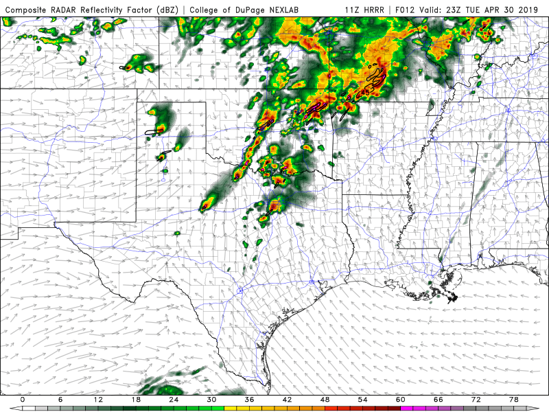
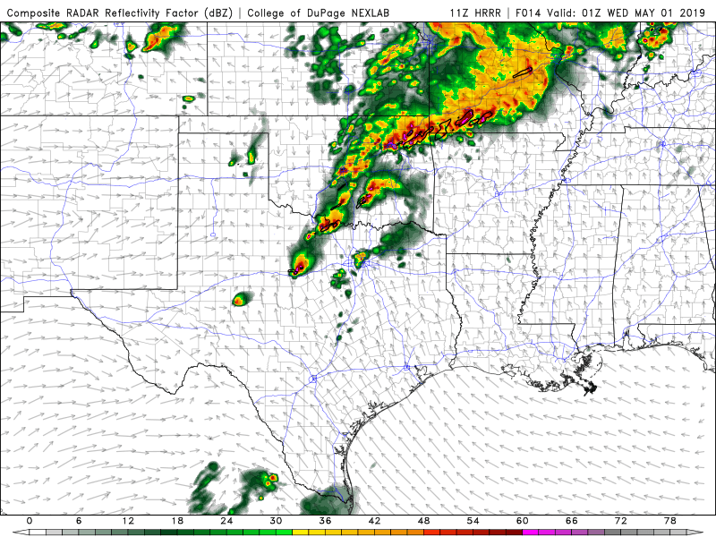
Above is one of the latest model runs of the HRRR this morning. It’s showing isolated and fairly spaced out storms this afternoon across the region. These would be super cellular in nature, with a threat for large hail and yes maybe even a spin up tornado. Timing as of now appears to be 1pm-10pm. Now that doesn’t mean you should panic and cancel everything on your list today! The best thing to do is monitor the weather closely, stay tuned for updates watches and warnings, and be sure you have multiple ways to receive warnings. There’s no reason to panic or be afraid of this, we’ve seen set ups like this a million times cause it’s spring. Just stay weather alert today and tonight 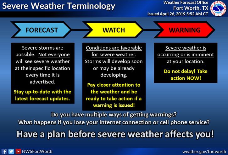
~JW
Leave a Reply