
Good morning north Texas, this is a quick forecast update for today. We have showers across the metro this morning, these should linger for a short time this morning, however these will NOT be severe in nature.

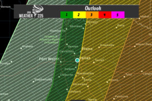
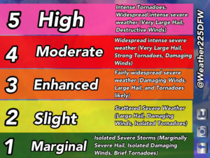
Models continue to show the dryline splitting the region by around 3pm today, the drylines movement looks to be slightly slower than anticipated so the risks have shifted slightly west into the metro area. Areas along and east of Dallas and Collim counties are in a slight 2/5 risk for storms this afternoon, as models are suggesting we could see some pop up random storms in these areas from 3pm-5pm. Bottom line this activity should be gone from the region by 7pm this evening

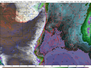
Dew points with the latest run look like they should reach near 73 along the dryline when it splits the metro! Area wide temperatures this afternoon should reach near the mid 80s
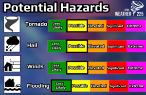
The main threats look to be large hail (tennis ball sized possible), and damaging winds. The greatest tornado threat will exist east/north east of our area. Timing once again looks to be from 3-6pm.
Leave a Reply