
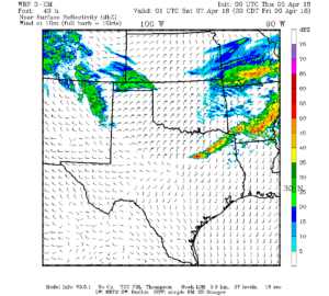
Good morning and happy Thursday NTX. This breif forecast will touch on the storm probabilities for tomorrow afternoon into early Saturday. To start a dryline and cold front will push into the region tomorrow afternoon, along and ahead of the dryline we will see the potential to see some strong to possibly severe storm development.
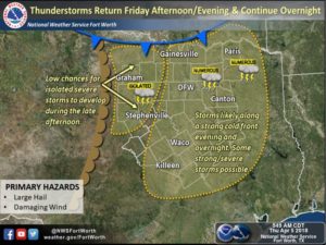
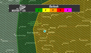
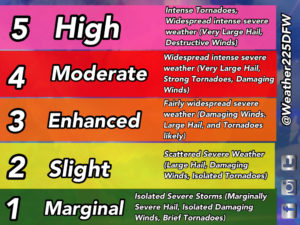
The SPC has placed a large portion of NTX under a (2/5) Slight Risk for storms, that could produce Large hail, damaging winds, and possibly a spin up tornado.
Storm development and coverage appears like it should be greatest for areas along and east of I-35 from possibly 5pm-1am tomorrow. However please check back for any updates on timing. 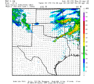
Thats pretty much it for this brief forecast. Check back for any updates. And stay up to date here on weather225.com and on our numerous social media pages @weather225dfw
Leave a Reply