
Hello North Texas. Quick Heads Up for Friday! We’ve been monitoring an upcoming system for days now that is expected to make its approach Friday afternoon into late Friday evening. The SPC has had outlooks for a few days now highlighting parts of the metro, into eastern north Texas. Today the SPC issued a day 4 outlook that includes almost all NTX areas along and east of I-35, with an Enhanced 30% risk area that includes parts of our eastern areas, into east TX, LA, and AR. 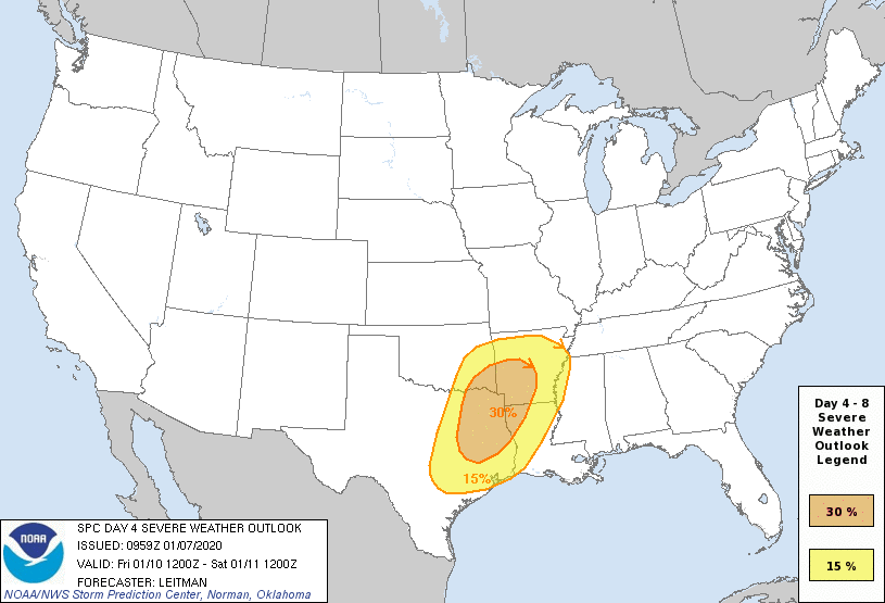
These 30% risk areas are not to common with SPC day 4-8 outlooks. And with that factor there is also a risk of over hyped forecasts online. So you will want to stay tuned to Weather225 and trusted forecasters for the latest. There’s still many uncertainties with this system and if our area will see strong/severe storms. These factors are cap strength on Friday, exact timing of the front itself, and if cloud coverage and rain prior to the system will have any effect on the strength of the system as it passes through. So there is still much to be determined. Storms on Friday if the conditions all come together, would be capable of producing all types of severe weather: Damaging winds, large hail, and possibly tornadoes. Damaging winds look to be the primary threat. The tornado and large hail threat would be greatest with any discrete cells ahead of the main front.
Regardless it is always a good idea to prepare before hand for storms just to be safe. You can prepare by reviewing your families weather safety plan: where is the best place to seek shelter, replace weather radio and flashlight batteries, and so on. It’s never a bad idea to over prepare, and review your weather safety plans, especially with spring approaching.
We will bring you the latest information in the coming days. Until then, enjoy this beautiful day!
-JW
Leave a Reply