
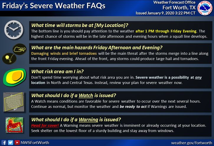
Good afternoon North Texas. There is a few things to go over, regarding tomorrow’s storm chances. First off it’s always a good idea to review your families severe weather safety plan. Severe weather has no calendar, and can occur at anytime of the year. Here’s a quick overview of what to expect tomorrow and what watches and warnings mean, if watches and warnings are issued.
To start, the Storm Prediction Center in Norman Oklahoma, has placed a large portion of areas along and east of I-35 under a (Orange 3/5) Enhanced risk for storms tomorrow. These outlooks are determined by expected storm coverage, not by threat alone. Regardless of the threat you’re located in tomorrow you will want to stay weather alert tomorrow afternoon and evening. 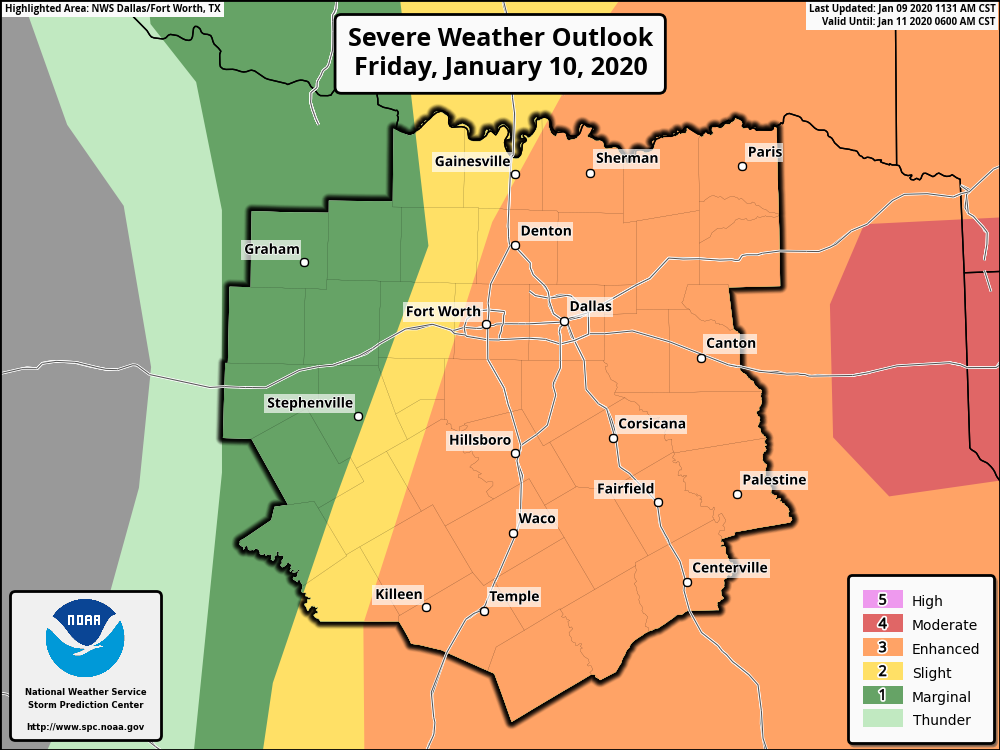
Further east of our area in east TX and north western Louisiana, a higher (Red 4/5) Moderate Risk has been placed over those areas, as the SPC is expecting a widespread damaging wind threat over those areas. 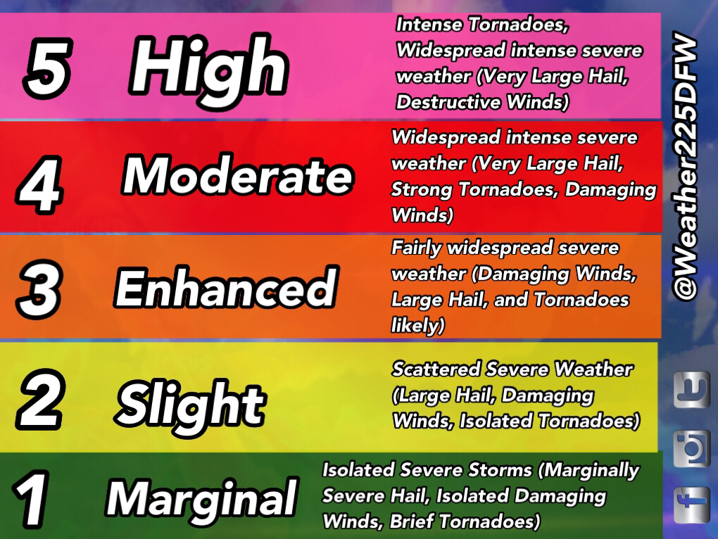
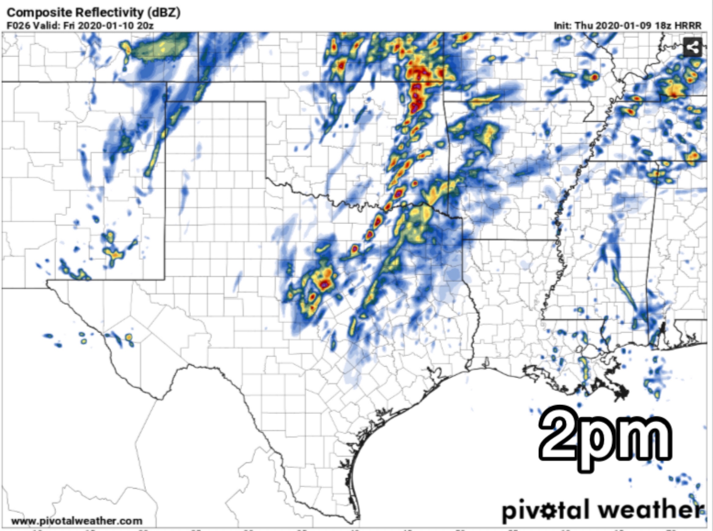
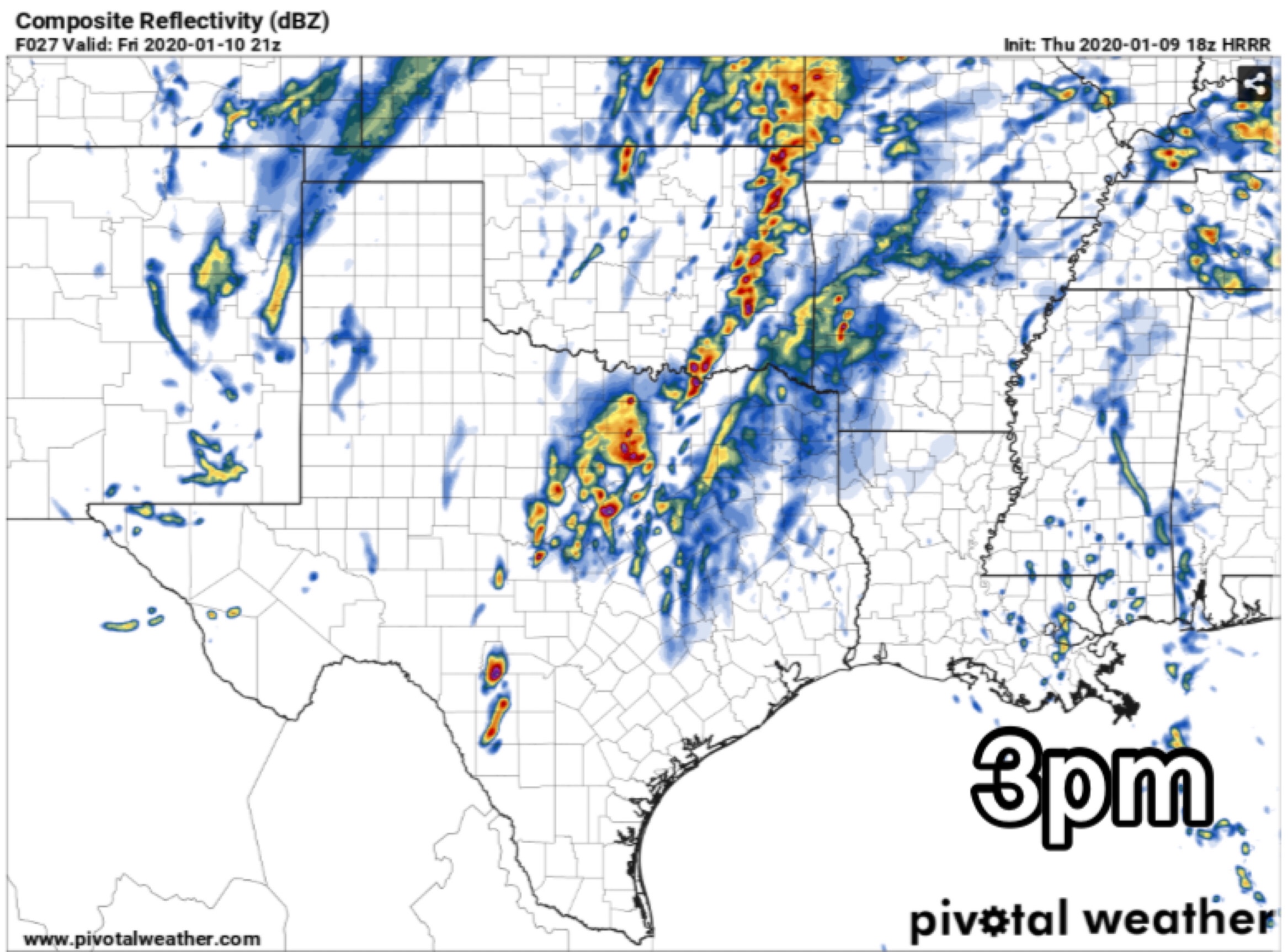
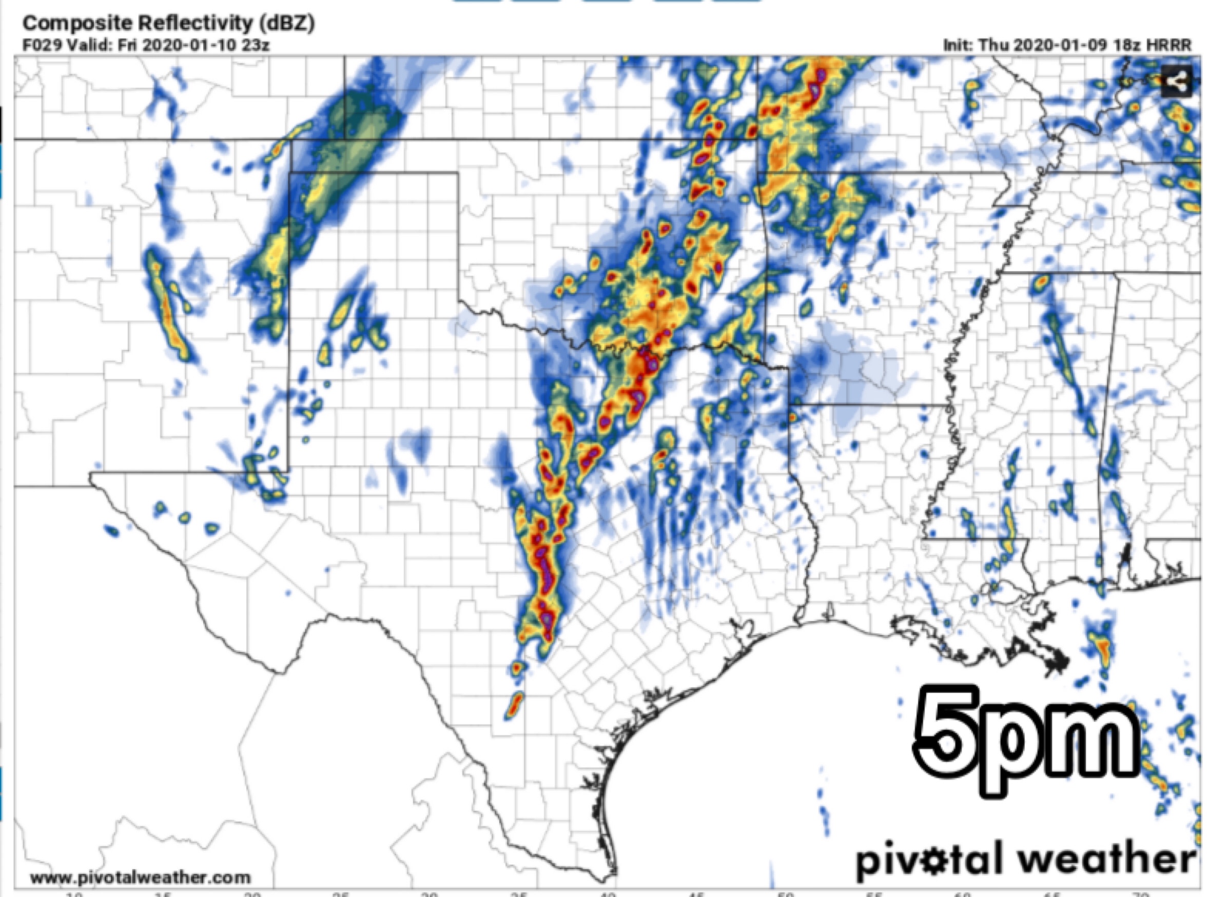
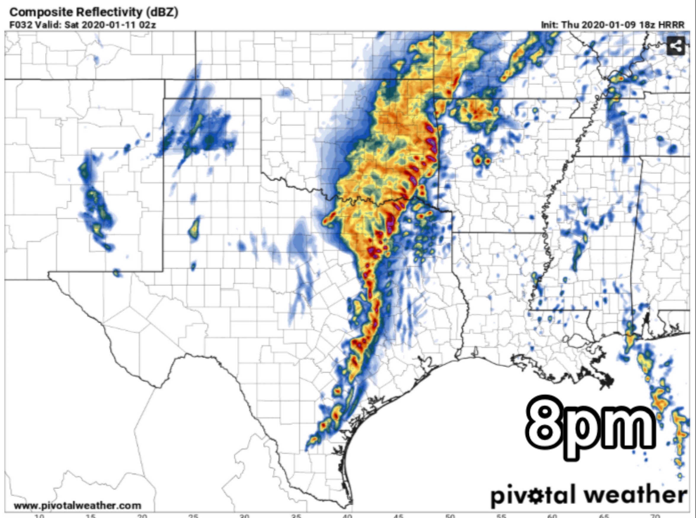
All types of severe weather are possible with tomorrow’s storms: damaging winds, tornadoes, large hail, and flash flooding. The biggest concern of mine would be for any discreet cells that develop during the early afternoon tomorrow, or ahead of the main squal line of storms that moves through later in the evening. Any discreet cell that develops will have the potential to produce large hail as well as a tornado or two. Later as the main line develops and moves through, the main threat will transition to a damaging wind threat, as well as an isolated embedded tornado threat in the line of storms. As of this afternoon, storm timing appears to be between 1pm-10pm. Stay tuned as this could change. The pictures bellow are of this afternoons HRRR model.

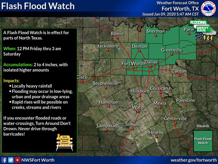
Along with the severe weather threat, a flash flood watch is in effect until 3am Saturday for parts of the area. As heavy rain with the main line of storms could lead to some flash flooding issues in some locations. 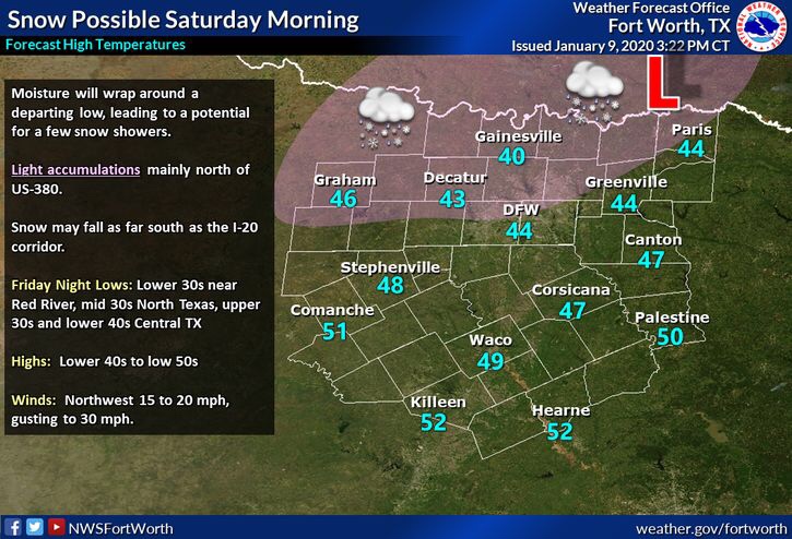
Finally we finish the forecast with SNOW!? Yes it’s a possibility that we could see snow on Saturday after the front pushes through. But before you get your hopes up this will not be snow event. Areas mainly along the red river will see the best chance for snow in the air, however temperatures around the region will be to warm for this activity to stick or have any impact, or measurable accumulation.
For the severe weather tomorrow, there’s still some things to refine with the forecast tonight and tomorrow morning. So stay tuned for any updates. Bottom line, NTX should be weather alert tomorrow for the threat of severe weather. Make sure you have ways to receive warnings, and review your severe weather safety plan. The best ways to receive warnings are: NOAA Weather Radio, Phone Emergency Alerts, and apps like Storm Shield or Weather Radio by WDT. It’s always good to have multiple ways to receive warnings.
If you have anxiety over the thought of storms or severe weather, I know how real, and how big that issue can be. You’re not alone, it’s a very real, and debilitating fear for a lot of people. Growing up I had severe anxiety, and would get sick over the thought of storms or severe weather. So what can help with these real, and big fears? Here’s some tips from the National Weather Service in Norman on what can help those fears. Link here
Stay tuned to local forecasters, and Weather225DFW for the latest. And you can track the storms on our websites main page.
Leave a Reply