
Good morning NTX. We’re going to start the day with warm and humid conditions. Temps this morning are currently in the lower 60s as of 8:50am.
Later tonight into tomorrow we’ll need to monitor the weather for some strong to severe storm activity. Heads up there is a large hail potential! So you may want to clean out the garage to get the car in
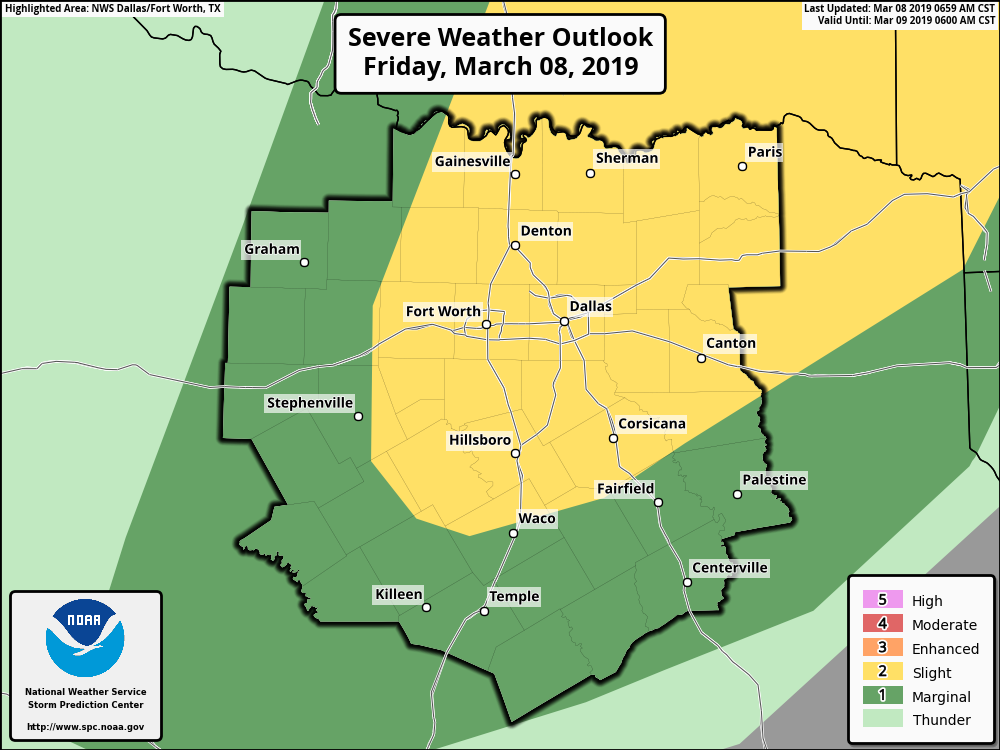
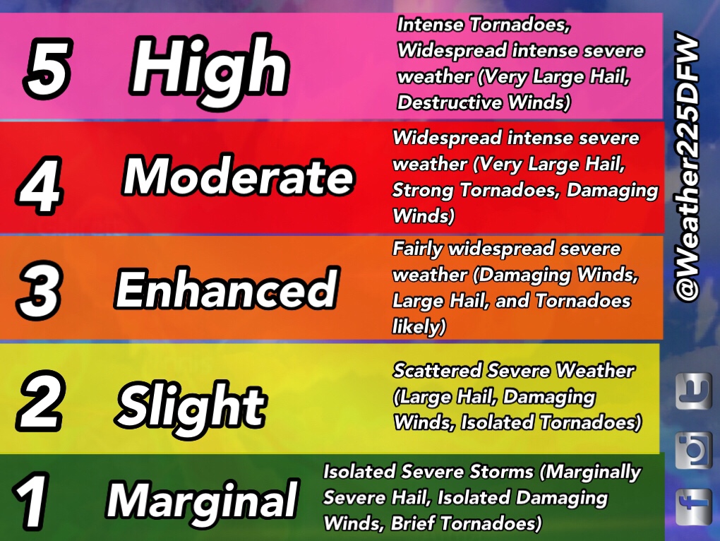
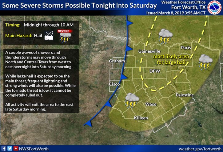
To start the SPC has upgraded the outlook for Friday into early Saturday from a (1/5) marginal risk across DFW to a (2/5) Slight risk for storms. What this means is there’s a higher chance for storm coverage across the area, as we’ve mentioned before just because you’re in a lower risk doesn’t mean you will see nothing, it’s all based on anticipated coverage. As a front pushes through some showers and strong storms may develop ahead and along the front bringing a chance for Large Hail (Around or greater than golf ball sized), Damaging Winds (60-65mph), and maybe a tornado.
Timing looks to be from 10pm Friday till 10am Saturday. There could be two rounds of storms tonight, the first with a hand full of storms with the warm front this evening around 10pm-12am, the other along the front overnight into tomorrow morning. The greatest tornado risk would be for areas north east. The tornado threat for DFW is low however not zero
Do you have a plan in the event of severe weather?
Make sure you have a way to receive warnings later tonight and especially overnights! I recommend the apps “Storm Shield” and “Weather Radio by WDT”, also NOAA weather radio is one of the best ways to receive warnings during severe weather. We have a post for spring storm safety you can visit here https://weather225.com/all/spring-storm-safety/
There is also a chance for some strong to severe storms on Tuesday so we’ll keep you updated on that. Stay tuned for the latest!
 q
q
Leave a Reply