
After today’s storms across the area, we have another shot at seeing some strong to possibly severe storms once again across parts of the area tomorrow.
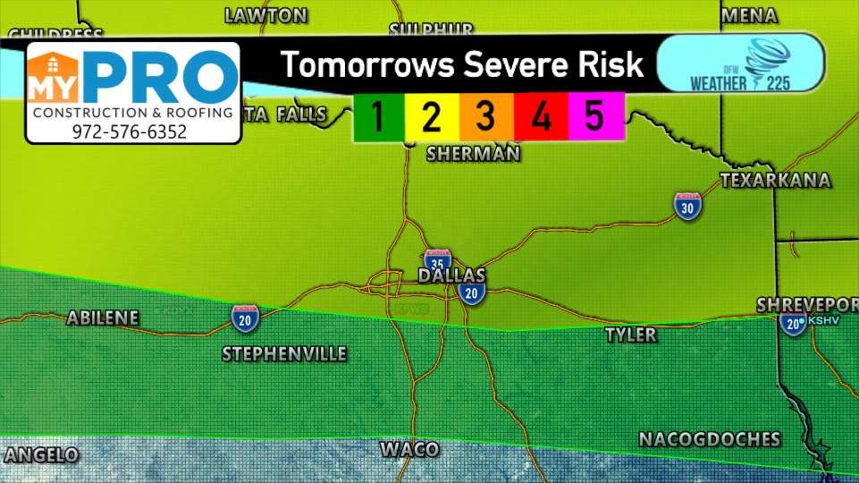
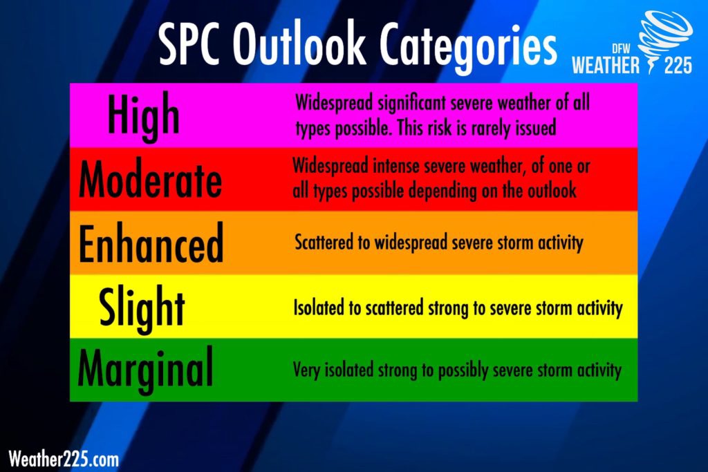
The SPC has placed a large area of NTX, under either a 2/5 slight risk (Yellow) or a 1/5 marginal (green) risk for the potential for some strong storms tomorrow across parts of the area.
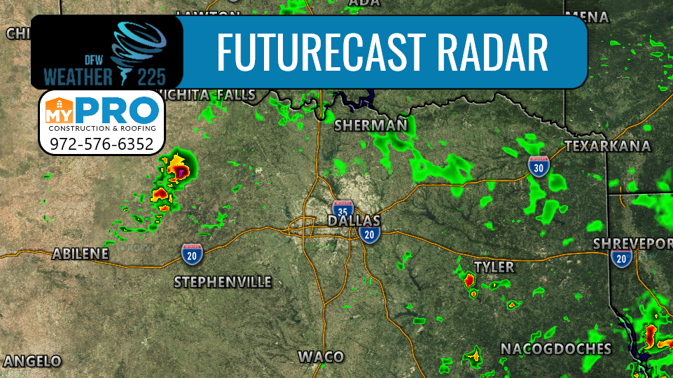
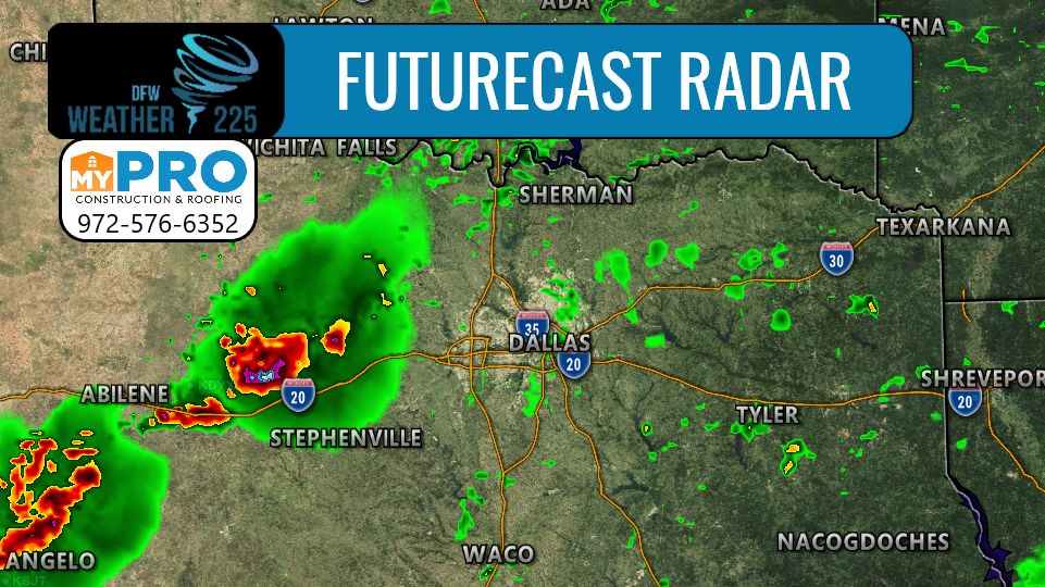
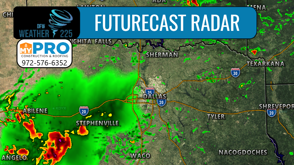
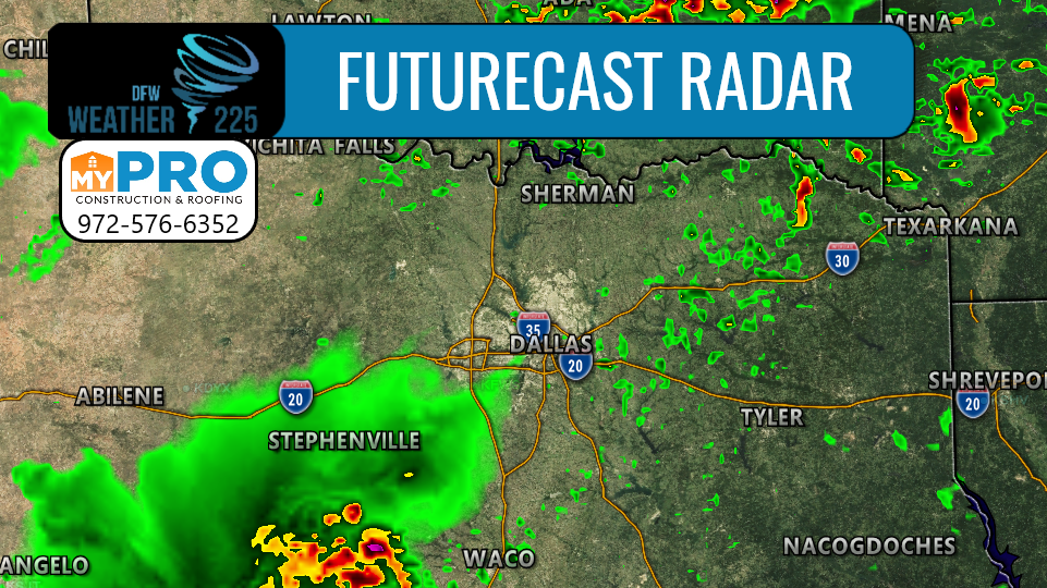
Above is our Future-cast radar system, this time looking at the NAM 3KM model for a more longer range view at tomorrow’s potential activity, until the HRRR, gets a closer look at tomorrow’s activity later on in the day.
This model has some pop up showers/storms forming north of I-20 and West if I-35, in the mid to late afternoon hours, before moving south/southeast of the I-20 area later in the evening. Some (NOT ALL) of these storms could be capable of producing hail near 1”-1 1/2” in diameter, as well as 55-60mph. The tornado threat is very low. There’s still some things we’ll need to refine for tomorrow’s forecast, so stay tuned for the latest.
And let’s be clear for tomorrow, NOT everyone will see severe activity, or even rain/storm activity in general.
Check back for the latest updates, as well as updated forecasts and severe weather risks right here on our website!
-JW
Leave a Reply