
Good afternoon North Texas, today we have a decent shot at seeing strong to severe weather activity across parts of the region. To be clear and reduce fears, NOT EVERYONE will see this severe activity, however those who do, could see possibly any and all types of severe weather.
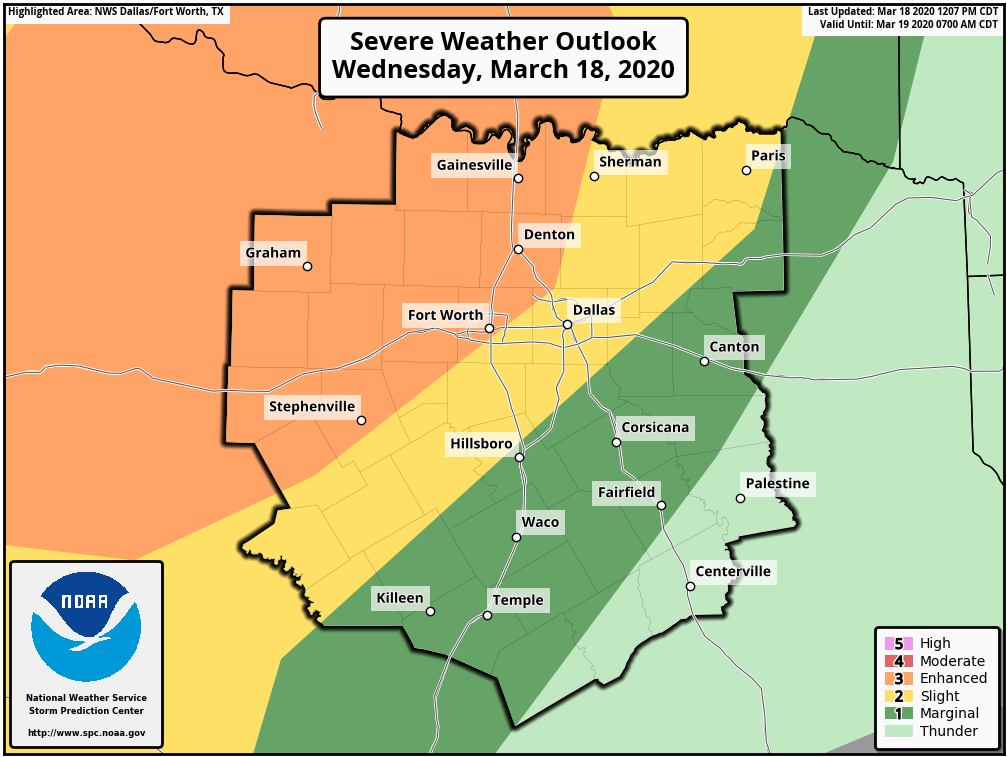
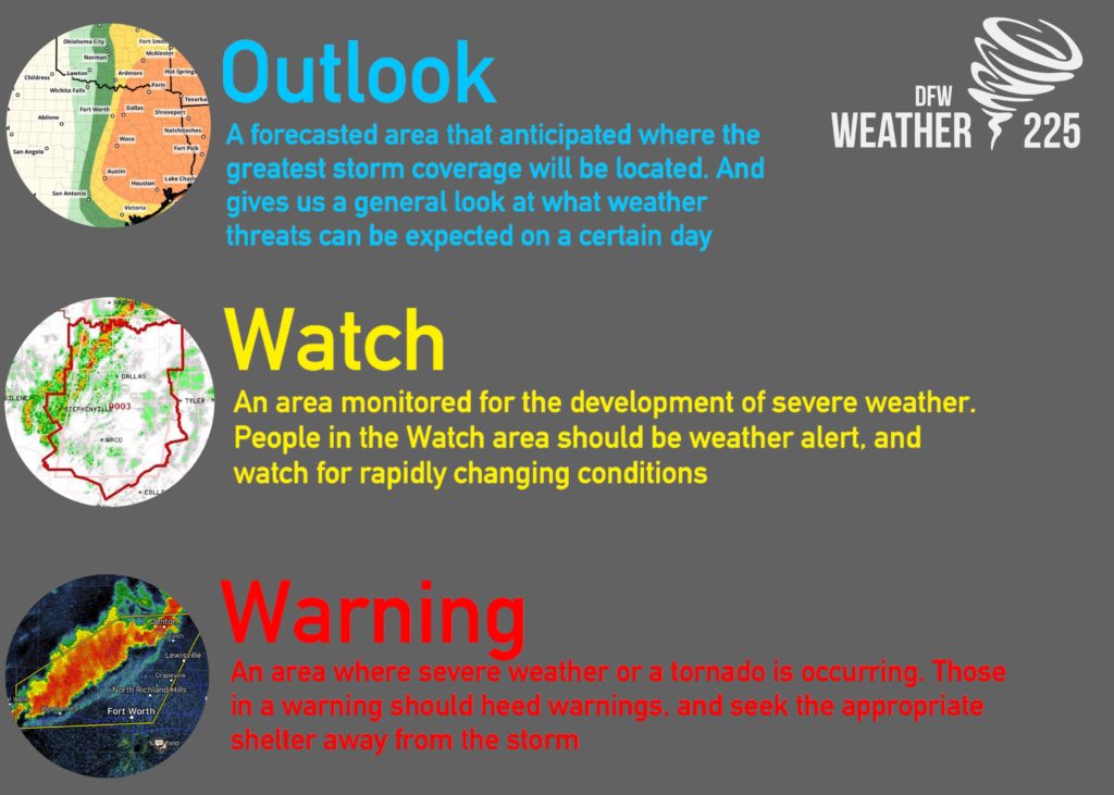
To start the forecast, the SPC has recently shifted the 3/5 Enhanced risk for storms further east into parts of DFW. As previously mentioned in our forecast posts, these Outlooks are determined not just by intensity, but also where the greatest coverage is forecasted. Regardless of what outlook you’re located in, you should always stay weather alert.
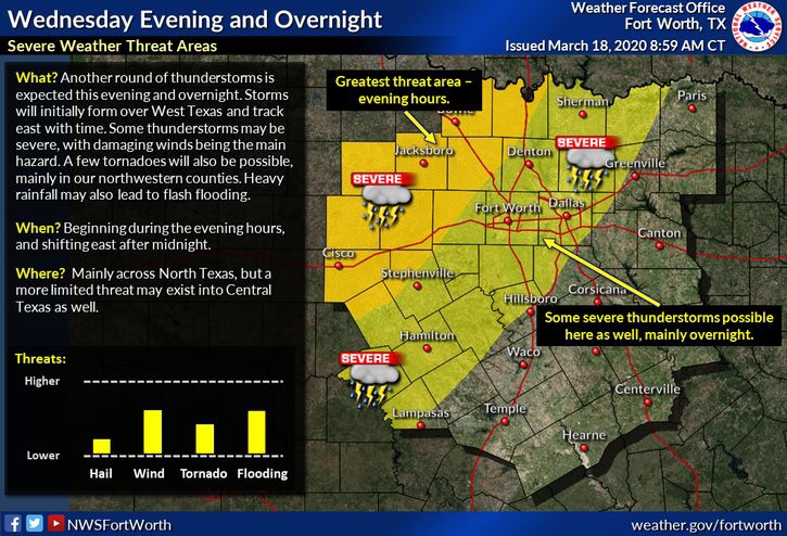
Where will the best threat exist? At this point it looks like the very best conditions and anticipated activity will be located for the western and north western half of our viewing area, in the areas shaded in orange on the graph from the NWS above this text. And the timing looks to be from 6pm into the overnight hours.
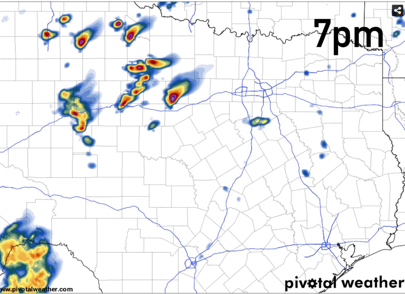
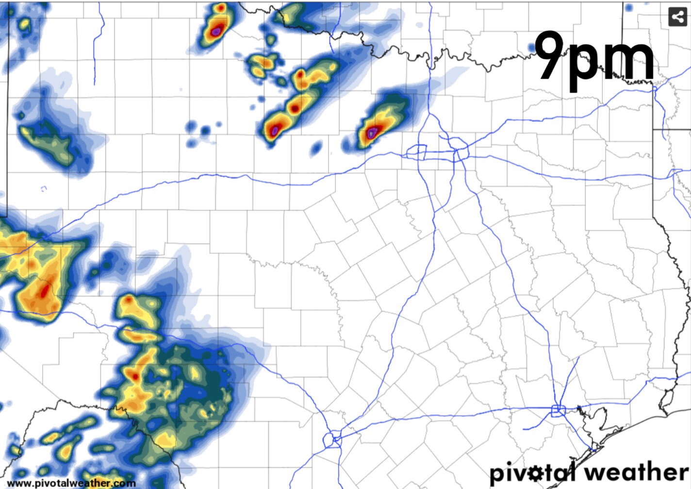
Above is the HRRR American Short range models current prediction for activity this evening into tonight. This will be the activity with the greatest threat for severe weather. As you can see it’s keeping storms within that west and north western region we’ve mentioned for storm development this evening. These storms look to be supercellular in nature. Large hail, damaging winds, and tornadoes are possible with this activity.
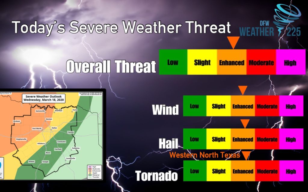
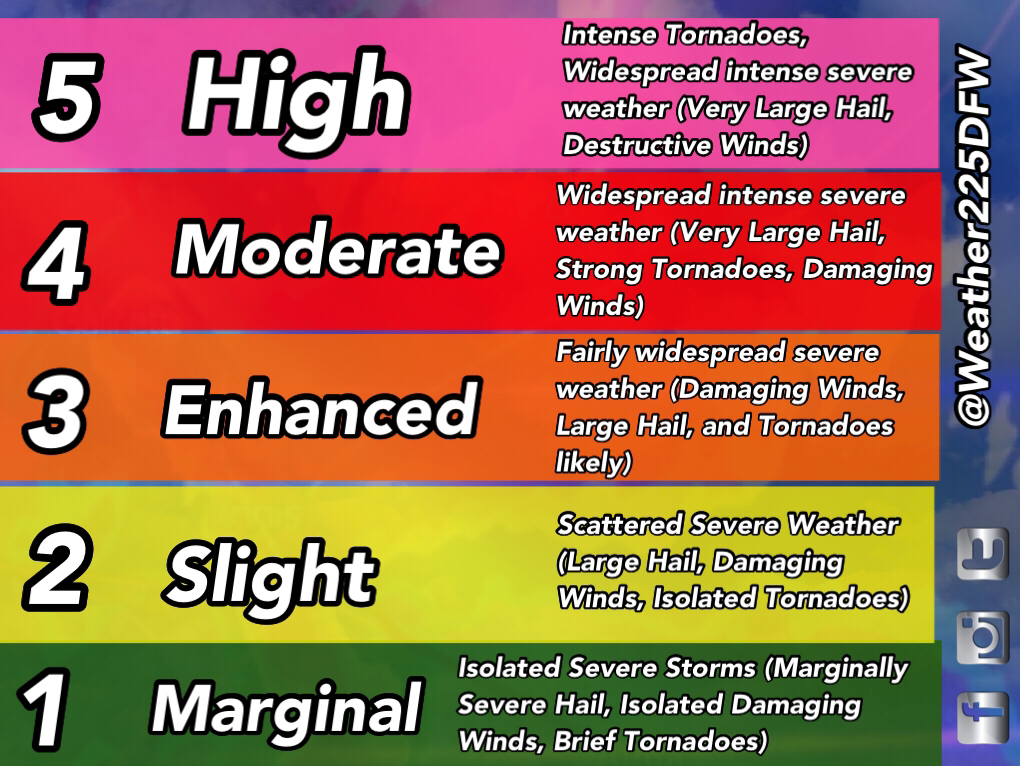
As of 1pm, we have all the risks at a 3, just because of the SPC individual risks. It may look scary, however, just know not every threat is a 3 for everyone. Just for the areas in orange. And even then, not everyone in the orange shaded area will see storms, however, that doesn’t mean you shouldn’t stay weather alert. Just be mindful of the weather, and make sure you have a way to receive warnings if they are issued
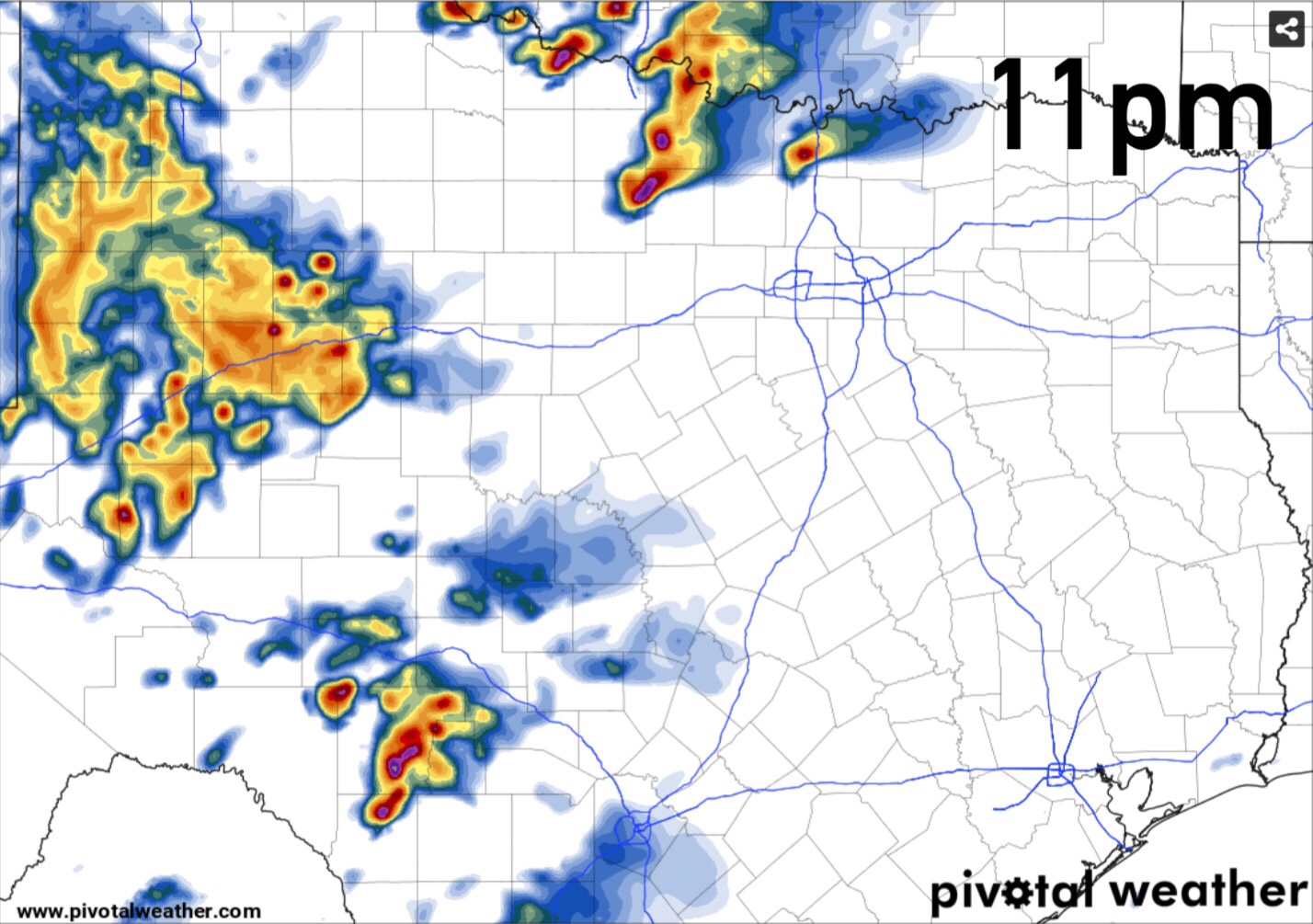
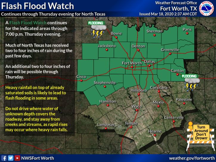
After this first round of activity this evening, we will see a second round of storms overnight, however, these will be non severe in nature. Just a threat for lightning and heavy rain. This second round of activity will bring heavy rain, that could cause some flooding concerns to parts of the area. This activity is why the Flash Flood Watch has been extended into Thursday evening.
For those with storm anxiety. What does this mean? Is this really bad? We at Weather 225 do not like hyping up the forecasts, as it causes fear, and from personal experience growing up, we know how paralyzing fear of storms can be. We give the facts of what the forecast is calling for, we never over hype. From my personal experience, I found what helps with storm anxiety, is to make a plan preparing for severe weather, and learn more about severe weather. Your weather plan should be, a way to receive warnings, understanding where you would seek shelter IF storms impacted your area, and making sure you know where the items you would bring with you are located, just so it’s piece of mind for you and you know where the stuff you need is, just in case you do see storms in your area, just understand that doesn’t mean your location will get hit every time there’s a threat.
Brief overview of the forecast. Storms are possible from 6pm into the overnight hours. Storms during the late afternoon and evening hours may be sever with all types of severe weather possible. Not everyone will see this activity. Best areas for storms will be located generally west and north west of DFW, storms are possible in DFW, but the greatest areas for activity look to be west and north west at this time.
Stay tuned from the latest from us or the National Weather Service for the very latest
Leave a Reply