
Hello North Texas, we have another chance for severe weather today across parts of North Texas. However, once again like yesterday, that doesn’t mean everyone will see this strong to severe activity, if it develops.
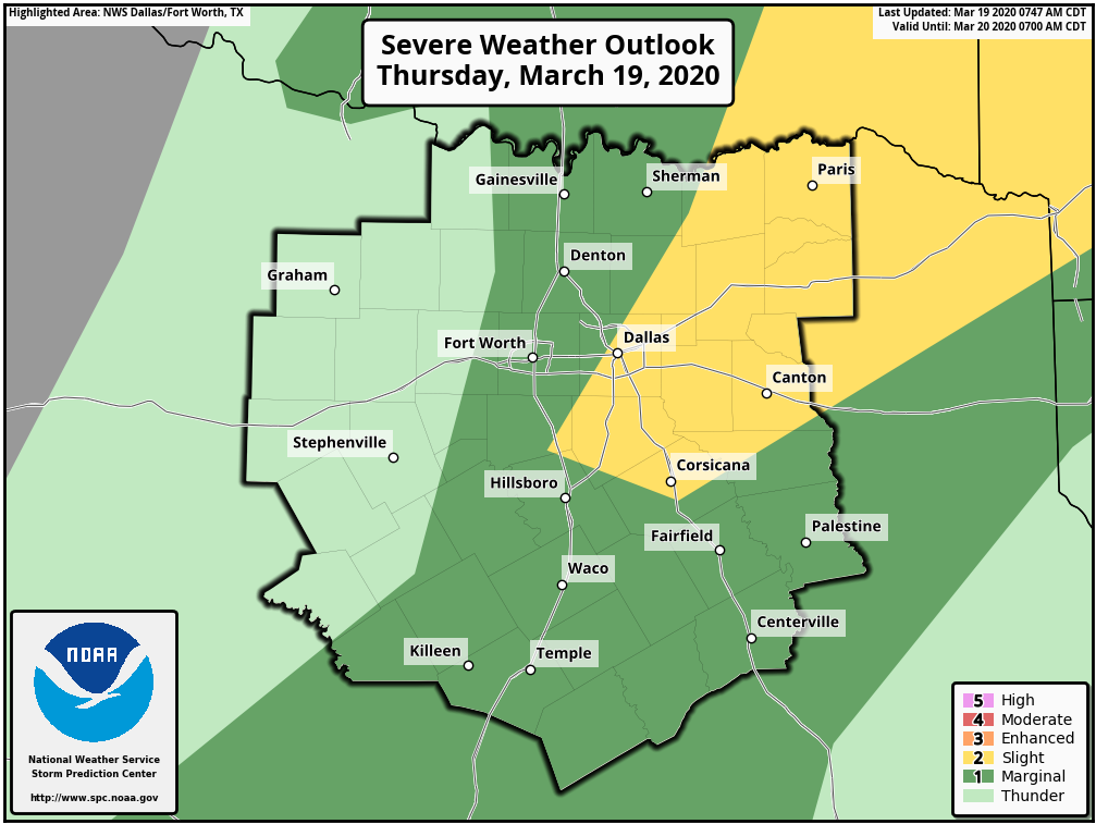
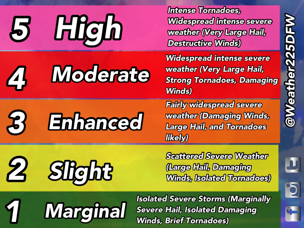
To start, the SPC has placed parts of the metroplex under either a 1/5 (green) Marginal Risk, or a 2/5 (yellow) Slight Risk for storms this afternoon. Hail up to half dollar sized, and damaging winds of 60mph look to be the primary hazards. However, a tornado cannot be ruled out, as there is a low, but not zero, tornado threat this afternoon.
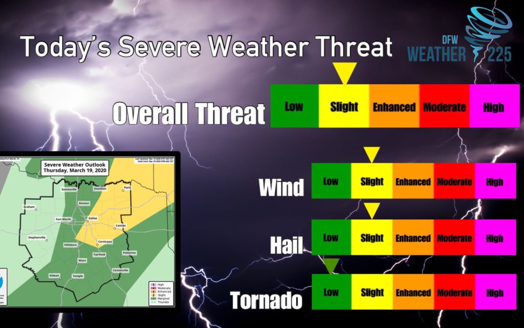
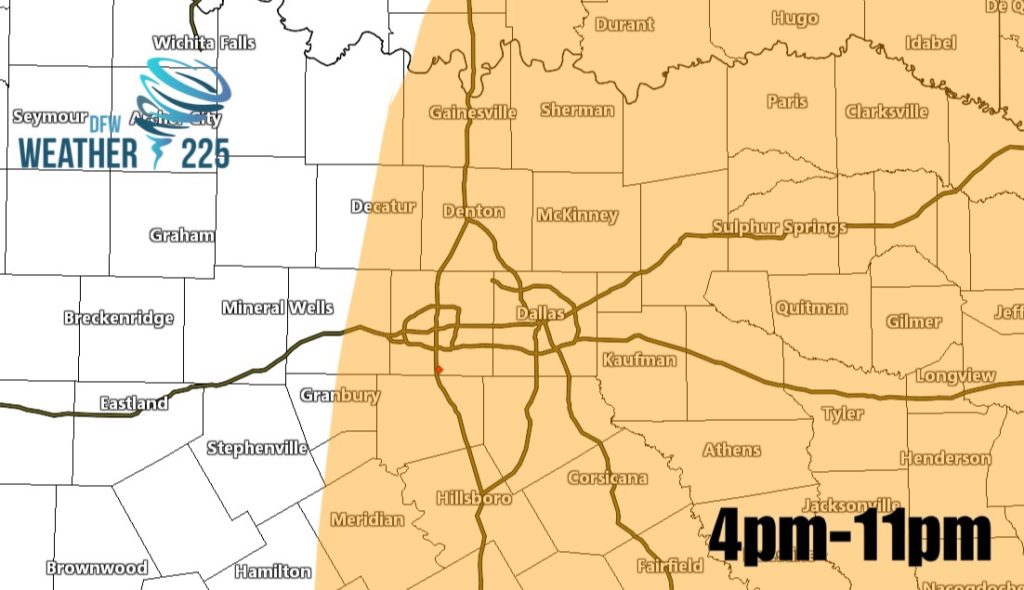
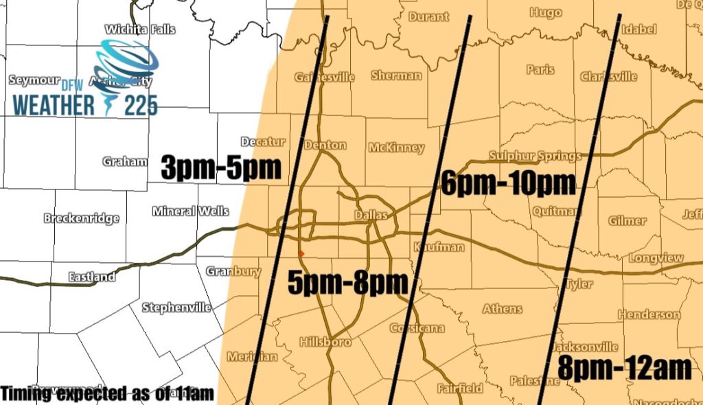
Above is a highlighted area where we expect the possibility of storm development this afternoon. However, that doesn’t mean that every area shaded will see severe activity, or activity in general. Development later looks to be relatively isolated to scattered based off of the latest model runs. The best chances for storms looks to be right along and east of I-35. Timing for development looks to be from 4pm-11pm for the whole area shaded in orange. Bellow is a breakdown of the timing for the area, as of 11am
The threat today is lower than Yesterdays threat, but that doesn’t mean you shouldn’t be weather alert this afternoon and evening. Just make sure you have a way to receive warnings IF any are issued, and stay aware of the forecast and tune back for updates throughout the day. And stay tuned to Weather 225 for the latest.
Leave a Reply