
Good morning North Texas and happy Tuesday. Today we will see a chance for showers and storms across parts of the area, some of these storms could be strong to severe.
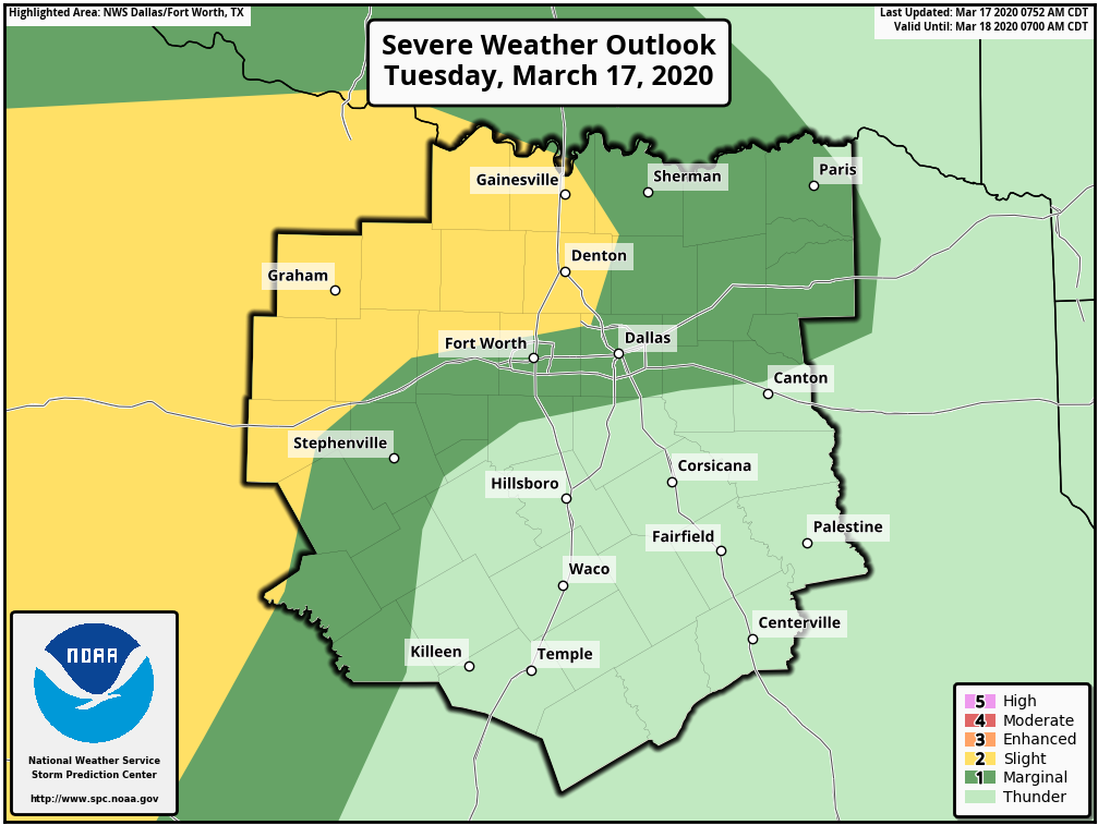
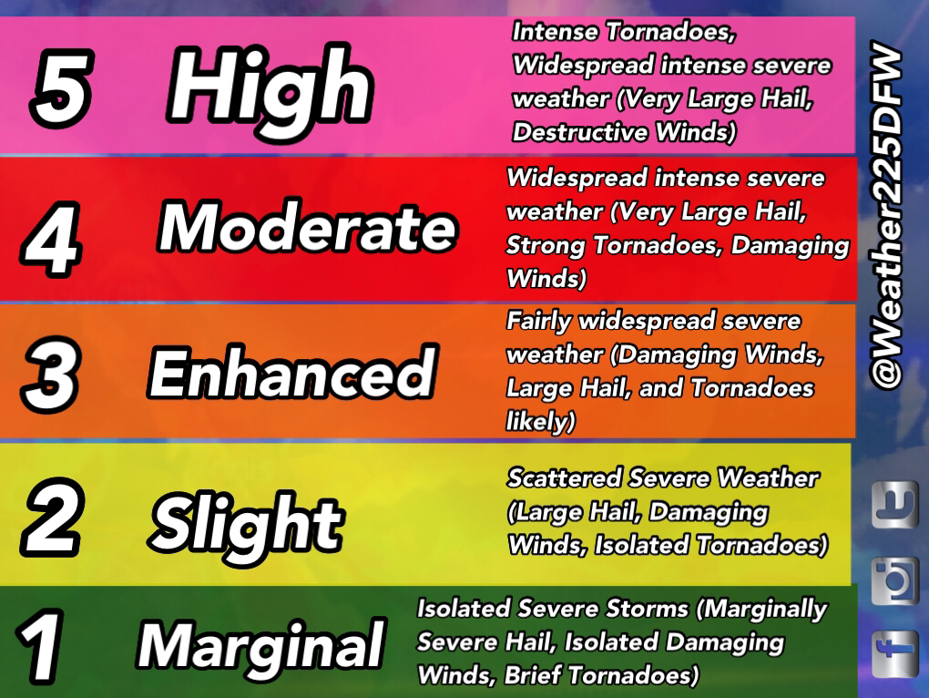
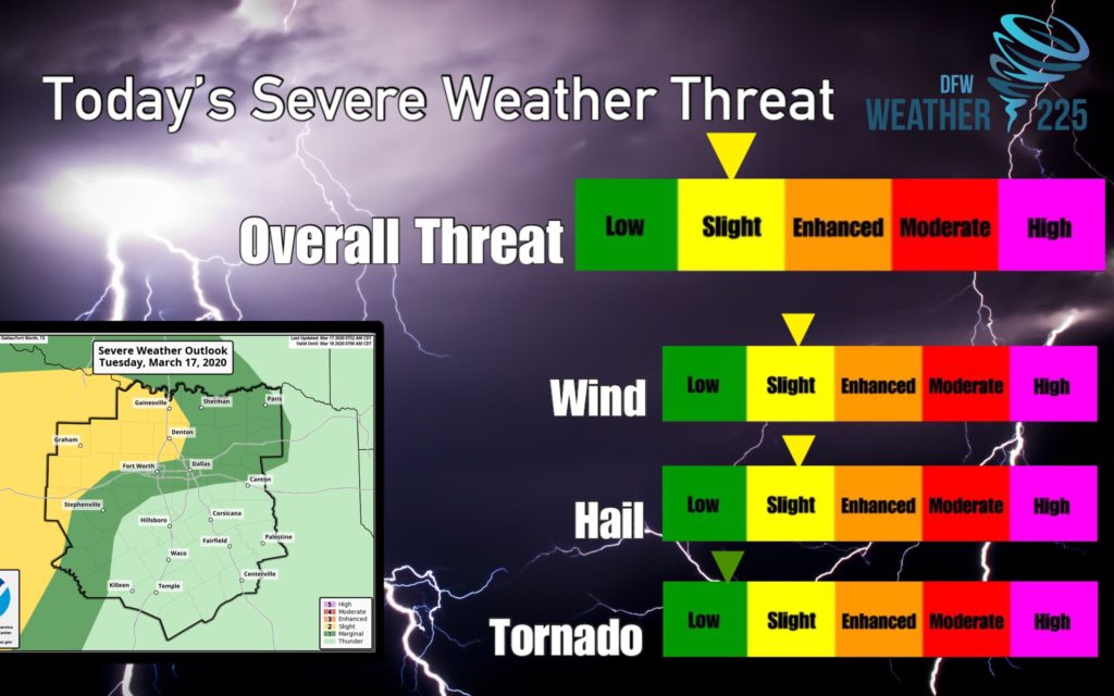
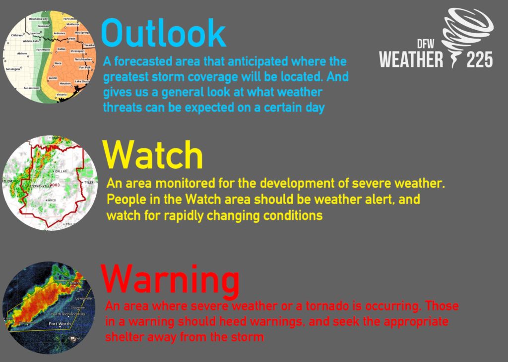
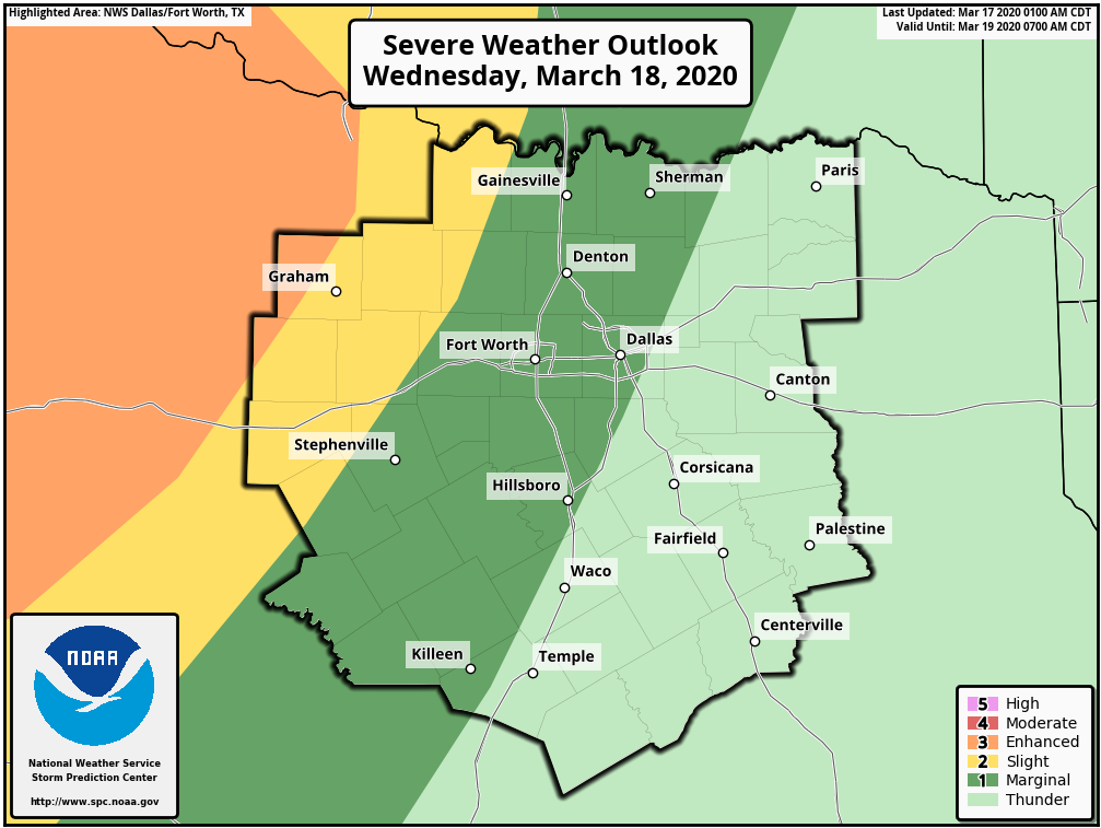
Today, we have a 1/5 (Green) Marginal Risk and 2/5 (Yellow) Slight Risk across the viewing area, for the threat of storm development later today. What do these Outlooks mean? These color risk areas issued by the SPC, highlight areas where severe weather is forecasted, not just based on storm intensity, but rather the highest anticipated coverage of storm development. Regardless of what risk you are in, you should always stay weather alert, because Mother Nature has no boundaries for storm development.
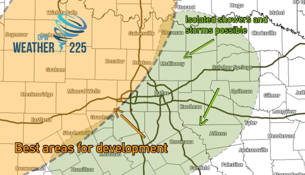
What are the times we could see storms? We could see this activity start later in the afternoon hours, continuing into overnight. I would say from 5pm into overnight. Based on this mornings model runs, we have made a graph for where we anticipate the best areas for activity (orange shaded areas) this afternoon. Not everyone will see severe storms, however, those who do see this activity, could see threats for large hail up to half dollar sized, and damaging winds of 60-70mph. There will be a low but not zero tornado threat as well.
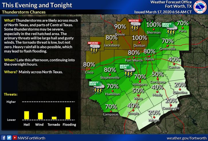
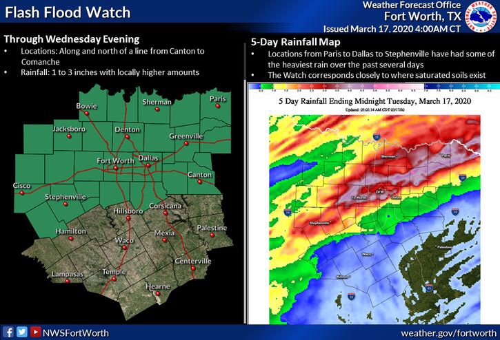
Rain and general thunderstorm wise, most areas along and north of I-20 and areas west, will see the highest coverage up to 70%-90% for showers and heavy storms overnight. Other areas will still see rain activity, just with less coverage of around 50% or lower. Because of this anticipated widespread rain activity, the NWS has issued a Flash Flood Watch until Wednesday evening for a large part of North Texas. Expected rainfall amounts will be 1”-3” with localized amounts of higher possible.
To ease any fears, this is just a typical severe weather threat for this time of the year. That just means you should stay weather alert throughout the day, in case any watches or warnings are issued. Just stay tuned to local NWS, NOAA Weather Radio, and Weather225DFW for the latest.
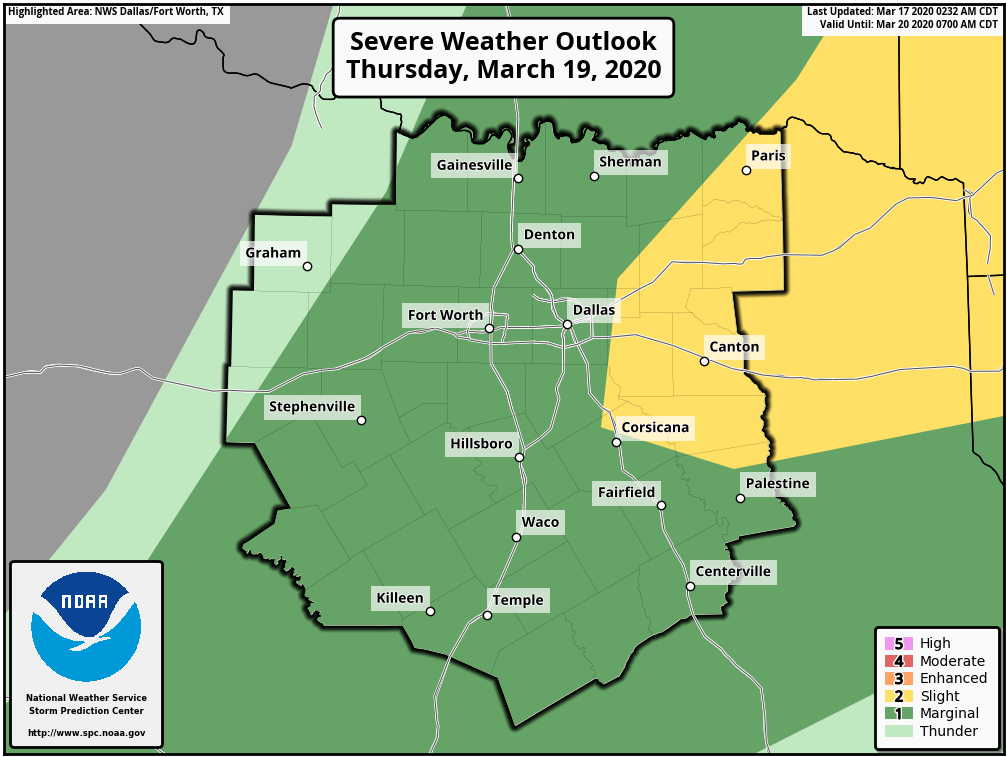
We also have a threat for strong storms through Thursday so stay tuned for more on these threats in the coming days.
Leave a Reply