
Good morning NTX and happy Saturday. We saw a little bit of rain last night across parts of the area, however our thoughts that activity would stay east of DFW stuck true. Expect gusty winds today behind the front from 25-30mph with some reaching 40, with partly cloudy to mostly sunny skies and a high near 67. 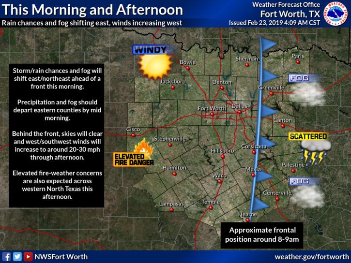
Fire weather will be an issue for areas west as humidity will decrease behind the dryline, and strong winds will pose a threat for fire weather. 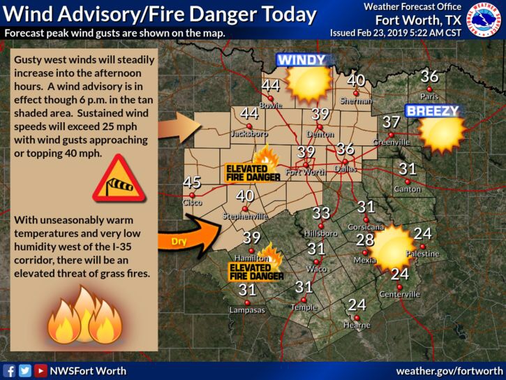
Tomorrow winds should calm and the day should be pleasant with a high near 59 and clear skies for the area.
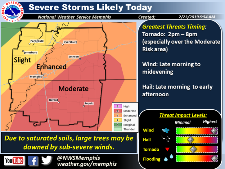
Something bigger in the weather headlines (not for DFW) is the severe weather outbreak likely to take place this early afternoon through this evening for parts of Mississippi, Tennessee, and parts of Alabama. 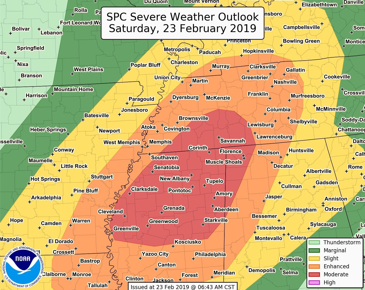
Destructive 70mph winds, large hail, and a handful of tornadoes will be possible, some tornadoes may be strong and long track! Anyone living in these areas should remain alert for rapidly changing weather conditions, and stay tuned to the forecast and local NWS, especially if you have plans for the weekend. The outlook issued for today is a (4/5) moderate risk for severe storms across several populated areas in MS, and southern TN, and far north eastern AL, where the greatest chance for a few strong tornadoes is located. If you have family in the area let them know to stay weather alert today, these types of set ups are not something to mess around with when threats are higher end. 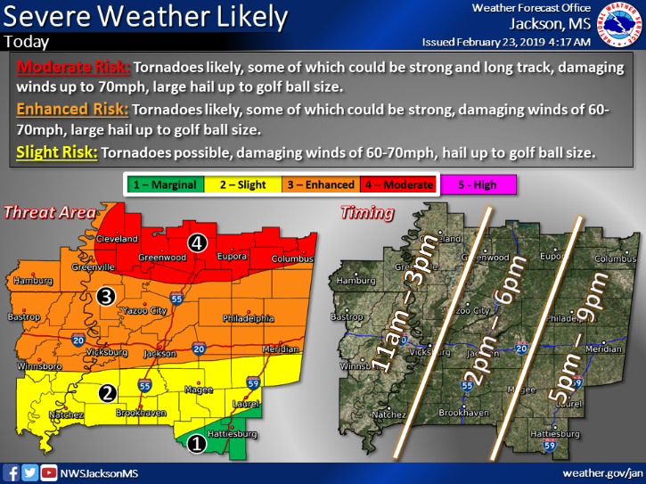
However, for DFW again we will remain quiet, so enjoy the weekend with mild temperatures 🙂
Leave a Reply