
Good morning NTX, today’s going to be a hot and humid one! However, besides the heat, today will be relatively pleasant with mostly sunny skies throughout the day, until storm chances start late this afternoon into this evening. 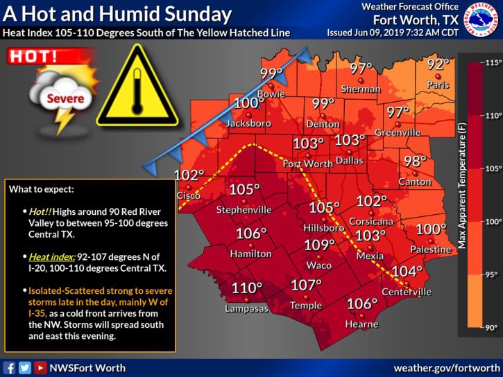
Highs today will be in the mid to upper 90s across the metro, with heat index values between 100-107. South of I-20 temperatures will be slightly higher, with heat index values near 110 in some spots! So if you have any activities outdoors today, be sure you take breaks in the shade, and stay hydrated! DO NOT leave kids or pets in an unattended vehicle! 
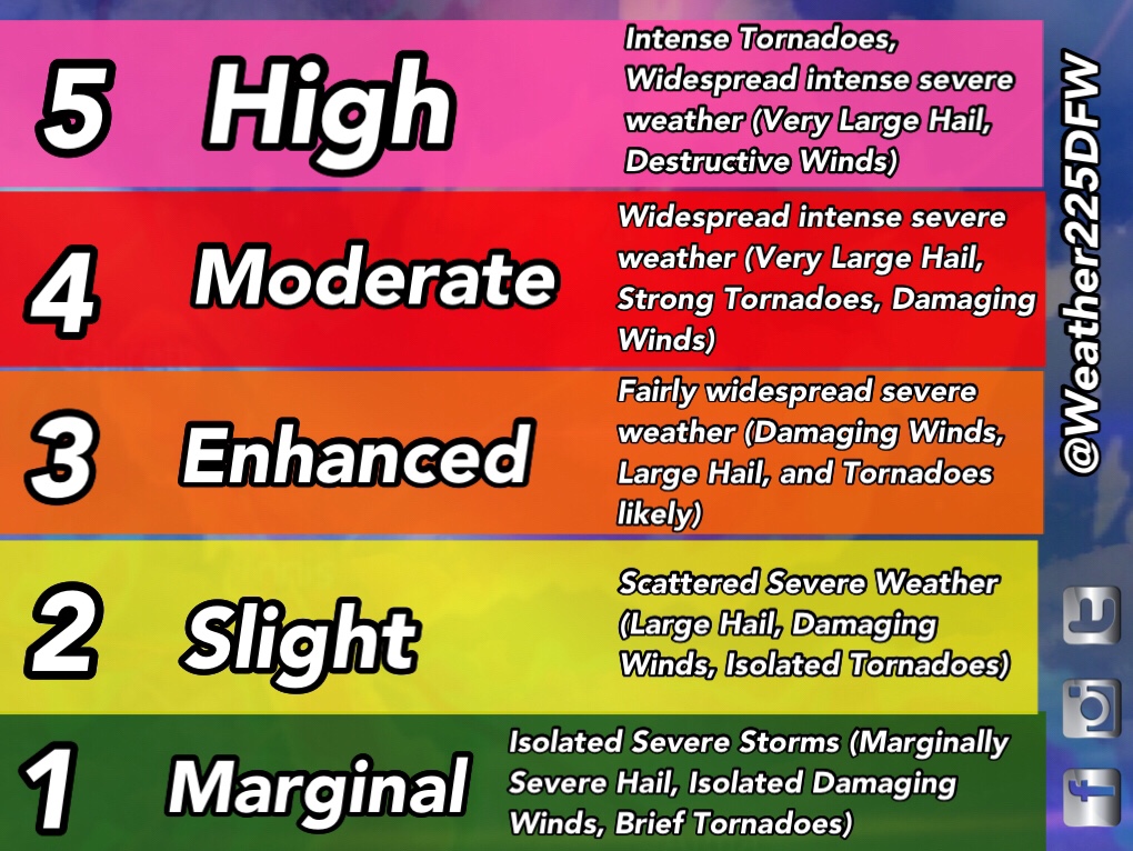
Later this afternoon and evening we will see a threat for severe weather as well. Timing looks to be (and this is for the whole region we cover) between 5pm-11pm. The SPC has upgraded us to a now (3/5) Enhanced risk for storms, that does include the Dallas, and Fort Worth area, and areas south and west. 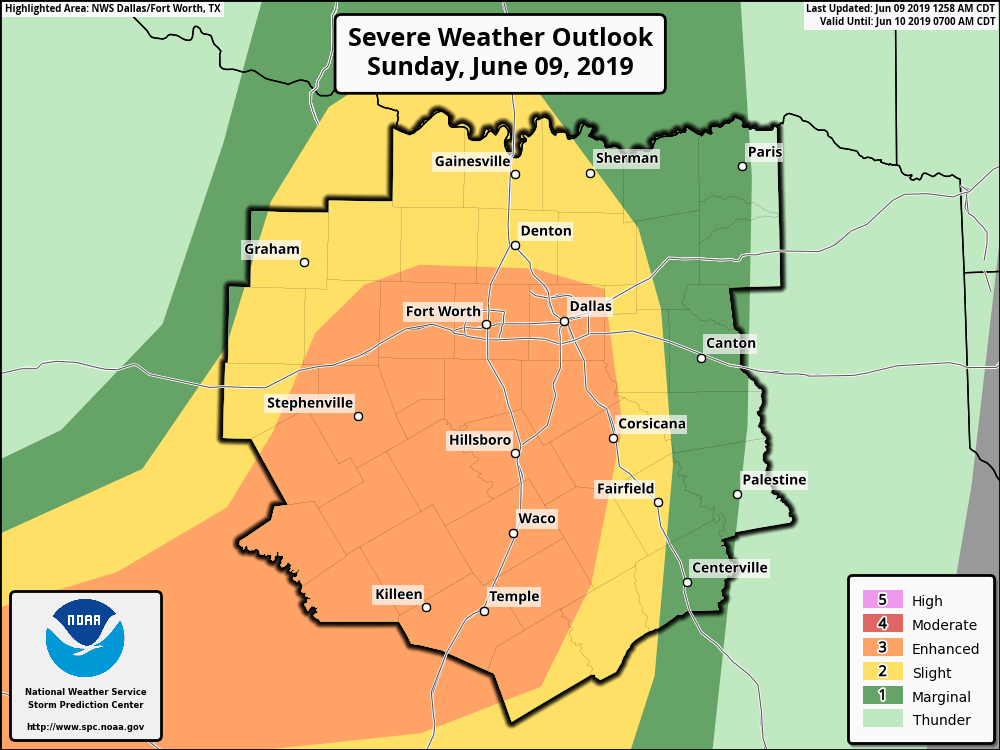
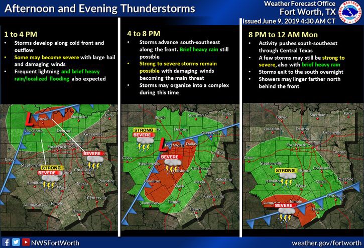
Storms are expected to develop as a cold front pushes through the region later today. Storms will be capable of producing Damaging Winds, and Large Hail as the primary hazards, however a low tornado threat is also in place, so a quick spin up cannot be fully ruled out. Not everyone will see rain/storm activity tonight. 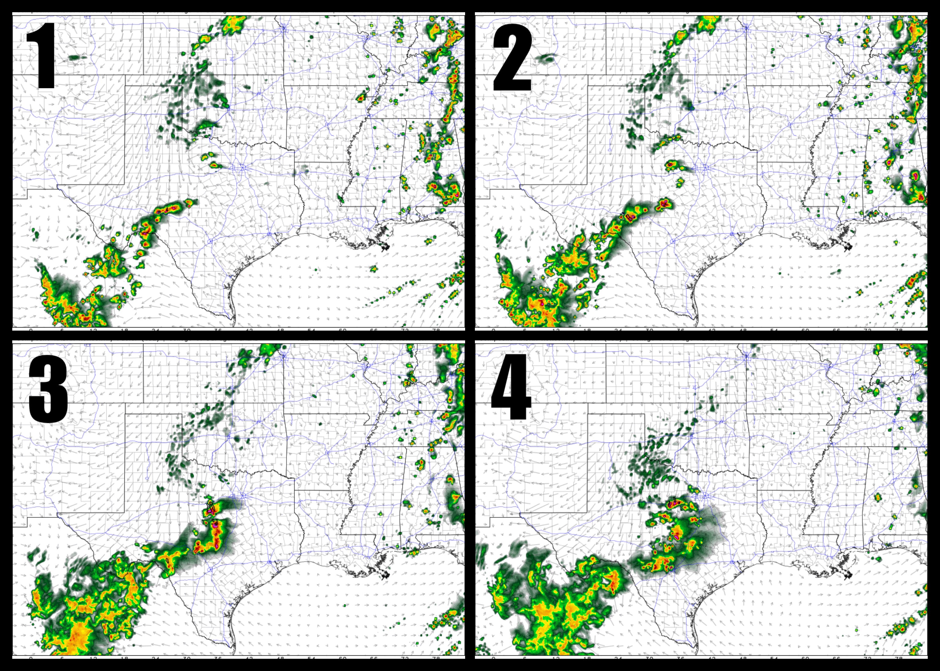
Stay weather alert today! And stay tuned to Weather225DFW for the latest, and for our broadcasts if any warnings are issued.
Leave a Reply