
Good afternoon NTX. We have a few weather headlines to talk about for tomorrow. To start this let’s be clear, at this point there’s NO significant severe weather threat! And not everyone will see rain/storm activity
Tomorrow will be hot with mostly clear skies and temperatures in the low to mid 90s, with heat index values near 100-103 across our area depending on location. Humidity will be fairly high as well, so expect hot and humid conditions. If you have outdoor activities be sure you stay hydrated and take breaks in the shade.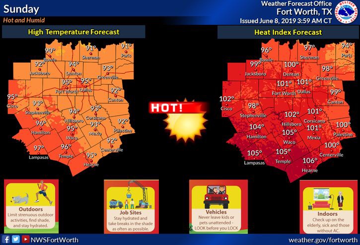
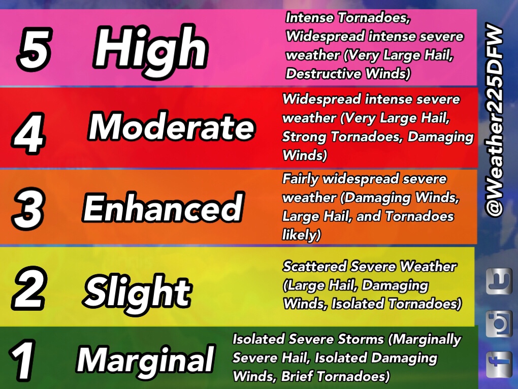
We’ll have a hot, and relatively pleasant day tomorrow, before we see some storm chances late tomorrow afternoon into tomorrow night as a cold front pushes into the region. Some of these storms may be strong to severe with Damaging Winds, and Large Hail being the primary hazards. To ease any fears, the tornado threat is LOW, the SPC has labeled it at this time as a less than 2% on the outlook. Currently the SPC has placed the DFW Metro and areas west under a (2/5) slight risk for storms tomorrow. Remember SPC outlooks aren’t based on intensity alone, these outlooks are based on anticipated storm coverage and where the greatest risk areas for activity are anticipated. This could shift or be adjusted before tomorrow so stay tuned.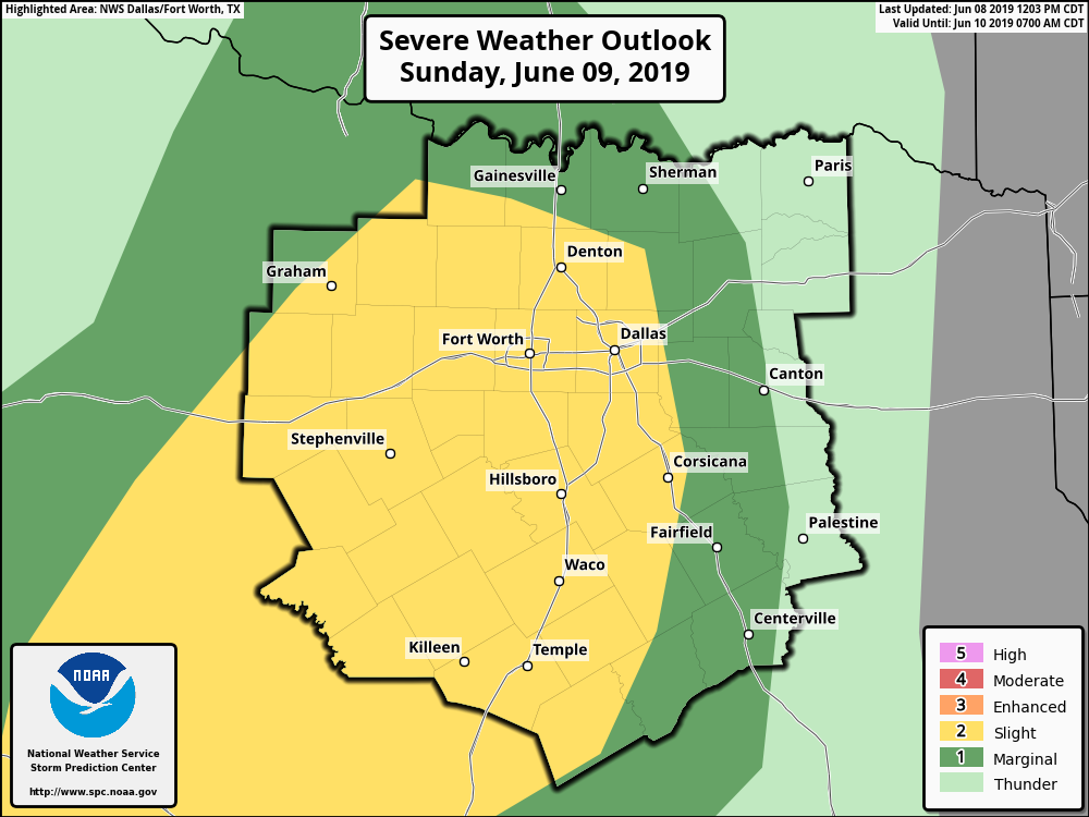
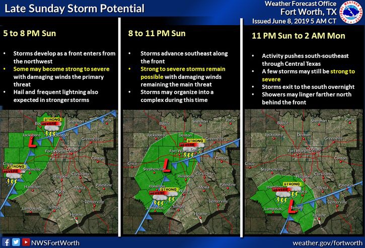
Not everyone will see storms as activity based on the latest medium to new short range model runs are showing scattered storms across the area late tomorrow afternoon/evening into tomorrow night. These storms may be strong to severe in nature with large hail and damaging winds being the primary hazards. 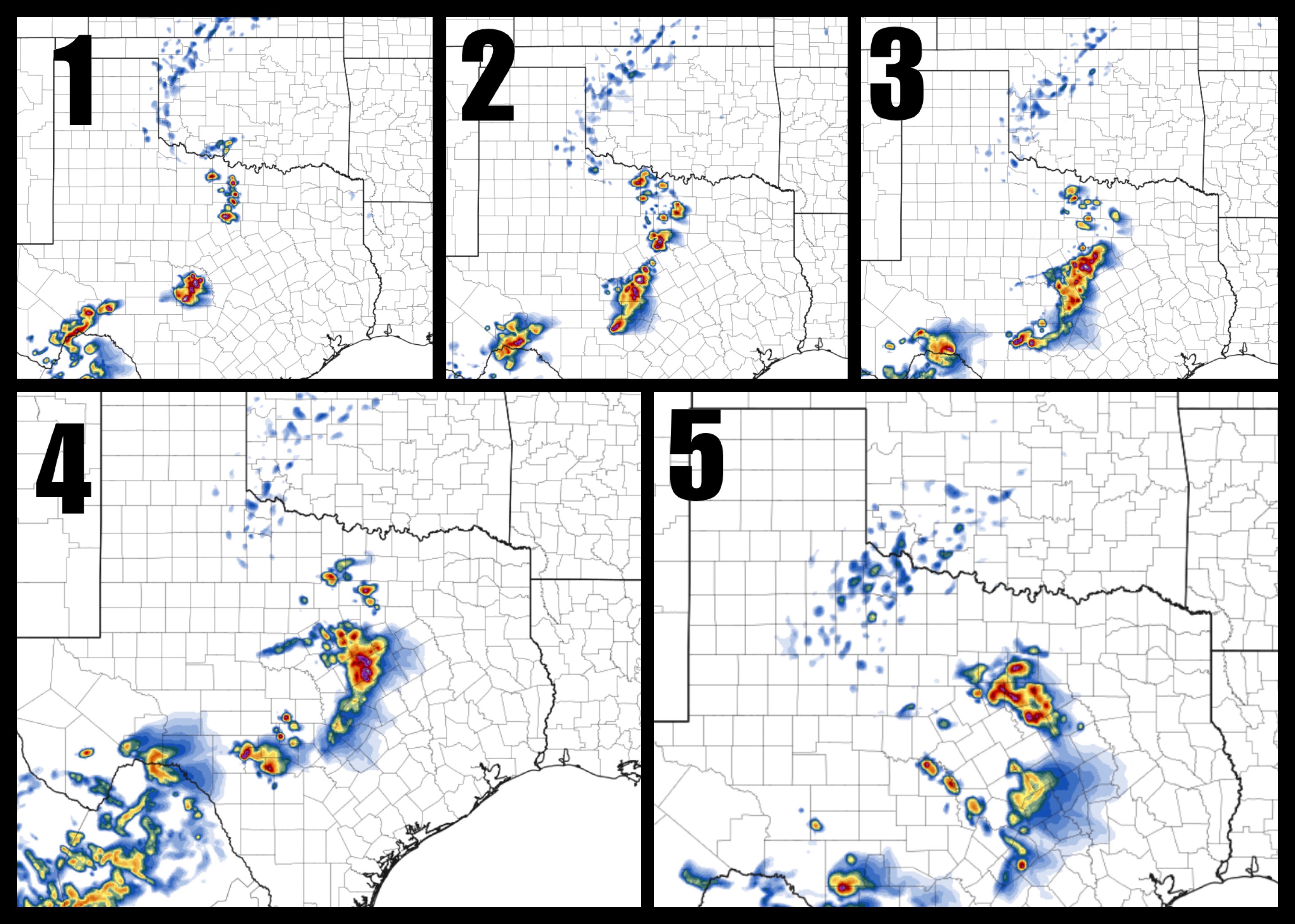
Should you cancel plans? NO! There’s no threat for storms tomorrow until late tomorrow afternoon and into tomorrow night. Enjoy the weekend, and monitor the forecast as the day goes on. Stay tuned
And check for the latest with @Weather225 and @Weather225DFW
Leave a Reply