
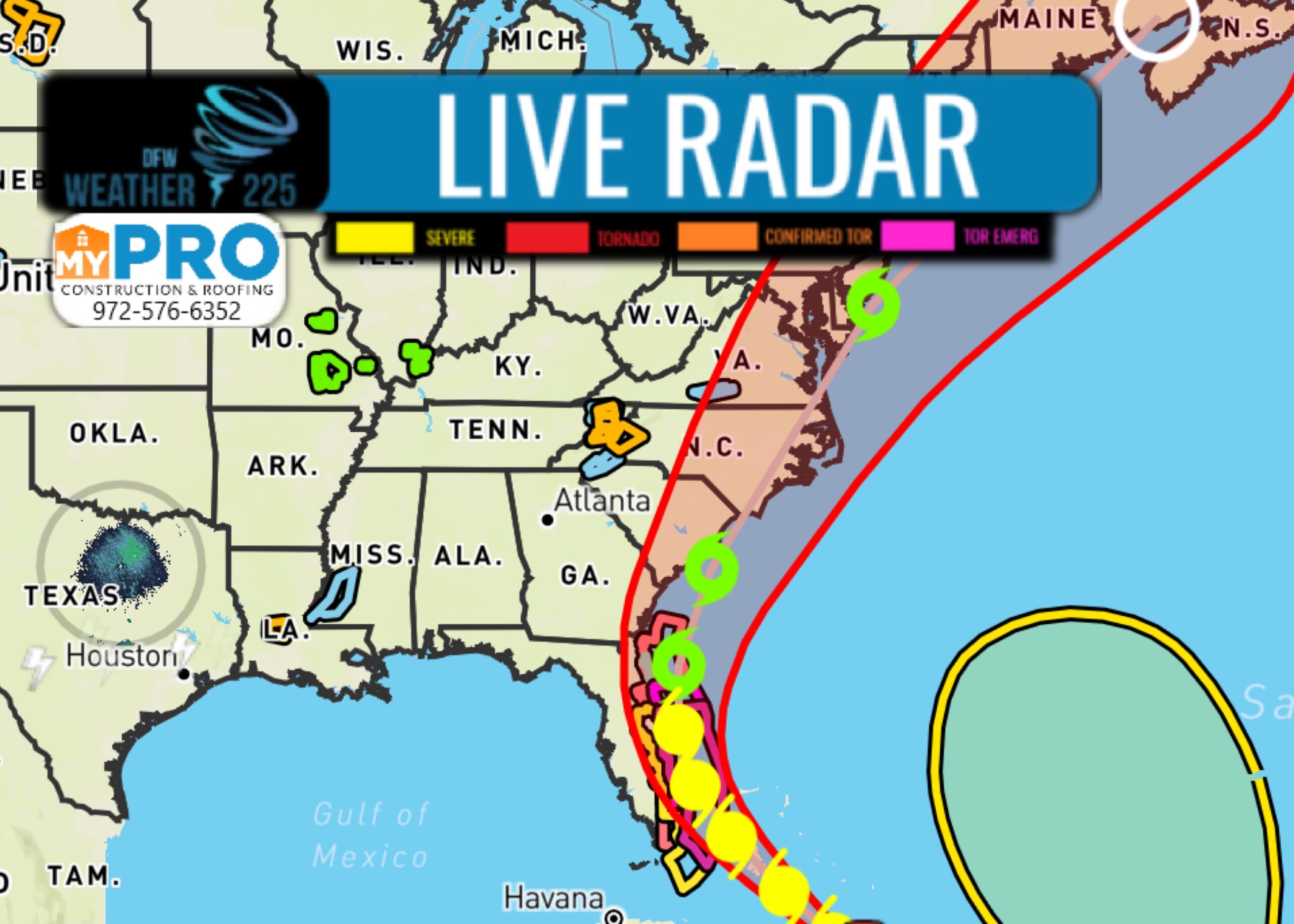
The latest track from the National Hurricane Center, has Isaias remaining a CAT 1 Storm, and not strengthening into a CAT 2 storm. It’s path remains to show it skirting the southeastern US coast (FL, GA) before moving up the coast past Jacksonville as a Tropical Storm with the current forecasted path. Here’s the latest statement on Isaias from the NHC.
Tropical Discussion
000
AXNT20 KNHC 311729
TWDAT

Tropical Weather Discussion
NWS National Hurricane Center Miami FL
129 PM EDT Fri Jul 31 2020

Tropical Weather Discussion for North America, Central America
Gulf of Mexico, Caribbean Sea, northern sections of South
America, and Atlantic Ocean to the African coast from the
Equator to 32N. The following information is based on satellite
imagery, weather observations, radar and meteorological analysis.

Based on 1200 UTC surface analysis and satellite imagery through
1650 UTC.

...SPECIAL FEATURES...

The center of Hurricane Isaias at 31/1500 UTC is near 21.7N
74.5W. The center of Isaias is about 315 nm SSE of Great Abaco
Island, Bahamas and about 355 nm SE of Nassau, Bahamas. Isaias is
moving NW at 14 kt. The maximum sustained wind speeds are 60 kt
with gusts to 85 kt. The estimated central pressure is 992 mb. The
12 ft seas extend 300 nm in the NE quadrant, 180 nm in the SE
quadrant, 90 nm in the SW quadrant, and 300 nm in the NW quadrant.
Most of the precipitation is confined in the northern semicircle
of the storm, with numerous moderate to strong convection from
21N-23N between 74W-75W. Scattered moderate to strong convection
is noted from 21N-23N between 71W-76W. Scattered showers are noted
120 nm from the center in the SE quadrant. This convection is
impacting the southeastern Bahamas with some of the scattered
showers impacting the Turks and Caicos. Seas are up to 26 ft near
the center of the storm. Isaias will continue its northwestward
motion with some decrease in forward speed expected for the next
day or so followed by a turn toward the north-northwest. On the
forecast track, the center of Isaias will continue to move near or
over the Southeastern Bahamas today. Isaias is forecast to be
near the Central Bahamas tonight, and move near or over the
Northwestern Bahamas Saturday and near the east coast of the
Florida peninsula Saturday afternoon through Sunday.

Please read the latest NHC Public Advisory at
https://www.nhc.noaa.gov/text/MIATCPAT4.shtml, and the
Forecast/Advisory at
https://www.nhc.noaa.gov/text/MIATCMAT4.shtml, for more details
Leave a Reply