
Good afternoon North Texas, here’s an update on the winter weather potential for NTX, late tonight into tomorrow. 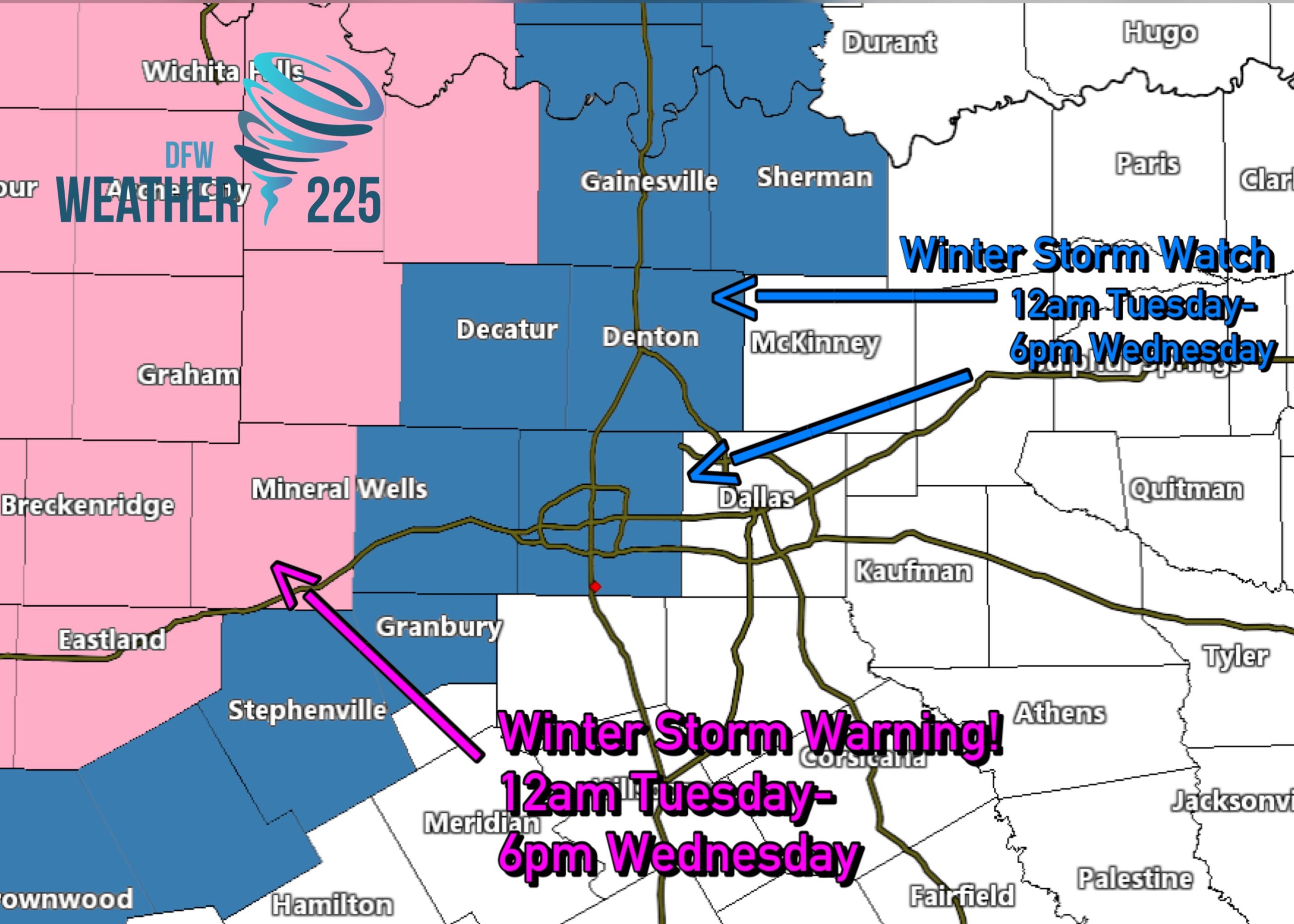
A Winter Storm Warning has now been extended further west to include some of our far western NTX counties (areas shaded in pink). This warning is in effect from Midnight tonight through 6pm Wednesday!
Winter Storm Watch continues for parts of the metroplex, and areas north and west (shaded in blue) from Midnight tonight through 6pm Wednesday.
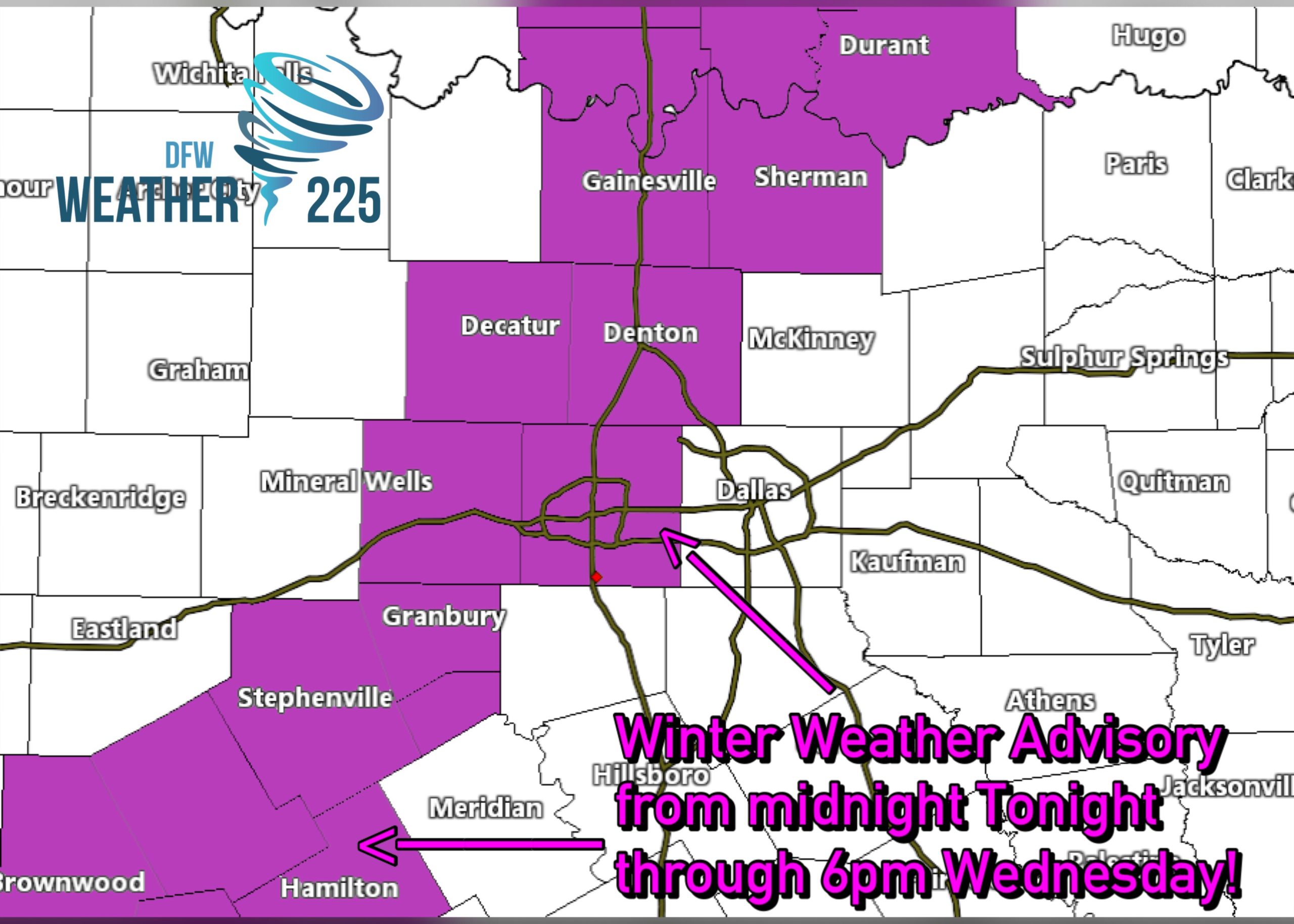
In addition to the winter storm watches and warnings, a Winter Weather Advisory has been issued for the counties above (shaded in purple) from Midnight tonight through 6pm Wednesday.
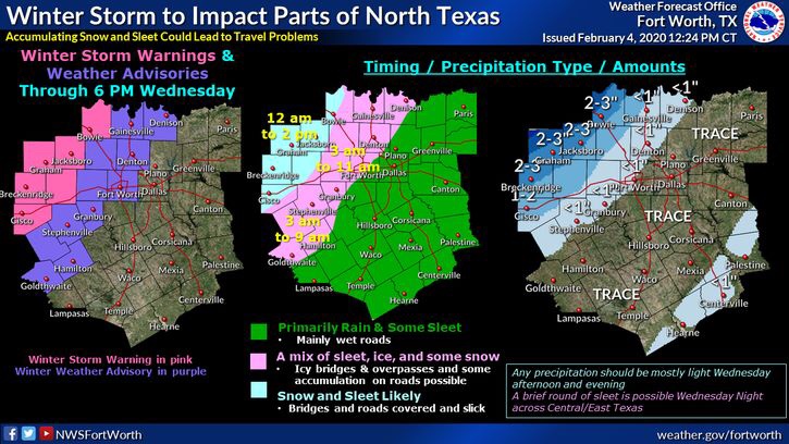
For the immediate DFW metroplex, we could see trace amounts across the area, with western parts of DFW seeing potentially a slight bit more. The best area for snow and freezing rain accumulation looks to be further west of DFW into west TX.
Will there be travel impacts? For the immediate DFW metroplex, there is a possibility for some slick spots on the roadways, especially on bridges and overpasses. Impacts would not b significant for DFW.
Areas further west and north west of DFW could see some slick spots on area roads as well. The most significant impacts would be for our far western areas. Within the winter storm warning.
You can check road conditions through TXDot here
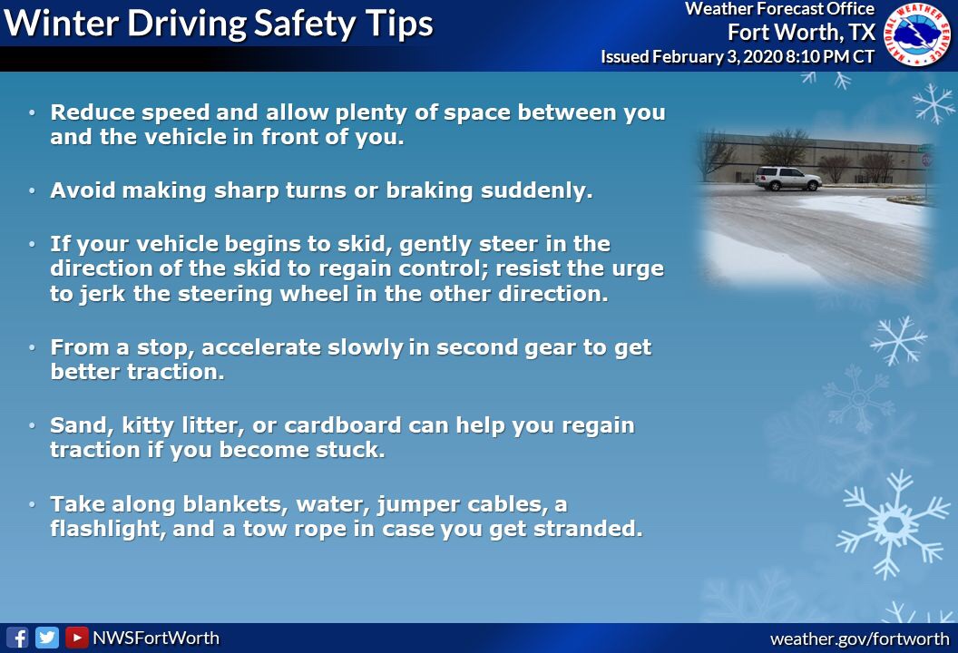
When our driving, be sure to drive carefully if the roads are slick. Above is some winter driving safety tips.
So quick run review. The warnings, watches, and advisories are all in effect from 12am Tonight through 6pm Wednesday. This includes parts of the western half of DFW, not all of DFW. DFW could see trace amounts, with western portions of DFW seeing possibly a little bit more. For DFW there could be slick spots, but it appears to be nothing significant. More significant impacts would be for our far western and north western counties.
Stay tuned for more updates!
-JW
Leave a Reply