
Just a short time ago, the National Hurricane Center reporter that it’s Hurricane Hunter aircraft recorded data that indicates Isaias has now reached Category 1 Hurricane strength just north of the coast of Haiti. This storm is expected (at this time) to skim the Southeastern United States coast, before impacting the North Carolina coast by Monday, based on the current forecast. Stay tuned for the latest.
Track the activity with our interactive Tropics map.
Tropical Weather Discussion
NWS National Hurricane Center Miami FL
2256 UTC Thu Jul 30 2020
Tropical Weather Discussion for North America, Central America
Gulf of Mexico, Caribbean Sea, northern sections of South
America, and Atlantic Ocean to the African coast from the
Equator to 32N. The following information is based on satellite
imagery, weather observations, radar and meteorological analysis.
Based on 1800 UTC surface analysis and satellite imagery through
2345 UTC.
...SPECIAL FEATURES...
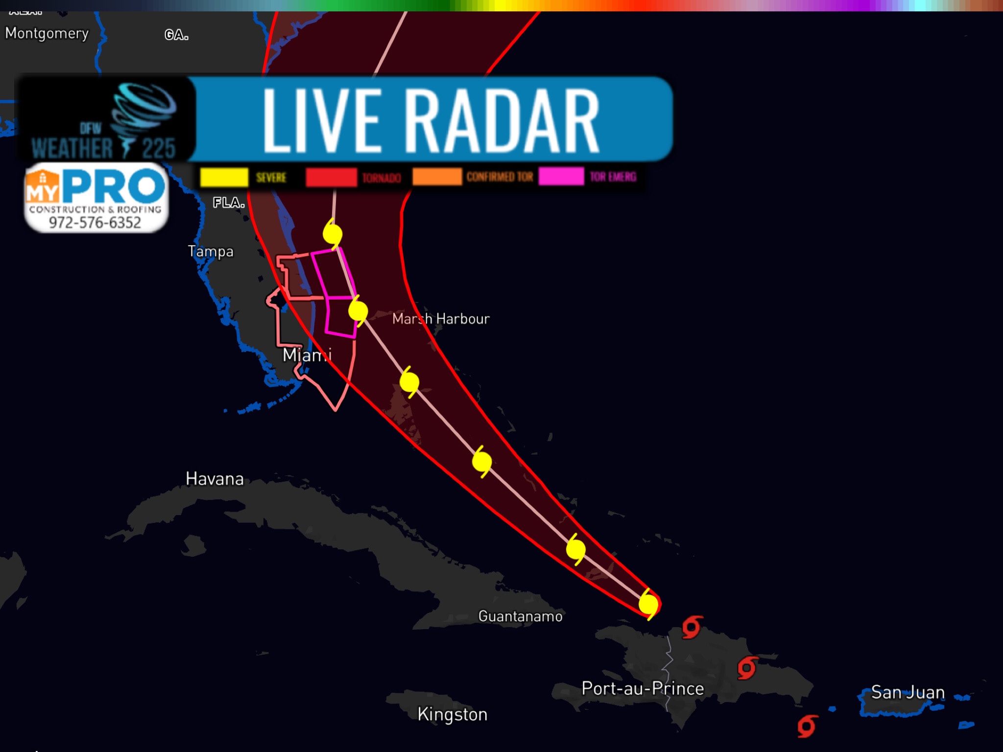
As of 30/2100 UTC, Tropical Storm Isaias is centered near 19.5N
70.6W, or about 135 nm WNW of Punta Cana, Dominican Republic,
moving NW at 17 kt. Estimated minimum central pressure is 999 mb.
Maximum sustained winds is 50 kt with gusts to 60 kt. Numerous
moderate to strong convection is from 18N to 22N between 67W and
72W. Scattered moderate convection is in bands elsewhere from 14N
to 24N between 65W and 75W. On the forecast track, the center of
Isaias will move near the Southeastern Bahamas by late tonight.
Isaias is forecast to be near the Central Bahamas Friday night
and move near or over the Northwestern Bahamas and near South
Florida on Saturday. Strengthening is forecast during the next
day or so, and Isaias is forecast to become a hurricane on Friday
or Friday night.
Please read the latest NHC Public Advisory at
https://www.nhc.noaa.gov/text/MIATCPAT4.shtml and Forecast/
Advisory at https://www.nhc.noaa.gov/text/MIATCMAT4.shtml for
more details.
Leave a Reply