
Good morning North Texas, here’s a look at today’s forecast and storm chances.
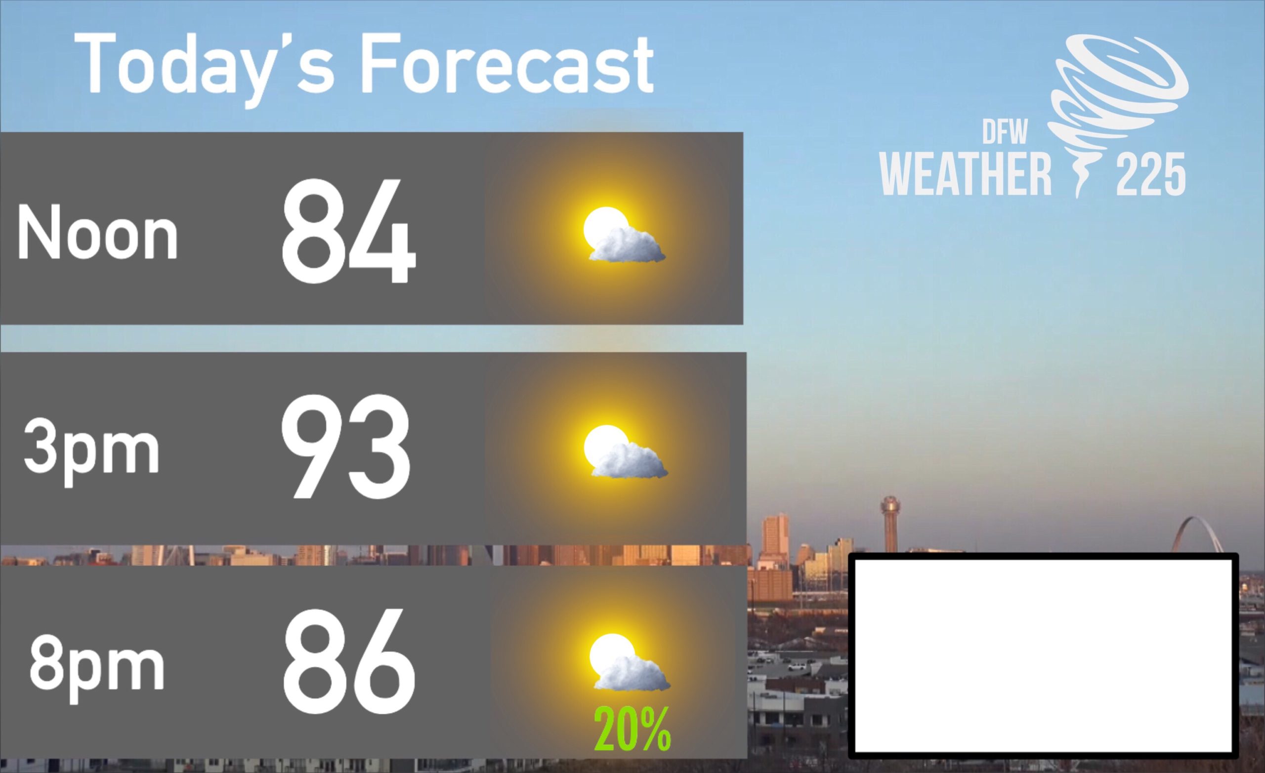
Today expect hot temperatures with a high of 93 this afternoon, with mostly sunny skies and a few patchy clouds. Later this evening there could be some storm chances for PARTS of NTX. Not everyone will see rain and storms. Our current confidence (as of this morning) in storm coverage will be for areas North along the Red River.
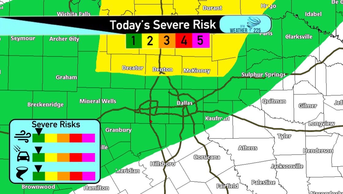
The SPC has placed a large area of NTX under a (1/5 Green) Marginal Risk for some strong to possibly severe storms, with areas North and along the Red River under a (2/5 Yellow) Slight Risk. Again not everyone will see rain or storm activity. Storms will develop south of Oklahoma City and move south towards NTX, as they move towards the Red River they should be weakening. Our thinking is these could possibly be strong to severe along our Red River counties, before fizzling out before they reach our DFW counties. Risks for our Red River counties would be hail up to or larger than quarter sized, and some gusty 45-60mph winds.
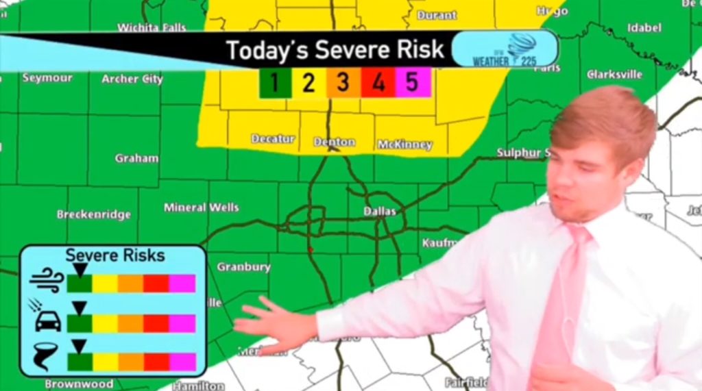
Click the video Forecast above for more.
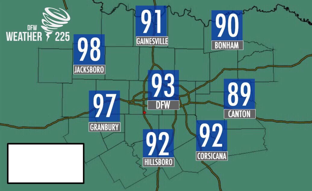
For most of the day we will see mostly sunny skies with highs in the low to mid 90s for DFW. Areas west of I-35 will see temperatures in the upper 90s, and possibly some highs near 100!
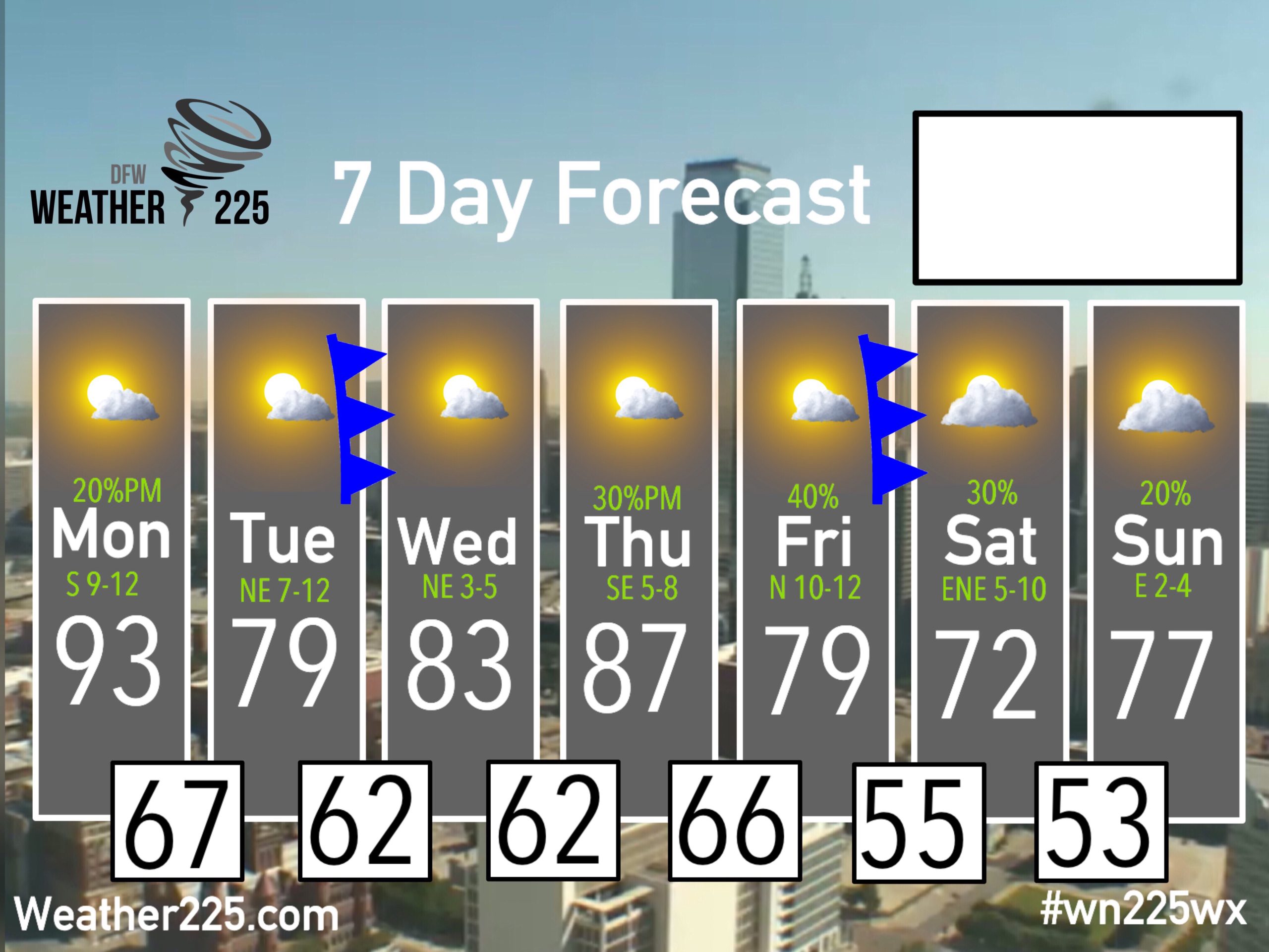
Here’s the updated 7 Day forecast. Enjoy your day and week! Stay tuned for any updates with Weather225
-JW
Leave a Reply