
Good evening North Texas. Tomorrow a strong cold front will push into the region. Here’s our latest thinking on tomorrow’s forecast.
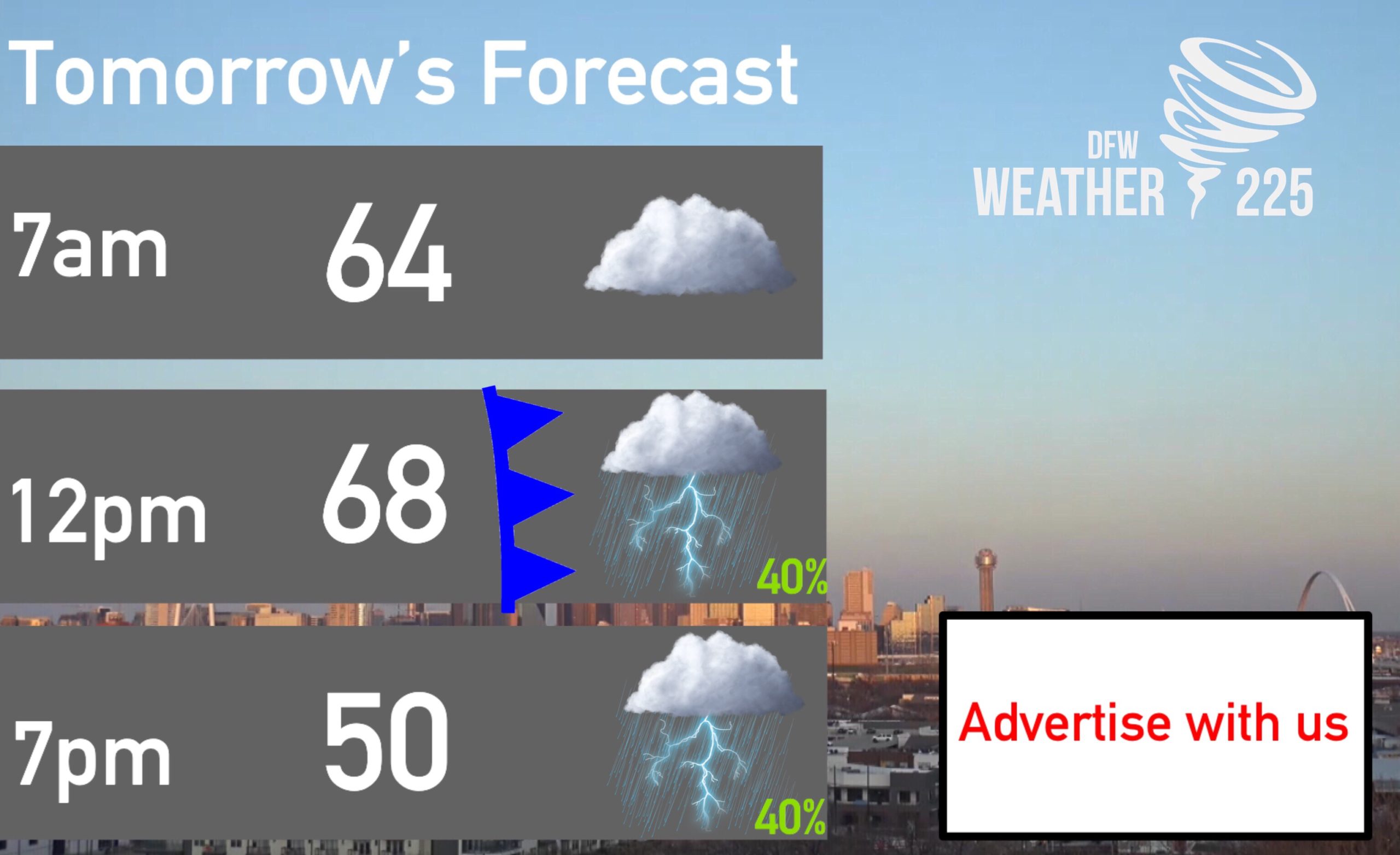

Above is our current timing and look at the temperature change with tomorrow’s cold front. We’ll see temperatures in the upper 60s across the area tomorrow until early afternoon, before the front pushes in, dropping temperatures into the 50s for the remainder of the day, and even the mid to upper 40s overnight Friday!
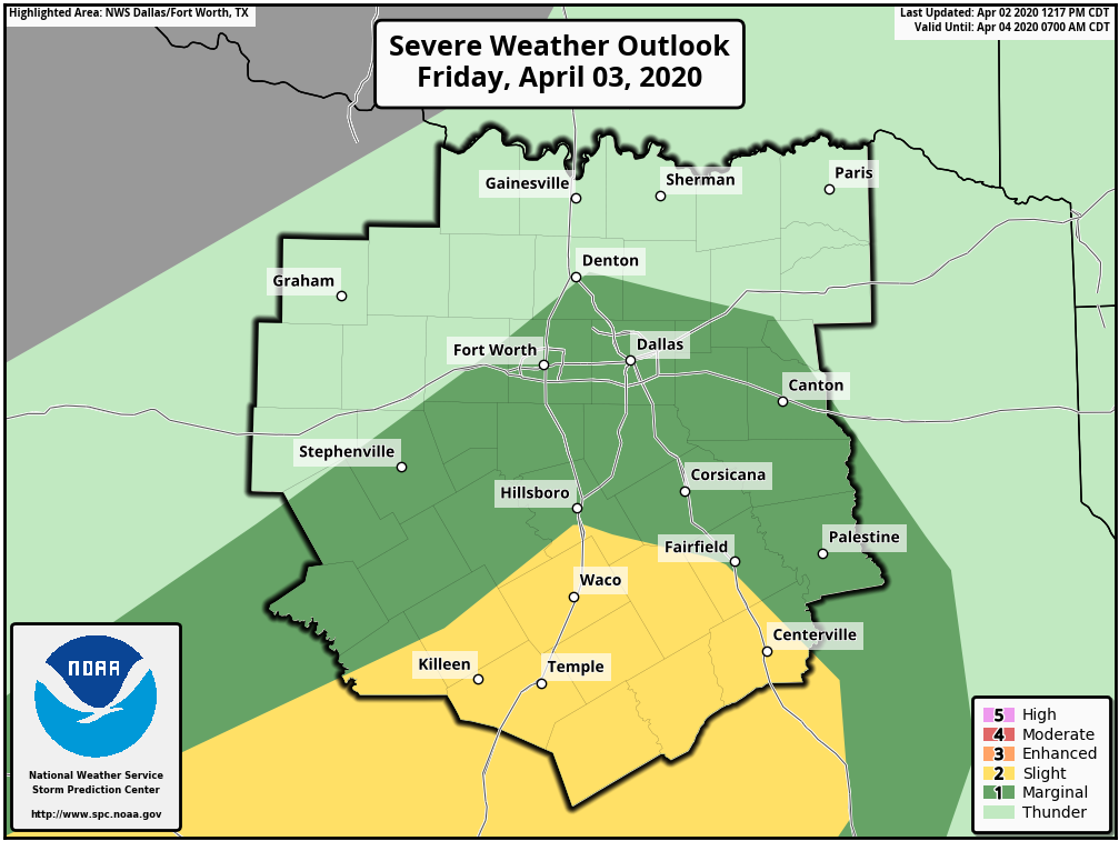
Depending on the timing, there could be a low end severe weather risk. This is all dependent on the fronts timing and position. If the front arrives around noon in the metro, our severe weather chances will be low to almost zero. If it arrives later in the afternoon, there could be a low end threat for some storms with a hail and gusty 45-60mph wind threat. But let’s be clear, NOT everyone will see this storm, or severe storm activity. There is a higher likelihood we see nothing. At this point at 11pm, my confidence in severe storm development in our area is low, as almost every model is showing lower shower and storm coverage, as well as the fronts position and timing appears to be earlier in the day. However, as we’ve said in previous posts, we should be mindful that there is some type of severe weather threat. We’ll be keeping an eye on the forecast and let you know if anything, or if our thoughts change in the morning.
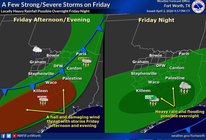
Regardless, we will all see cooler temperatures tomorrow, so be sure you’re aware of that. We will also see winds between 12-20mph following behind the front tomorrow, so quick heads up if you have any outdoor activities planned. Stay tuned for the latest. To ease any fears, this is nothing major, just a strong cold front bringing cooler temperatures, and with that, there could be a low end severe weather threat, however, that threat will be low, and theres a chance there could be no severe weather, the threat is dependent on the fronts timing, and position.
You can keep up with the latest with our live twitter feed on our website, as well as radar on our home page!
– JW
Leave a Reply