
Good morning North Texas, and happy Friday. Late tonight we could see a widespread line of storms enter the region, bringing a threat for some strong to severe storms with it, as well as heavy rainfall.
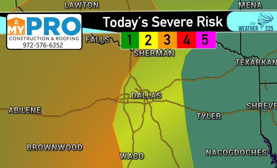
This morning the SPC has upgraded parts of the area just along and West of I-35 to a (3/5 Orange) Enhanced Risk for storms. With areas across DFW under a (2/5 Yellow) Slight Risk, and Eastern TX under a (1/5 Green) Marginal Risk for storms.
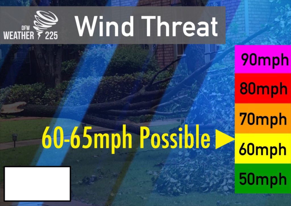
Threats with storms today across DFW look to be winds of 55-65mph, hail near quarter sized to possibly golfball sized, and possibly a spin up tornado within the line of storms.
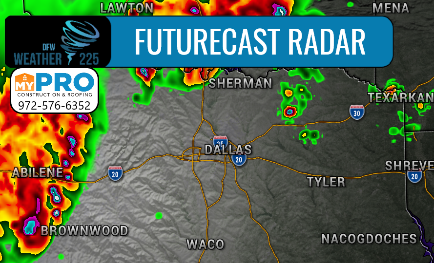
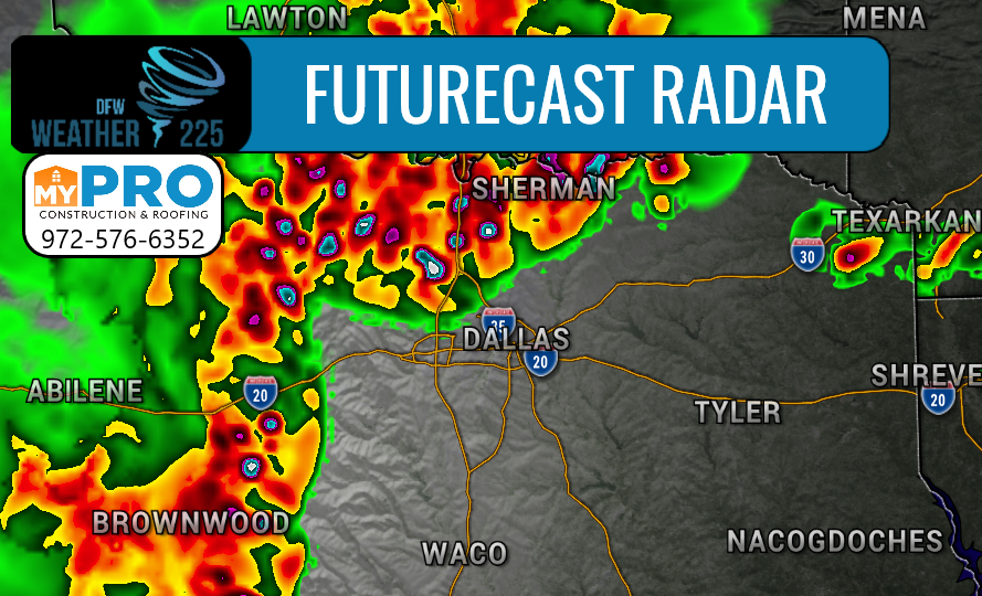
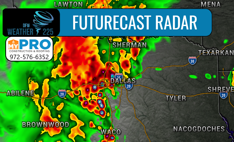
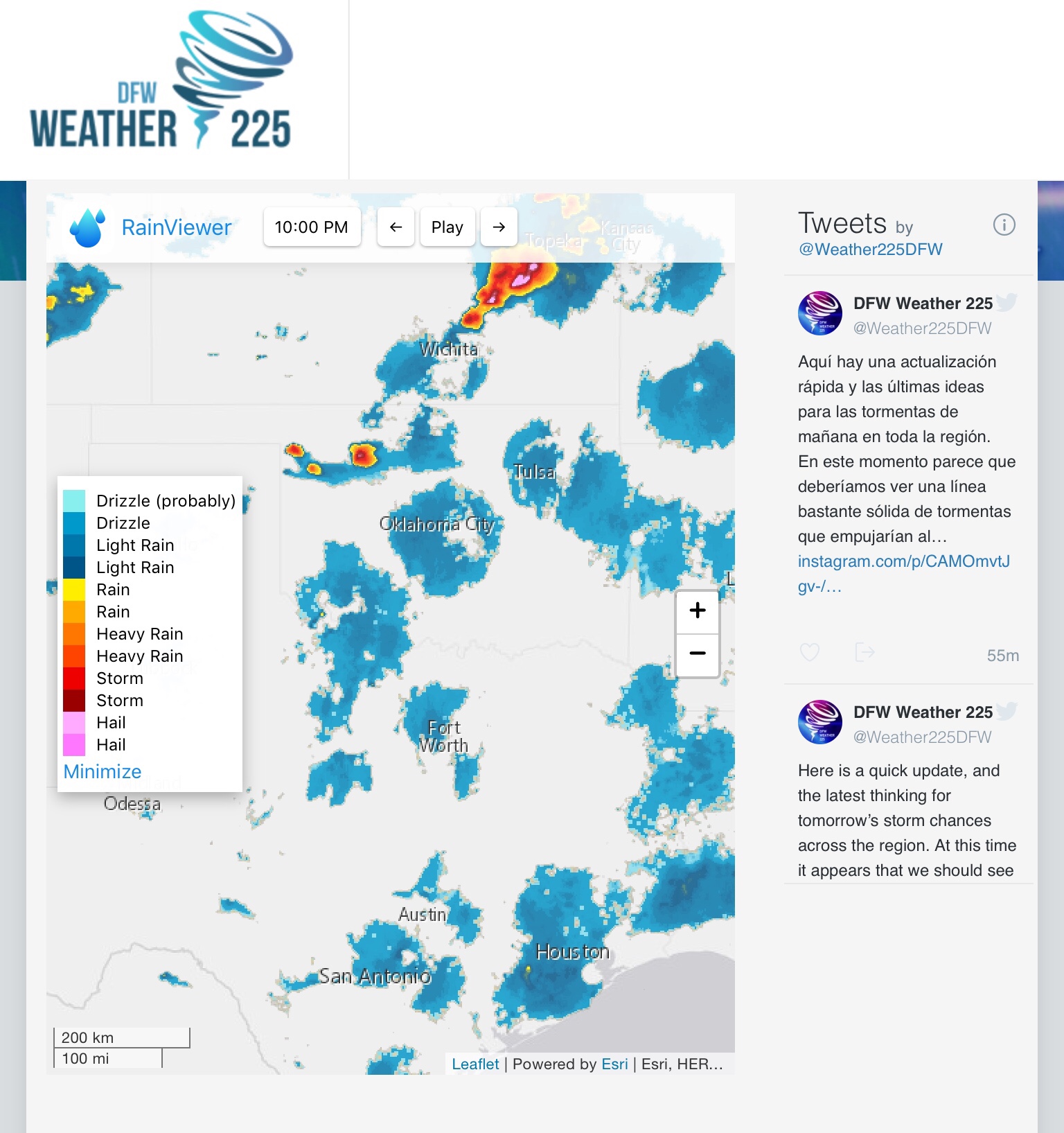
Timing for storms across the area appears at this time this morning, to be between 8pm-3am for areas we cover (as shown above with our future cast radar).
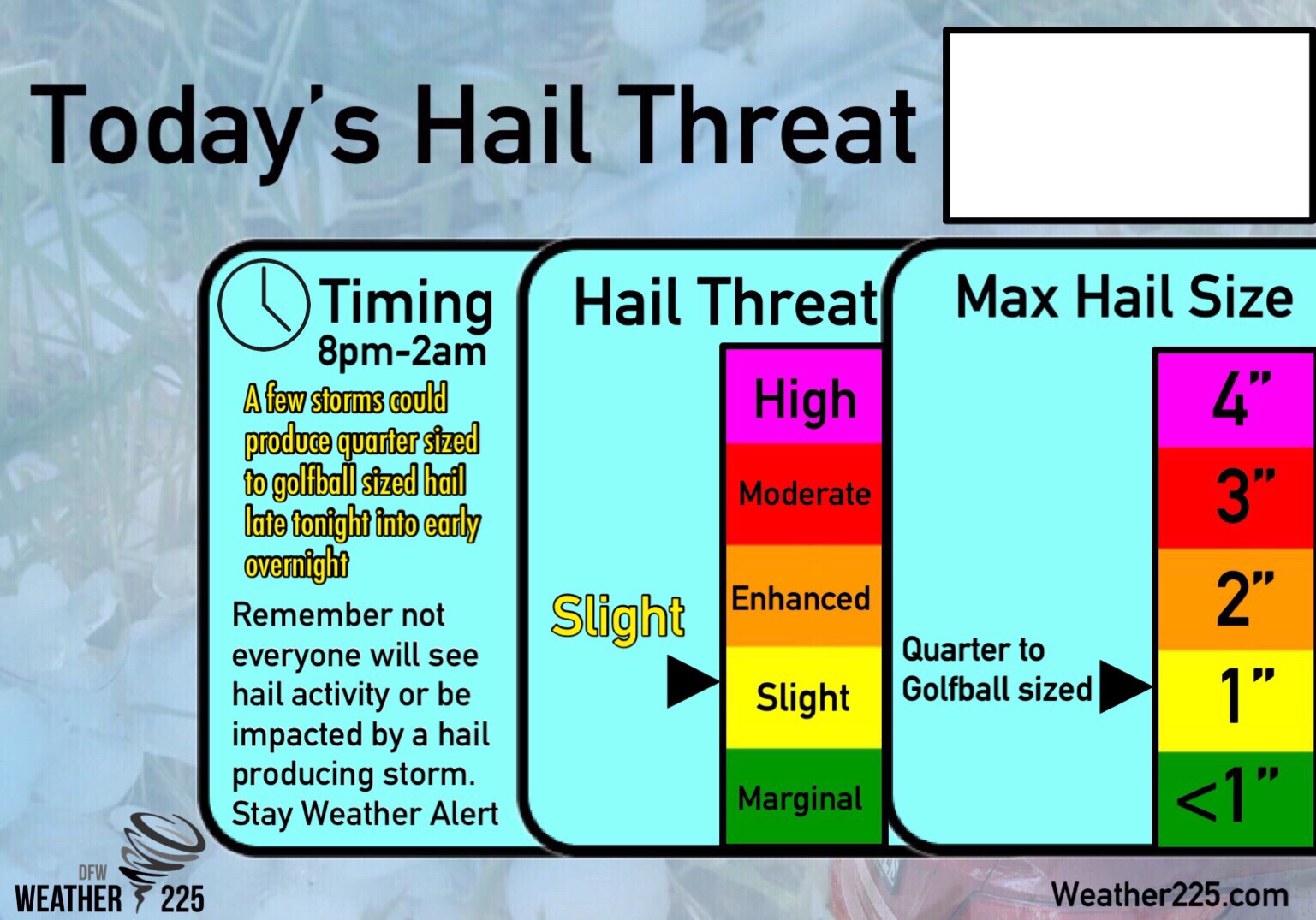
Above is our Exclusive Weather225 Hail Threat meter for the areas we cover. As previously mentioned in this forecast, hail from quarter to golfball sized will be possible. Not everyone will see this hail activity, however, there is a threat for hail today across the area we’ll have to be mindful of.
Not everyone will see severe storms, but we will have to monitor the potential for a widespread line of storms that will push through the region late tonight and the threats with it. It appears that a large majority of us will see rain activity this evening and overnight, so regardless, coverage for general storms appears to be around 80%. We will have to be mindful of heavy rain activity that could cause some minor flooding issues across the area as well. Stay tuned for any updates throughout the day. Make sure you have a way to receive warnings late tonight just to be safe as well.
You can now view our daily updated Day 1 Severe Weather Risk page for daily severe weather risks across NTX here on our website! As well as daily forecasts and our updated 7 Day forecast!
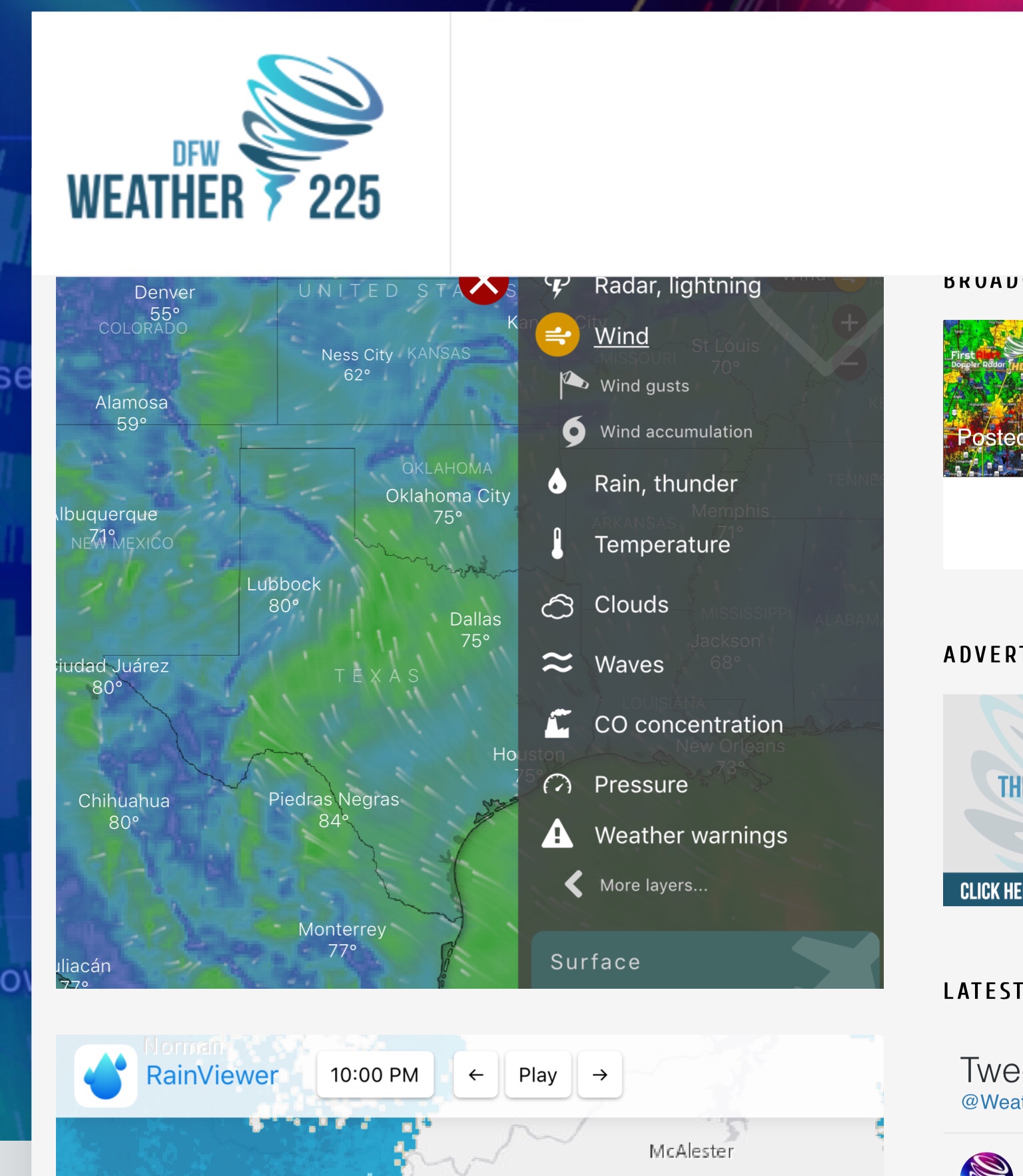
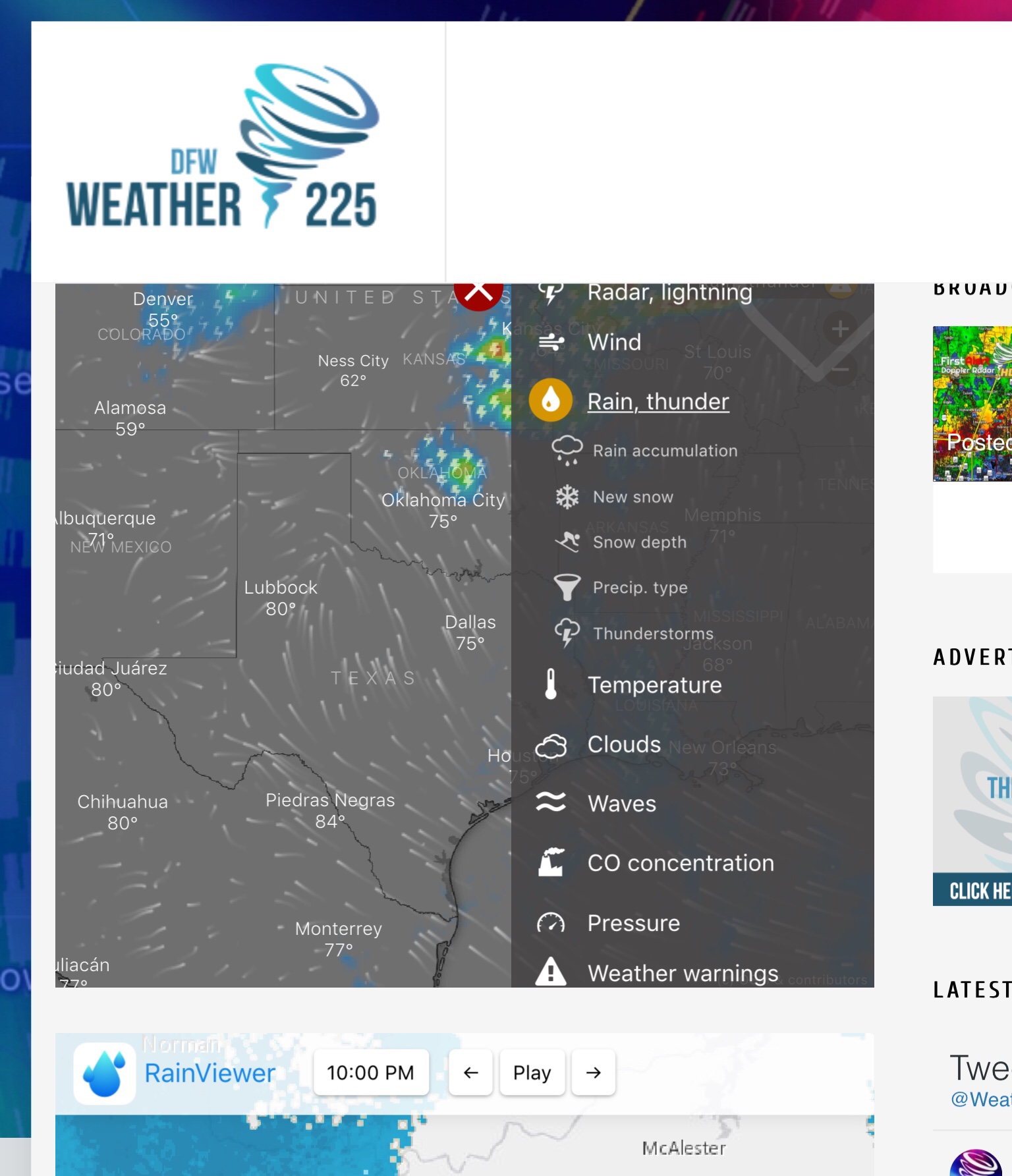
Be sure to track the activity tonight with our Free interactive radar’s! Our first radar on our “Weather Maps Page” gives you access to watches, warnings, and lightning feeds, as well as radar!
Stay tuned for the latest with Weather225
Leave a Reply