
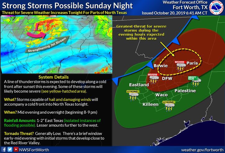
Good morning NTX. Later today and overnight, a strong cold front will enter the region, bringing with it a chance for strong/severe storms, and cooler temperatures. As of this morning, a large portion of NTX is under a (2/5 yellow) slight risk for
storm activity, with areas north from Denton, to Sherman, to Paris under a higher (3/5 orange) enhanced risk for storms.
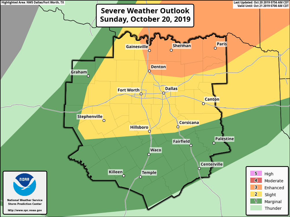
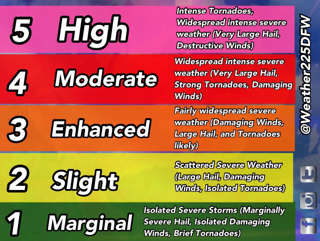
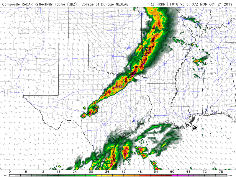
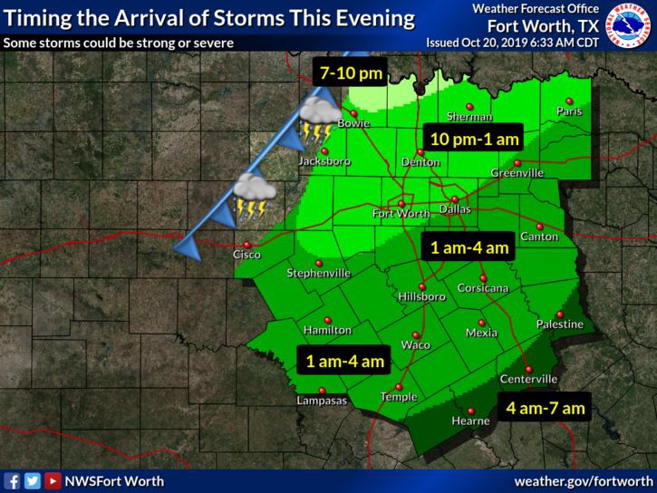
Here is a brief look at what each outlook means if you’re knew to these outlooks, and terminology. Each outlook generally means where the highest storm coverage will be forecasted. We could see some isolated storms develop between 5pm-10pm tonight ahead of the main activity. If any isolated cells were to develop between 5pm-10pm, those storms could produce large to giant hail up to the size of baseballs, as well as a tornado threat, and downburst winds. The highest chances for this early activity will be for our red river counties and southern Oklahoma. Any isolated cell development should be kept at bay across DFW this afternoon as a strong cap will be in place across the area, so we’ll watch and see. The main activity for our area would likely be after 10pm and later, as a solid line of storms will develop and push through the area along the cold front. These storms will have a potential for producing damaging winds, and small hail, as well as a low tornado threat, as one cannot be ruled out, especially for our red river counties. NOT everyone will see severe storm activity, however, most, if not all of NTX, has the potential to see some type of shower and thunderstorm activity as the line pushes through the region.
What should you do to prepare? Severe storms after dark can be a dangerous, so make sure tonight and overnight you have a way to receive warnings if they’re issued. The best ways to receive warnings are with NOAA Weather Radio, or apps like Storm Shield! And stay tuned to Weather225 for the latest
Leave a Reply