
Good morning NTX, today there will be a cold front moving into the region this afternoon and tonight, bringing a chance for severe storms with it. As well as colder temperatures! Before the cooler temperatures, expect hot humid conditions with highs in the upper 80s and 90s with partly cloudy skies.
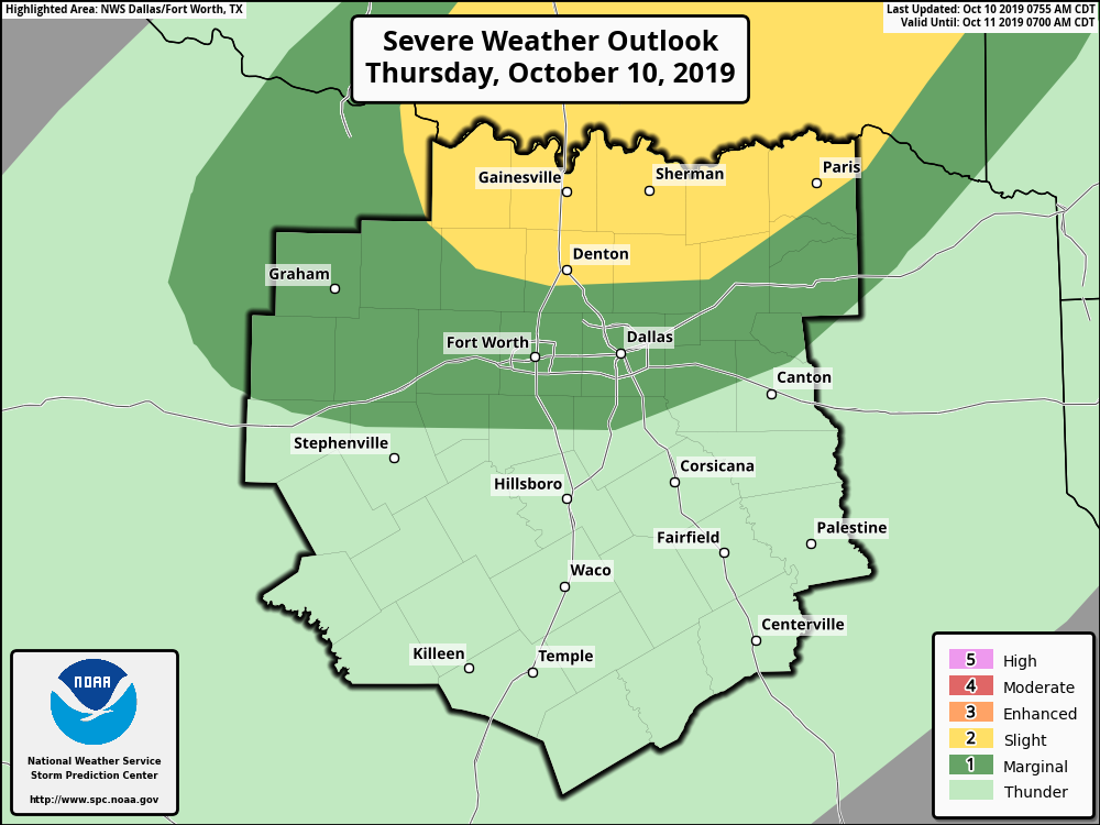
As of this morning, the SPC has placed most of the areas along and north of I-20 with a (1/5 Green) Marginal risk for strong/severe storm activity, with areas north of the immediate metro under a (2/5 Yellow) Slight Risk for storms. The difference between the two outlook risk areas is anticipated storm coverage. The risks with storms during the afternoon are Damaging Winds, Large Hail, and a low but not zero tornado threat. Timing for severe storms looks to be between 4pm-10pm, however depending on the fronts speed, that could be adjusted (for the whole region we cover). Overall rain chances will continue through the evening, into early Friday. 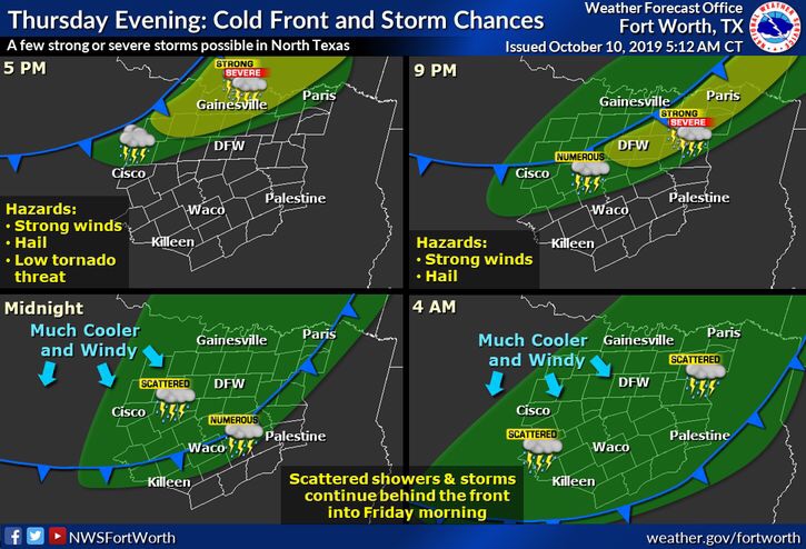
Following the cold front, we can expect temperatures almost 30 degrees cooler than today’s highs, as the region will have highs tomorrow in the 50s and 60s!
You can track the activity on our website with our free interactive radar! And stay tuned for the latest with our social media sites! 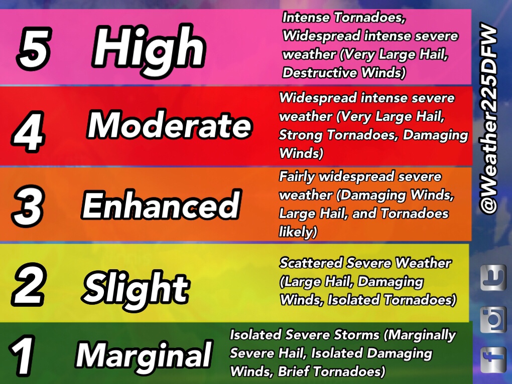
Leave a Reply