
Good morning NTX, and happy Friday. Today we will see a chance for storms across the area. Before we get to into the forecast, And to ease fears, we’d like to let you know NOT everyone will see storms or be impacted by severe weather. We all have an equal opportunity to see storms, so stay weather alert, however, not everyone will see severe weather or general storm activity.
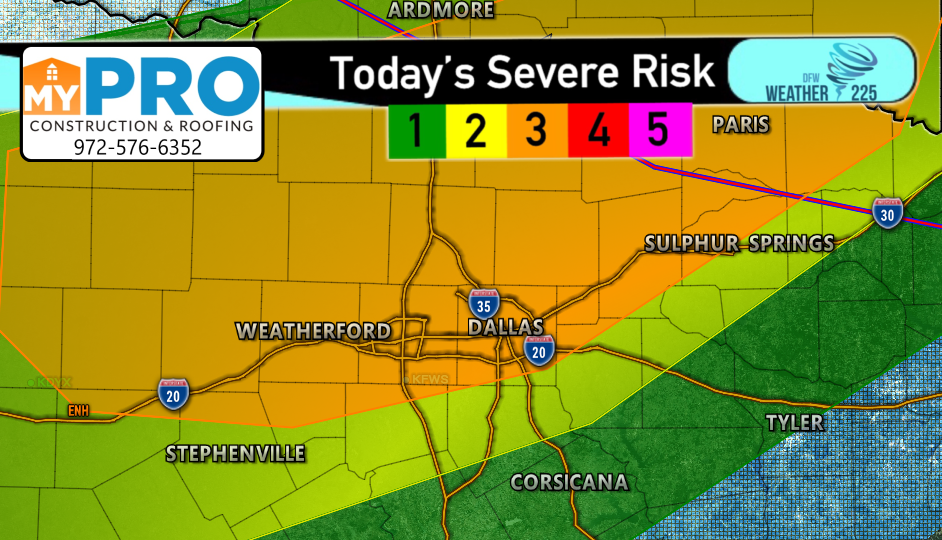
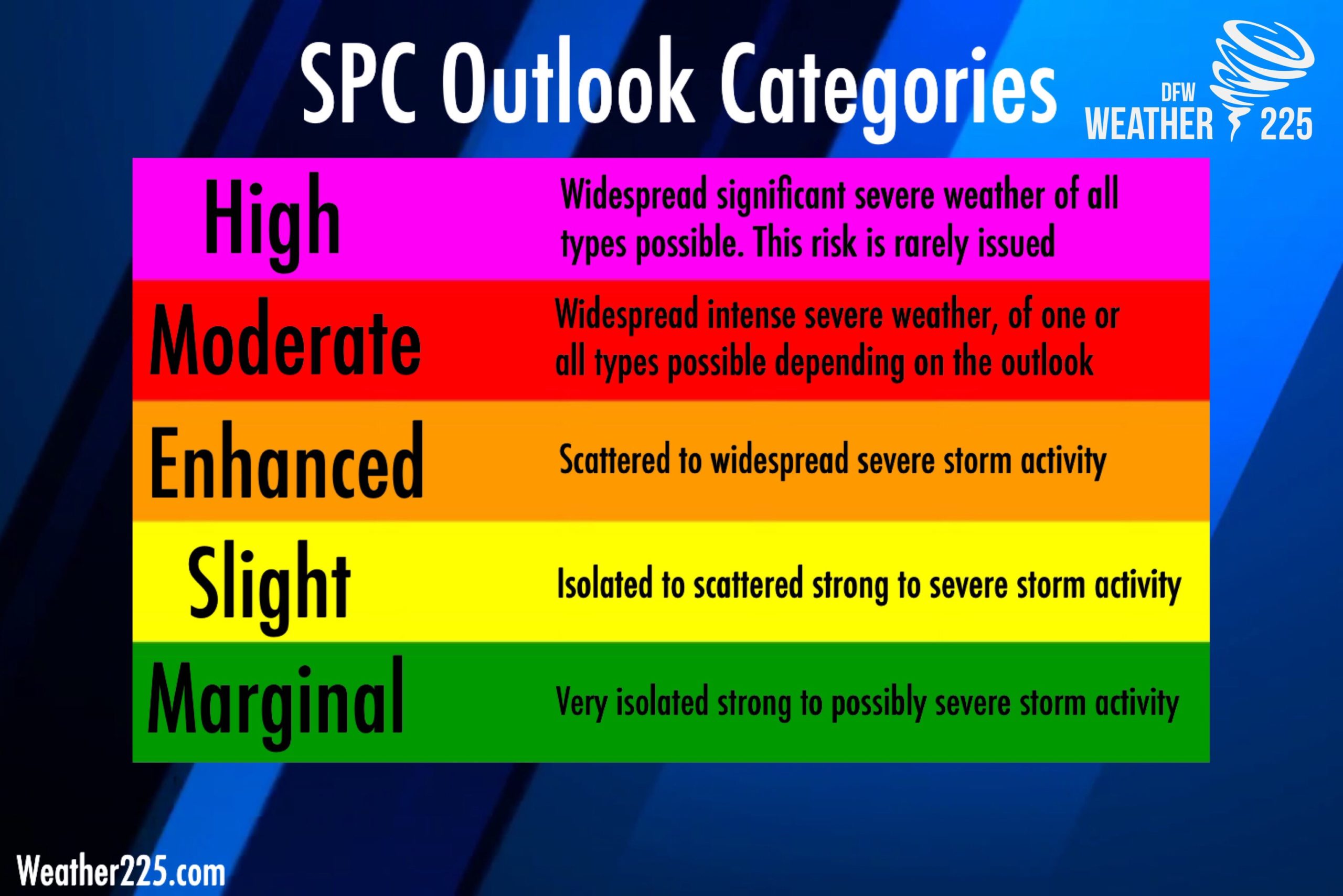
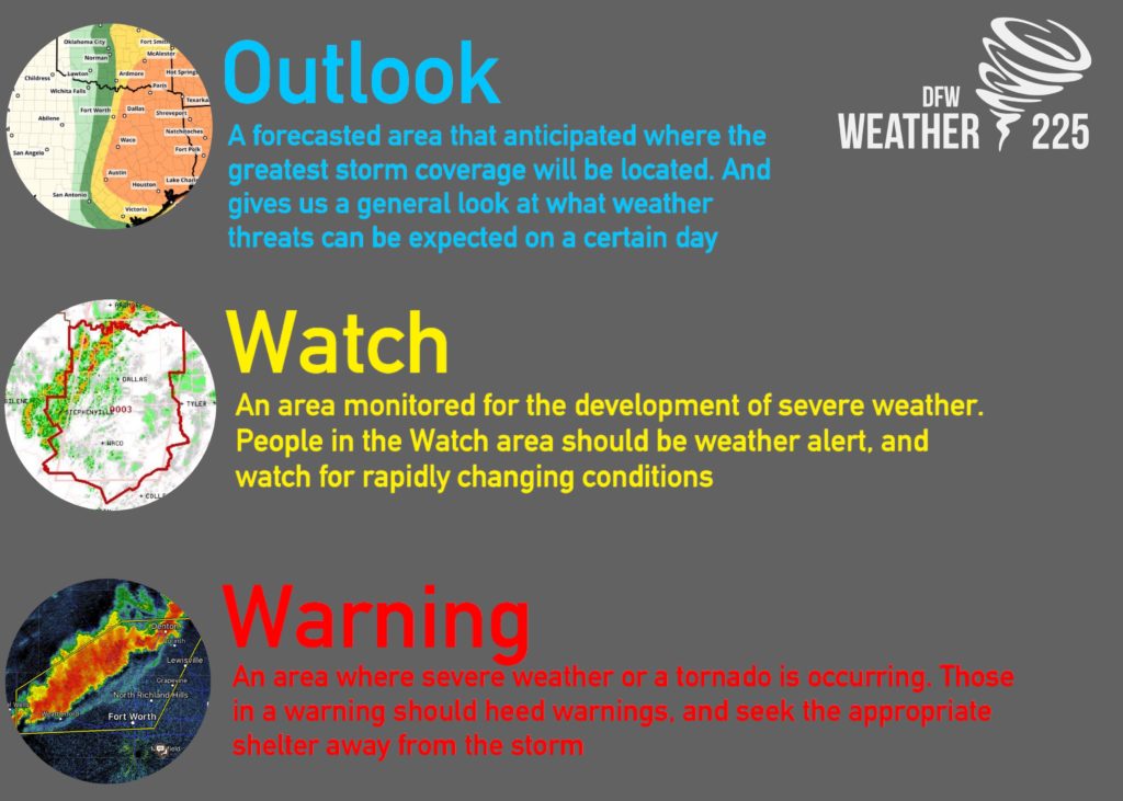
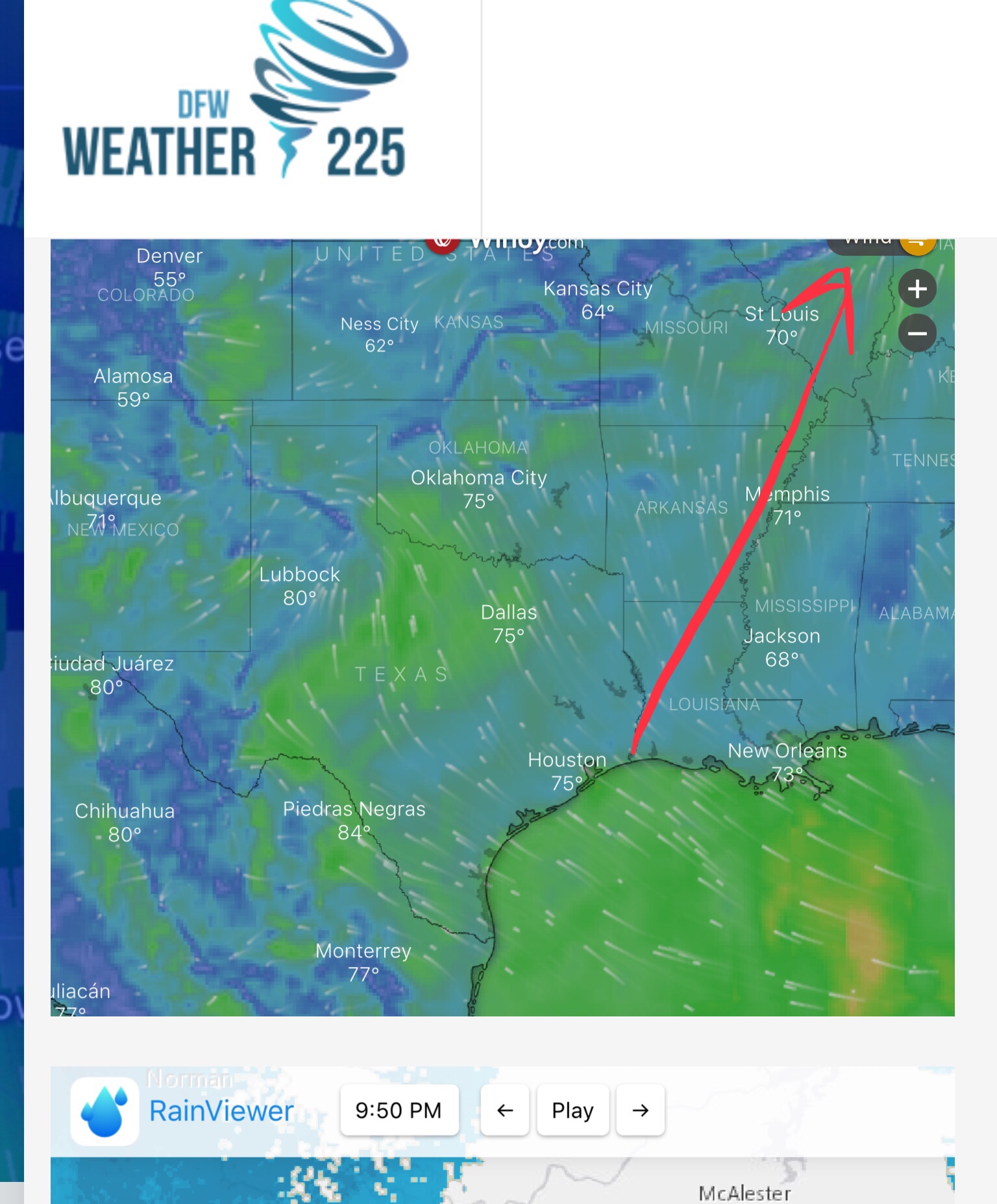
This morning the SPC placed a large portion of NTX under a 3/5 Orange Enhanced Risk for storms, with areas elsewhere under either a 2/5 yellow slight risk, or a 1/5 green marginal risk. Regardless of what risk you’re under NTX, should stay weather alert for storm development later on in the day. These SPC Outlook areas indicate where we anticipate the best storm coverage, not just storm intensity.
The threats with storms today appear to be large, to potentially very large hail anywhere from half dollar to tennis ball sized possible, as well as damaging winds of 60mph, and an isolated tornado or two.
Timing looks to be between 3pm- 2am or 3am for all the areas we cover.
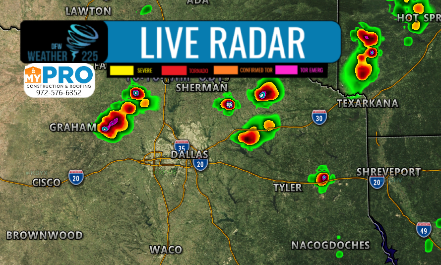
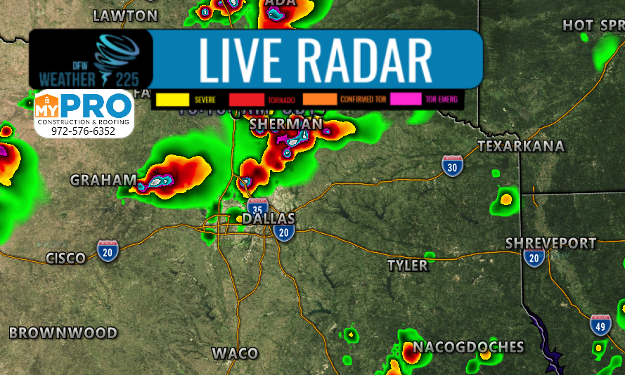
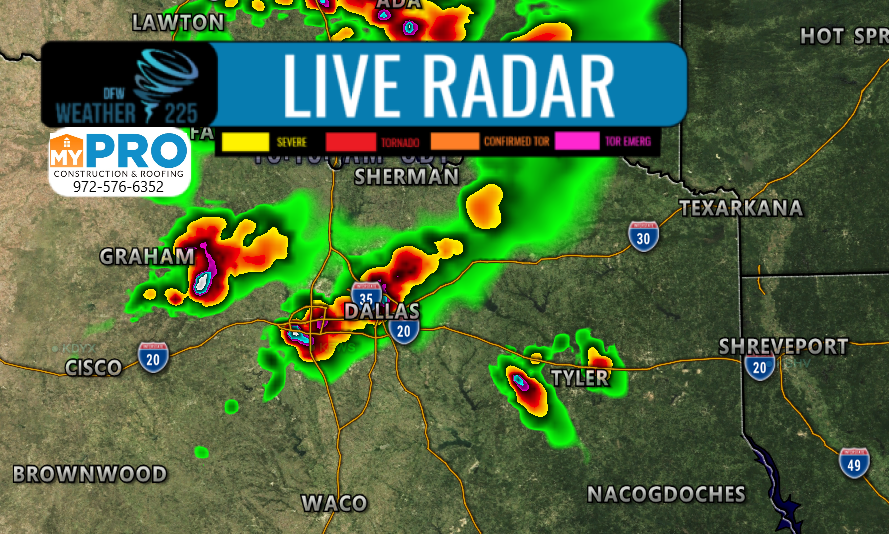
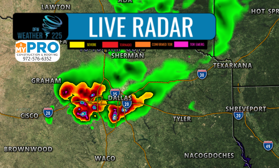
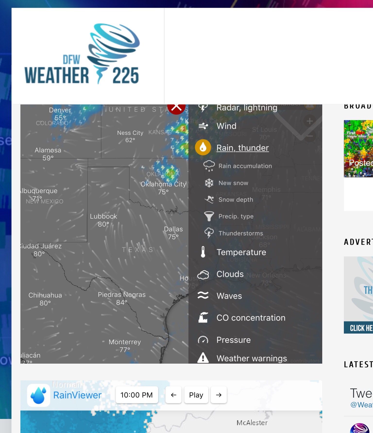
Above is our future cast radar system for storms later tonight. This group of photos shows activity between 3pm-11pm across NTX. We’re keeping an eye on the models, so stay tuned for updates. This was the latest thinking as of 10:30am.

So what should you do? Just make sure you have a severe weather safety plan in place, and keep an eye on the weather this afternoon and evening, as well as have a way to receive warnings and you will be fine. Stay tuned to Weather 225, as well as local NWS and weather media for the latest
You can view our sever weather safety tips any time on our “Severe Weather Safety” Page, and track the activity with our free interactive maps to view watches, warnings, and radar.
Stay tuned for any updates.
Leave a Reply