
Good afternoon North Texas. We’ve seen some spotty activity across the region this morning, now we could see some more scattered activity through this evening, some of which could be strong to severe.
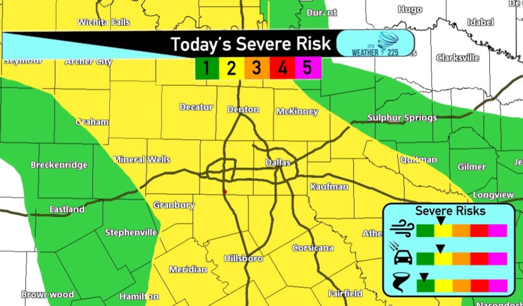
Latest update from the Storm Prediction Center, has upgraded the DFW Metro area to a (2/5) Slight Risk for storms. This upgrade simply means, there’s more confidence in slightly more storm coverage than previously anticipated. However, to ease any fears, the threat is still nothing major or historic, so there’s no reason to worry, just stay weather aware today and be mindful of the threat. The Tornado threat is low, however it’s not zero. Hail and gusty winds of 50-60mph are the main threats. Timing for activity looks to be from 3pm-12am
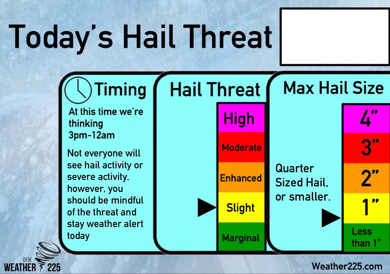
Our exclusive Hail threat Graph is still the same with Quarter Sized Hail as the hail size we could see with the strongest storms. We have an updated timing for strong to severe storm activity. Once again, not everyone will see severe or hail activity today. It’s just something to be mindful of. We say this because we know fears are up right now with a lot going on in the world, and we want to relay what we’re forecasting, in a way that you know what to expect, and so there’s less fear. Just stay weather aware today, by watching the forecast, and staying tuned to Weather225 for the latest, and by having a way to receive warnings, in the event any are issued.
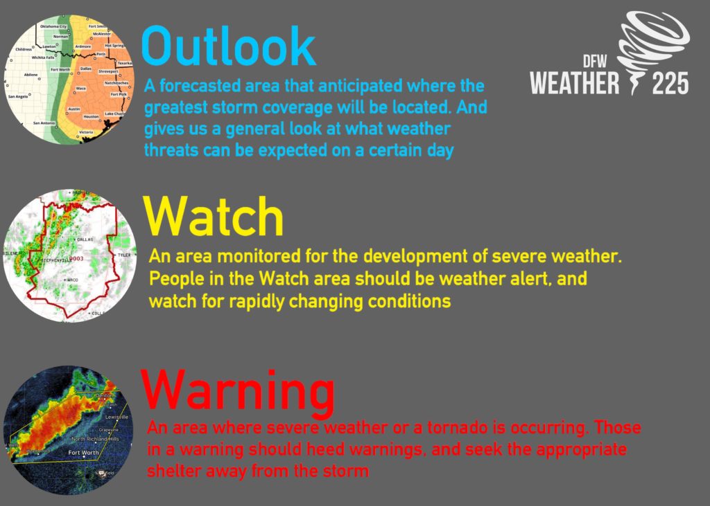
Above is the difference between an Outlook, a Watch, and a Warning.
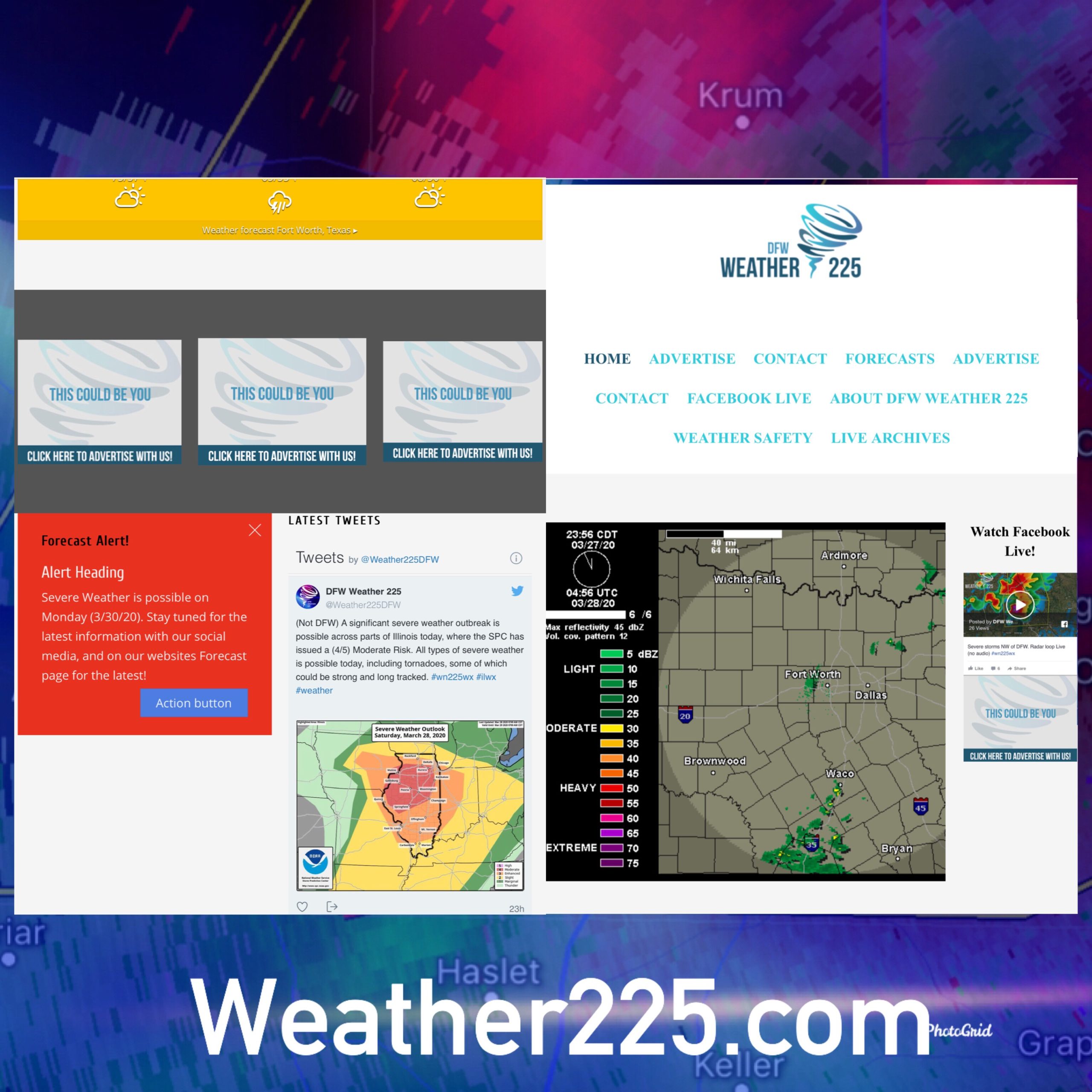
Stay tuned for any updates with Weather225. Track the activity with our radar on our main page, and track the latest updates with our twitter feed, for updates, warnings, and other information!
Leave a Reply