
Good evening North Texas. We hope you’ve enjoyed your weekend and the pleasant conditions. That will be a different story for tomorrow as widespread showers and thunderstorms are possible. Before we get to into the forecast, we want to ease any fears over the threat for severe weather, and let everyone know that the threat is LOW, and if storms were to reach strong to severe limits, NOT everyone would see this activity. There’s a chance we could see no strong to severe activity, we should just be mindful that there is some sort of threat. However, a large portion of NTX will see rain and general thunderstorms tomorrow, as coverage is expected around 80%.
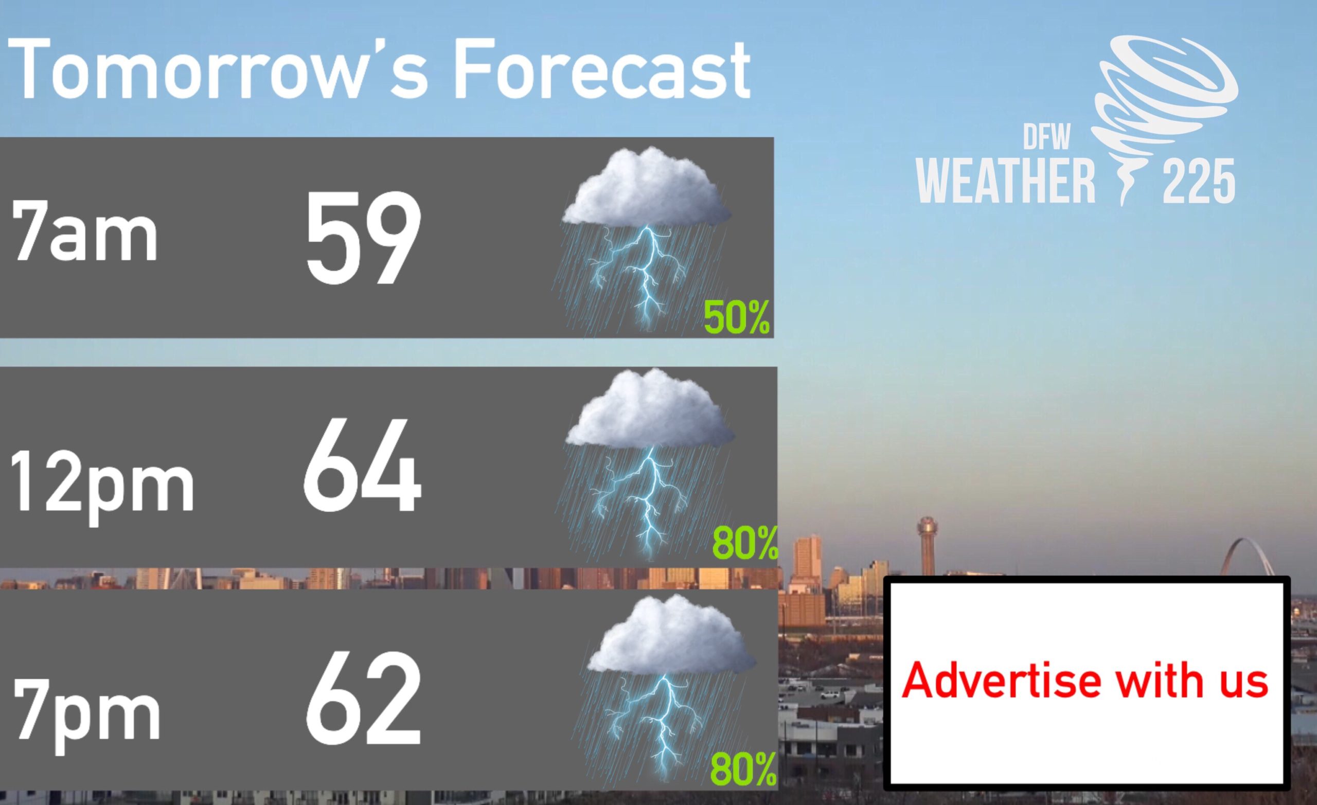
To start, here’s a look at tomorrow’s forecast and timing. Tomorrow morning we will see some shower and storm development, before more widespread coverage during around noon, and into afternoon hours.
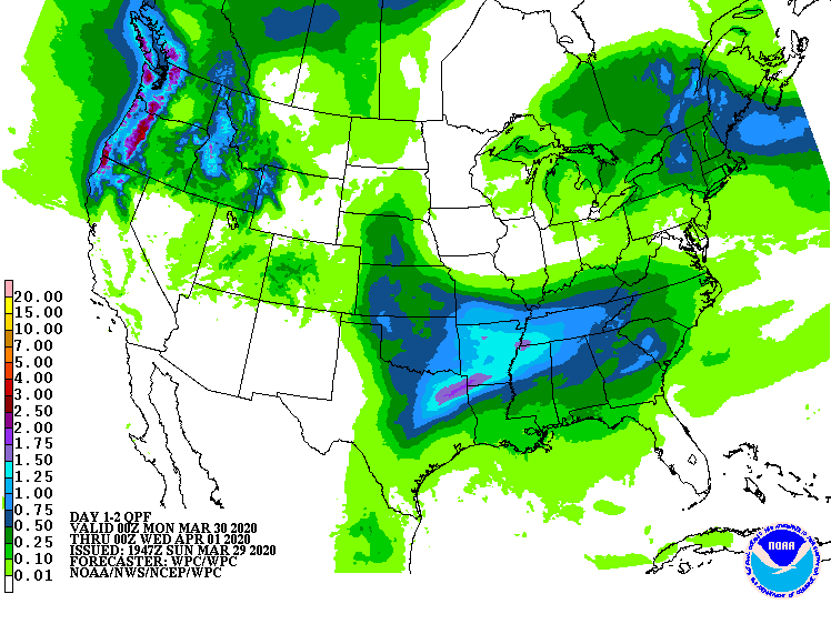
This widespread rain activity will bring a chance for some isolated areas of flash flooding. Some areas could see up to 1-2” depending on the area. Above is the days 1-2 Rainfall totals, from the WPC “Weather Prediction Center“.
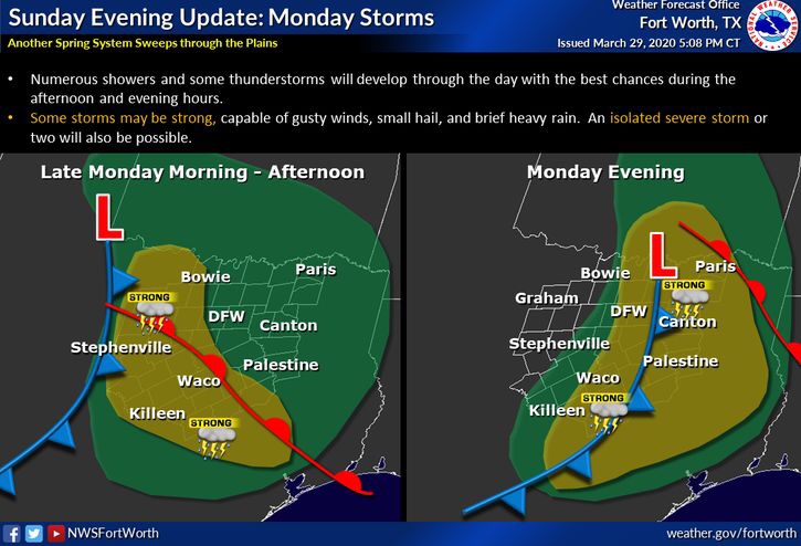
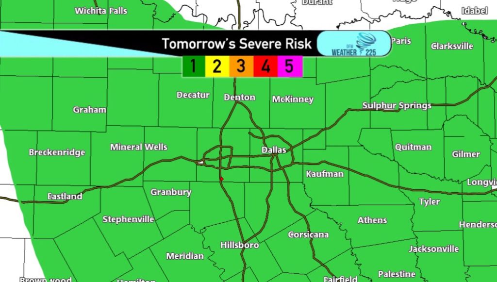
Now for the severe weather threat tomorrow. Now the severe weather threat we’re talking about for tomorrow is nothing major or historic. So to ease any fears, we’re NOT expecting anything major. The threat as of now is at a (1/5) Marginal Risk. These outlooks simply mean, anticipated storm coverage, not just intensity. For the early day, the threat for some strong storms will be for areas along and west of I-35, before shifting to areas along and east of I-35 during the afternoon and evening hours. Threats will be for gusty winds between 45mph-60mph, and hail around or less than 1” in diameter. This doesn’t look like a tornadic threat type of day.
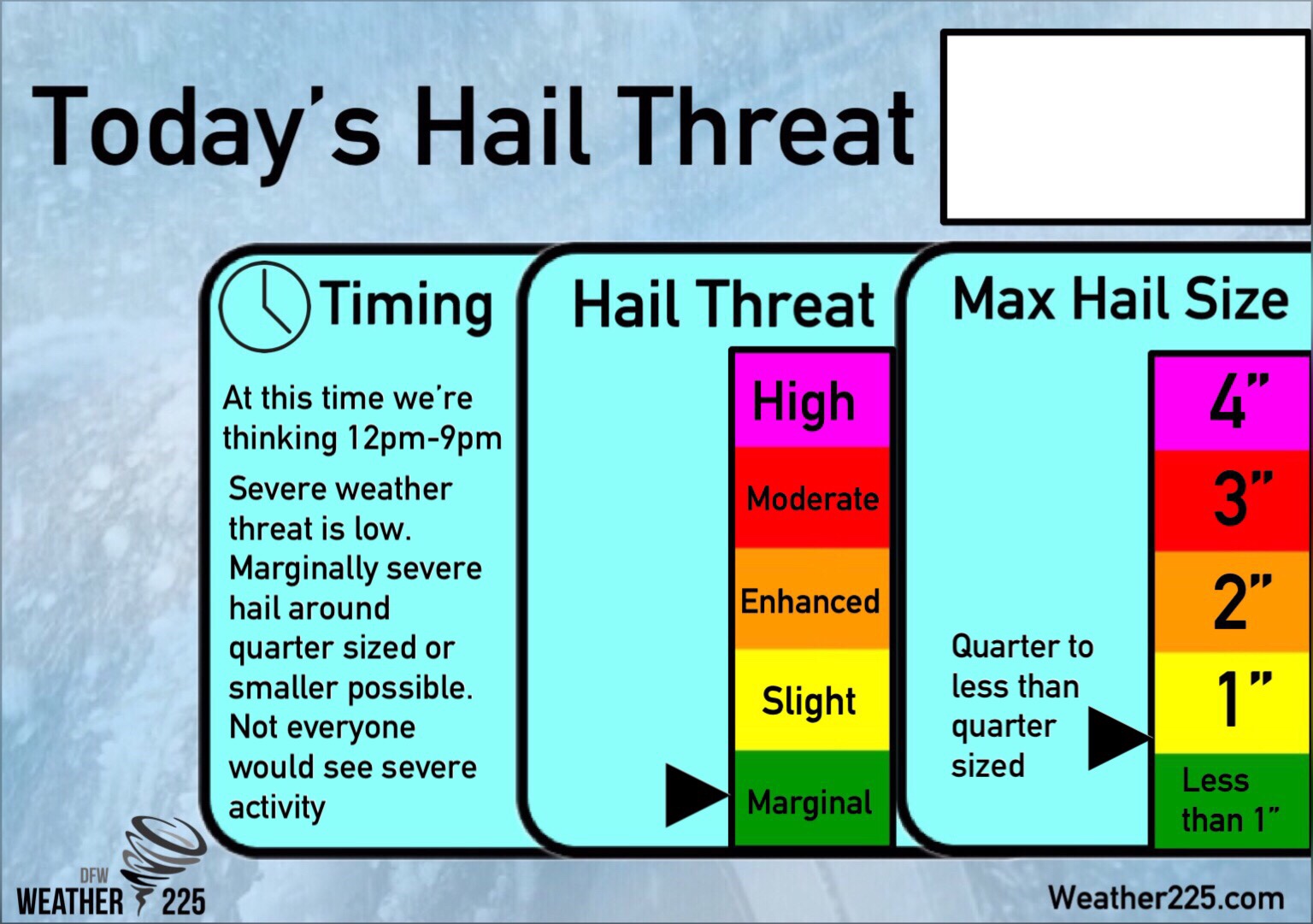
Here’s a look at a new Graph, exclusive to Weather225. Because we have many viewers ask of a hail threat every time there’s a severe weather threat of any kind, we’ve created a new graph for hail size and threat. NOT everyone will see hail tomorrow, if anyone does see hail, it would be between penny sized to possibly quarter sized.
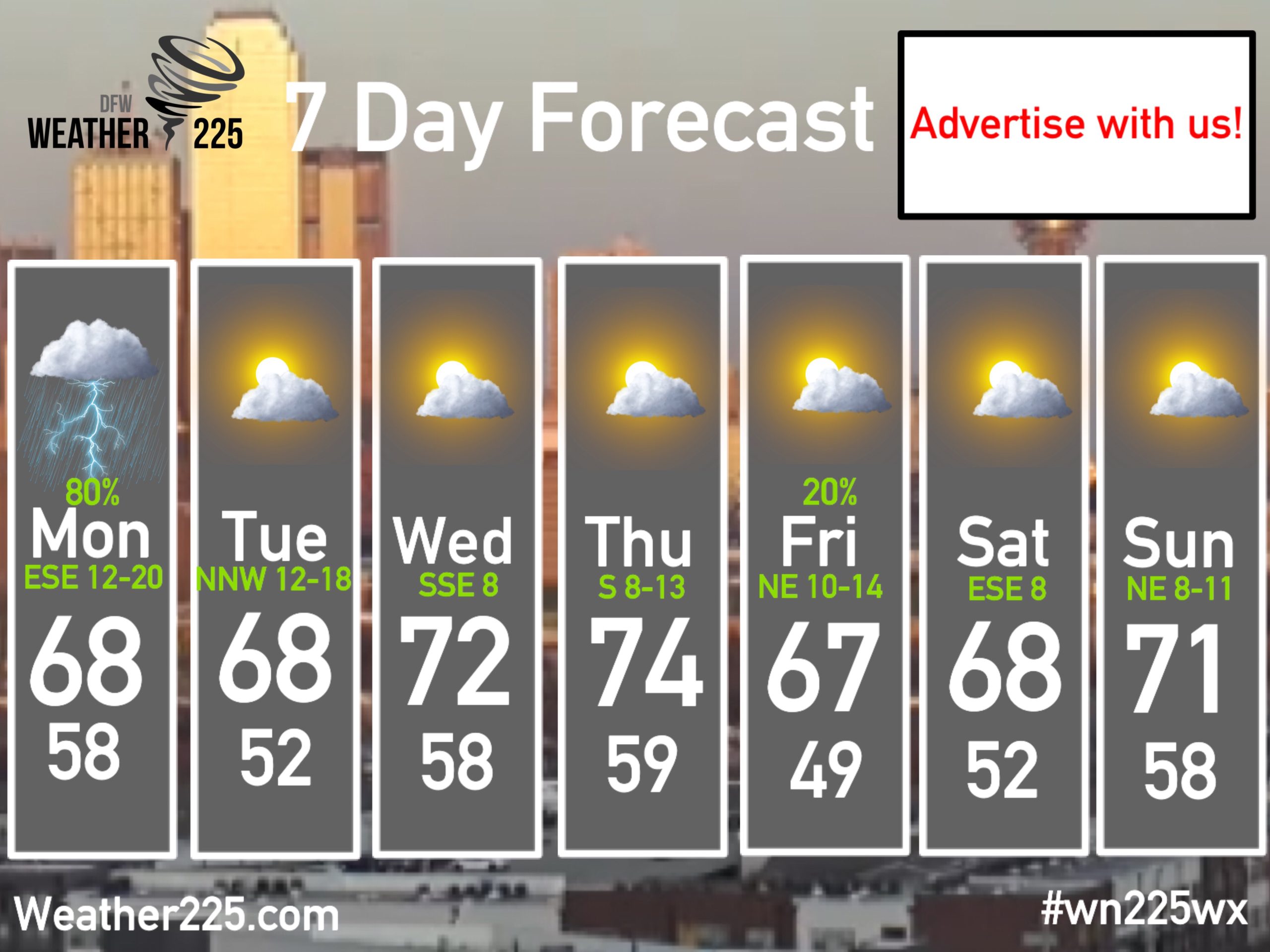
To finish our forecast, here’s a look at this upcoming week’s 7 day forecast. We will see some gusty winds Monday and Tuesday following Monday’s system. Highs will once again reach the mid 70s by mid week, before another system on Friday. It’s to early to determine if there’s a severe weather threat on Friday.
So quick recap. Wide spread general showers and storms are possible across the region tomorrow, heavy rain could lead to a localized flooding threat in some areas. There will be a low severe weather threat tomorrow, with gusty winds and hail being the main threats. NOT everyone will see severe activity, and there’s also a chance there could be no severe weather tomorrow, it’s just that we should be mindful of the threat. Tornadoes don’t appear to be likely.
Tomorrow, be sure to track the activity with our radar on our main page, and get the latest updates from our live twitter feed, located also on the home page! And stay tuned to Weather225 for the latest and any updates.
Leave a Reply