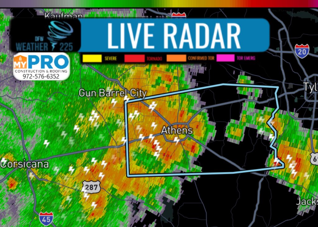
At 709 PM CDT, Doppler radar was tracking a strong thunderstorm near Athens, moving east at 25 mph.
Winds in excess of 40 mph will be possible with this storm.
Locations impacted include... Athens, Chandler, Malakoff, Frankston, Brownsboro, Eustace, Berryville, Edom, Coffee City, Caney City, Payne Springs, Log Cabin, Murchison, Star Harbor, Poynor and Moore Station.
PRECAUTIONARY/PREPAREDNESS ACTIONS...
Torrential rainfall is also occurring with this storm, and may lead to localized flooding. Do not drive your vehicle through flooded roadways.
Frequent cloud to ground lightning is occurring with this storm. Seek a safe shelter inside a building or vehicle.

Leave a Reply