
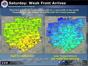
Good Saturday morning NTX, this is a quick forecast update for this week. Today a weak cold front will push through the region brining slightly cooler temperatures across the region. No rain chances or major temp drops expected from this front, the only real noticeable change will be wind shift to the north. Temperatures overnight tonight will reach the mid 40s in spots, areas along the red river could see lows in the 30s!
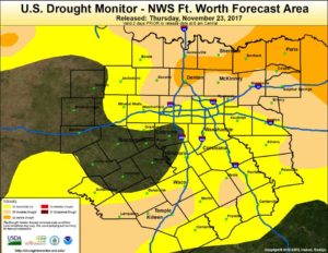
Lack of rain over the past couple of weeks has left much of the region moderate to severe drought conditions, and it doesn’t look like relief will arrive anytime soon. Storm tracks next week will stay well north of north Texas, resulting in an extended period of abnormal temperatures and dry conditions.
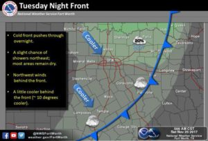
A cold front will move into the area on Tuesday, unfortunately this does not look like it will bring any rain chances for our region. Low rain chances will be possible for our far northern and Red River counties, with coverage expected to be around 20%
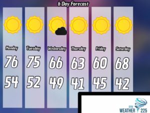
Your 6day forecast starting Monday of next week. Dry conditions will continue through next week. A front Tuesday will bring cooler temps Wednesday through Friday with highs in the 60s. Aside from the 6day forecast long range models differ, but suggest the next chances for rain we could see across our area would be closer towards the second week of December. Remember folks long rang models are just models, they’re not a guarantee and can often be off point, but if anyone would like to start a rain dance in hopes of getting rain sooner go right ahead! Enjoy your weekend!
Leave a Reply