
Good afternoon NTX and happy Sunday! Before we get into the new week we have some weather headlines to mention. However, we have to say this is a FORECAST! We’re into spring storm season and into one of the most active months for storms in the south so this is normal to see forecasts like this. When a forecast is issued several days out, it means conditions are looking favorable, as well as model guidance is pointing towards a potential for storms in the near future. There’s still many uncertainties with this, however, it’s a good idea to stay tuned to the forecast over the next couple of days. 
Today we still have a forecasted area on the now day4 outlook (Wednesday), which includes a large majority of TX, OK, KS, AR, and MO. At this point the SPC is watching for a possible Significant Severe weather event across NTX, and OK, where scattered severe storm activity will be possible ahead of an advancing dry line from the west. During the Day3 period a strong trough will push into the middle of the country. A substantial 500mb short-wave trough will move across NTX and Oklahoma during the afternoon Wednesday, accompanied by strong shear, instability, and large scale support, bringing the possibility for any isolated cells to become super-cellular in nature with a threat for, Hail, Damaging winds, and yes even tornadoes (to what extent and level is unknown at this time).
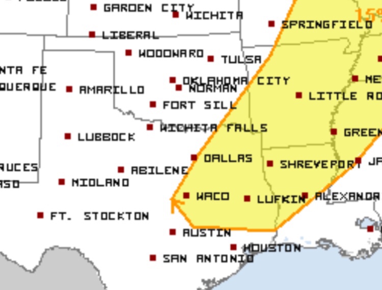
Theres also a day 5 outlook issued (Thursday), that includes areas east of I-35, and into east Texas. Theres still a threat for all types of Severe weather during this time, however the biggest day for our area looks to be Wednesday at this point. Once again theres still many uncertainties with this forecast.
So does this mean you must cancel all your plans Wednesday and Thursday? NO! Absolutely not! This is a forecast! There are ingredients and medium range model runs pointing towards a threat for severe activity mid week of this upcoming week, the point of us posting this in advanced is to give you plenty of time to be ready in advanced before said day of storms arrive, and to let you know there will likely be some sort of threat for storms.
What should you do? Nothing major, just stay tuned to the forecast the next couple of days, and check back for the latest on our sites- @weather225dfw and on instagram you can also get the latest with my personal weather site- @jwiselwx. And you can always get the latest by visiting the NWS (National Weather Service) website and media outlets here.
Enjoy the rest of your weekend! 🙂
Leave a Reply