
The SPC has circled an area they anticipate where a potential watch may be issued as we head into mid day and storms start to develop. As of 11:30am the dryline is still very well west of the area, and is moving slower than forecasted. This means we could start to see some storms developed on the western half of the metro, instead of areas east as forecasters were anticipating.
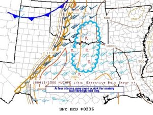
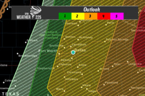
The SPC has shifted the slight risk westeard to now include the DFW metro area. Not everyone may see storm activity, however if storms pop up they will have the potential to produce Large Damaging Hail (possibly up to tennisball sized), damaging winds, and a few tornadoes cannot be rulled out.
As of 11:35am when we checked satellite images and station data, dewpoints around the region were at 68. Storm development now looks to be between noon-ish and 5pm. Make sure you stay weather aware this afternoon and have a way to receive warnings or weather alerts if they are issued! Stay tuned to weather225.com and @weather225dfw for the latest!
Leave a Reply