
We now have 2 low risk areas to monitor, for the potential of tropical development in the Gulf of Mexico. This morning the National Hurricane Center highlighted an area just along the TX coast, for a low chance for tropical development over the next 2-5 days, as a low pressure system in the Northwestern Gulf is currently producing disorganized shower activity. Area 2 is the area we mentioned in Yesterdays Outlook, that is now located over the Bahamas. This area of development has now been raised to a 20% chance for development within the next 5 days. The statements from the National Hurricane Center bellow:
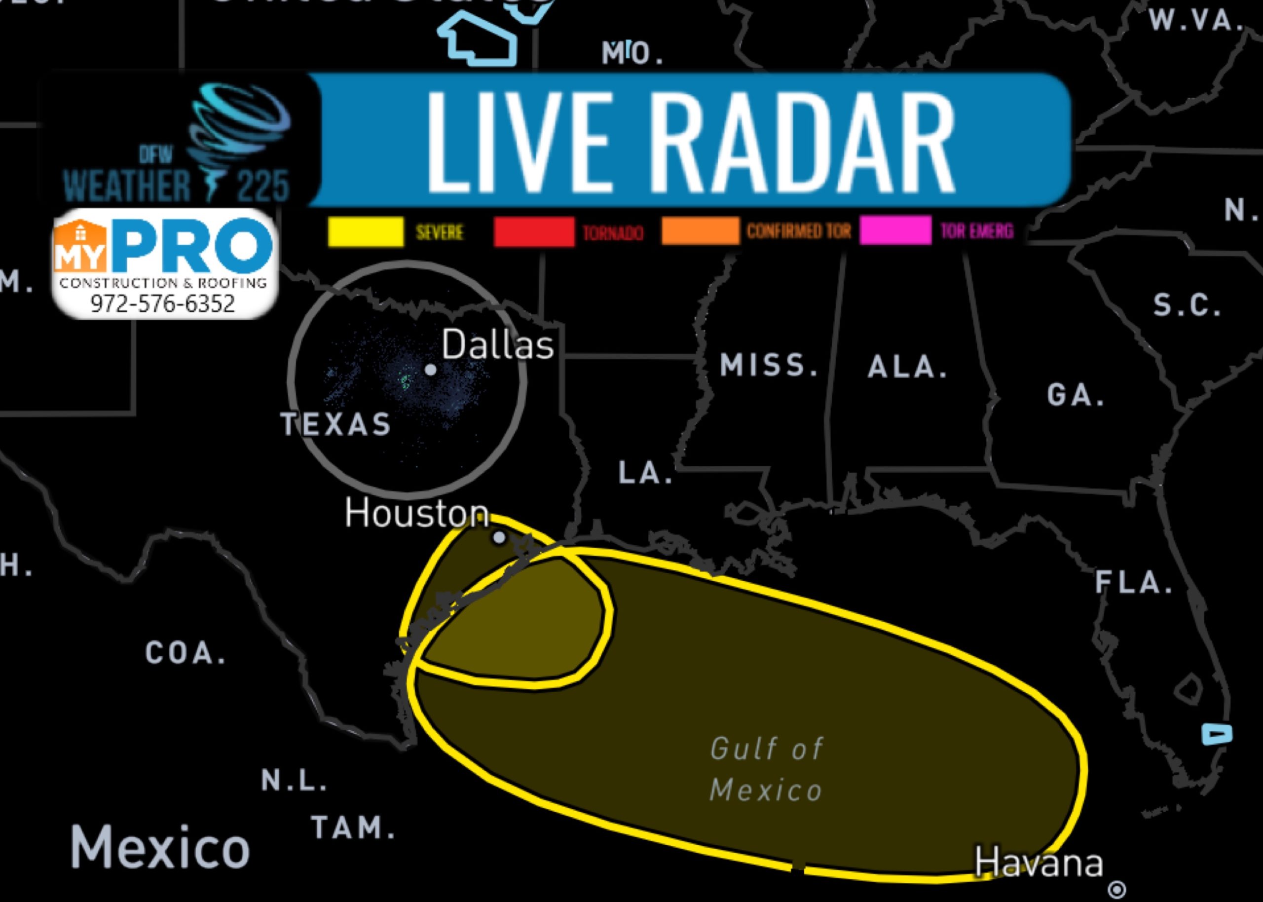
Area 1 located along the TX coast:
3. Surface observations indicate that a weak low pressure area has  formed over the northwestern Gulf of Mexico.  The associated shower  and thunderstorm activity is currently disorganized, and little  additional development is expected before the system moves inland  over Texas tonight or Tuesday.

 Formation chance through 48 hours...low...10 percent.

 Formation chance through 5 days...low...10 percent.
Area 2 located over the Bahamas:
1. Disorganized showers and thunderstorms over the Bahamas, central  and eastern Cuba, and the adjacent Atlantic waters are associated  with a tropical wave.  This system is expected to move  west-northwestward through the Straits of Florida today, over the  southeastern Gulf of Mexico by Tuesday, across the central Gulf on  Wednesday, and reach the northwestern Gulf on Thursday.   Environmental conditions could become a little more conducive for  development of this system once it reaches the Gulf of Mexico.

 Formation chance through 48 hours...low...10 percent.

 Formation chance through 5 days...low...20 percent.
Leave a Reply