
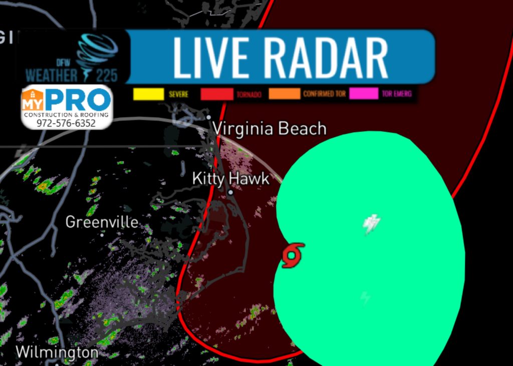
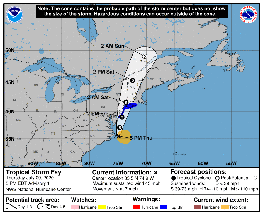
Tropical Storm Fay has now developed off the Eastern US coast, off the coast of the Carolinas. As this system moves north, it could bring tropical rainfall to the Northeastern United States by early Saturday. Here’s the latest track and Hurricane Center statement:
ZCZC MIATWOAT ALL
TTAA00 KNHC DDHHMM

Tropical Weather Outlook
NWS National Hurricane Center Miami FL
200 PM EDT Thu Jul 9 2020

For the North Atlantic...Caribbean Sea and the Gulf of Mexico:

1. Shower and thunderstorm activity associated with a low pressure area
located near the Outer Banks of North Carolina has continued to
increase and is showing signs of organization.  Recent satellite
and radar imagery, along with surface observations and data from an
Air Force Reserve reconnaissance aircraft that is just beginning to
investigate the system, suggest that a new center of circulation
could be forming east of Cape Hatteras.  If these development trends
continue, this system is likely to become a tropical depression or
storm later today or tonight.  The low is expected to move north-
northeastward along the mid-Atlantic coast tonight through
Friday night.

Regardless of development, the system is expected to produce
locally heavy rainfall that could cause some flash flooding across
portions of eastern North Carolina, the coastal mid-Atlantic, and
southern New England during the next few days. Gusty winds are also
possible along the North Carolina Outer Banks today, and along
the mid-Atlantic and southern New England coasts Friday and
Saturday.  Interests in these areas should monitor the progress of
this system and refer to products from your local National Weather
Service office.
* Formation chance through 48 hours...high...90 percent.
* Formation chance through 5 days...high...90 percent.

Forecaster Brown
Leave a Reply