
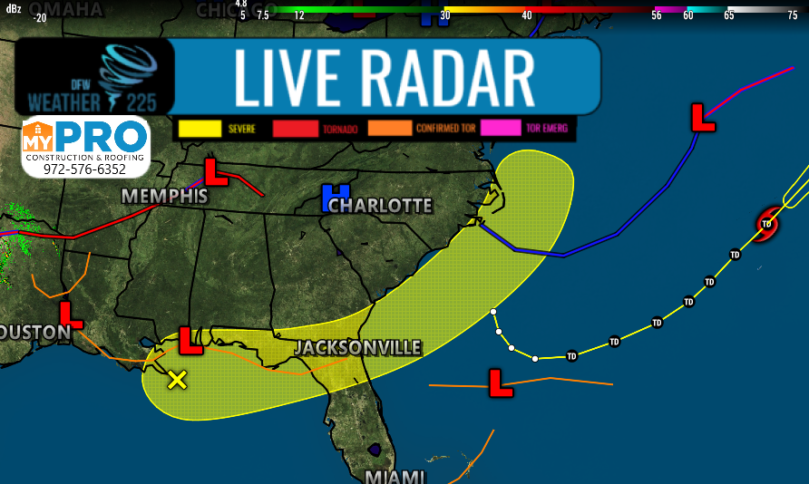
Here’s a quick look at the tropics. It’s been quiet for the past few weeks in the Atlantic, due to the Saharan Dust that’s moved Into parts of the United States. Now that the dust has mostly settled, we’re starting to see new potential development areas in parts of the Gulf of Mexico, that would move towards the Western Atlantic, along the Southeastern US coast. Currently this systems chance for developing in the next 2-5 days is low, as the thunderstorms we’re monitoring off the Coast of LA/MS, are disorganized at this time.
Development chances for the next 48 hours: Low 10%
Development chances over the next 5 days: Low 30%
Forecast Discussion Bellow
1. A broad area of low pressure located along the northern Gulf Coast  is producing disorganized showers and a few thunderstorms. Some  slight development of this system is possible before the disturbance  moves onshore along the northeastern Gulf Coast on Monday. The  system is then forecast to move northeastward and could emerge  offshore of the Carolinas later this week, where environmental  conditions are expected to be more conducive for development.

 Formation chance through 48 hours...low...10 percent.

 Formation chance through 5 days...low...30 percent.
Leave a Reply