
Good afternoon North Texas, this is a quick 1:35pm update. Currently we have some showers/thunderstorms moving across parts of the area, mainly North of I-20, in our Northern and Red River counties.
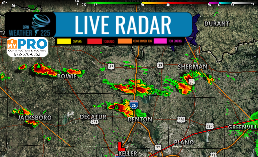
These will be capable of localized heavy rainfall, lightning, and possibly small hail around or smaller than Penny sized.
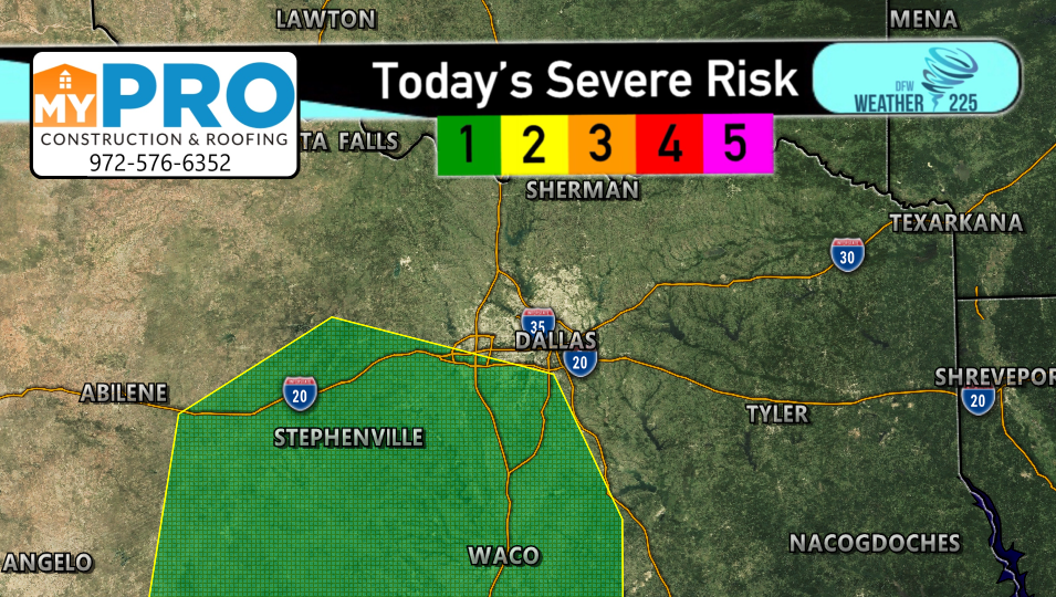
We’ve also got a low threat for some stronger storms across parts of our Western/Southwestern counties this afternoon, as the SPC has placed areas along and South of I-20 under a (1/5 green) Marginal Ariel for storms. To view this updated risk, and the outlook meanings, view our Severe Weather Risk page for more information.
Track the activity throughout the day with our interactive radar maps, and view updates on our “forecasts” page throughout the day.
-JW
Leave a Reply